1980s Maps of Davison County, South Dakota
Explore 11 historic maps of Davison County from the 1980s. These maps offer a rare glimpse into what life looked like during the 1980s — showing old roads, neighborhoods, homes, and landmarks that have changed or disappeared over time.
Whether you're researching your family's past, planning a metal detecting trip, or studying how Davison County's landscape evolved across the 1980s, these high-resolution maps are a powerful tool for exploring the history of this region.
- Focus on a specific era: All maps on this page are from the 1980s, giving you a focused view of this time period.
- See what’s changed: Compare century-old streets, trails, and buildings to today's modern landscape using overlays and satellite layers.
- Research with precision: Use these maps for genealogy, historical research, land use analysis, or educational projects.
- View, download, or print: Maps are fully viewable online in high resolution, and can be downloaded or printed for your own records.
Start exploring Davison County's history through authentic maps from the 1980s. This is your window into the past.
Davison County, SD maps
(11)- 1980 Map of Corsica Lake
 1980 Corsica Lake1980 Print · USGSThe rural landscapes of Douglas County are captured here in the late twentieth century, centered on the waters of Corsica Lake. Local historians can trace early community sites like St John Ch, the Old Ebenezer Cem, and the village of Valley.
 - 1980 Map of Old Stickney Lake
 1980 Old Stickney Lake1980 Print · USGSThe South Dakota prairie stretches across the Davison and Aurora county line in the late 1970s. Local history researchers can trace rural community centers like the Townhall and Baker Sch, or locate family sites at Nicolaisen Cem and Metzgerville.
 - 1980 Map of Mitchell SW
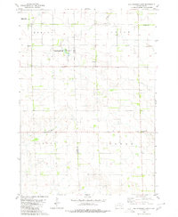
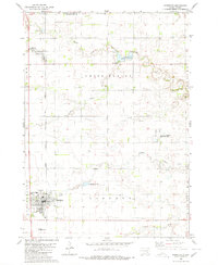
 1980 Mitchell SW1980 Print · USGSSouth Dakota's agricultural heartland is documented in the late 1970s, showing the rural grid of Davison County. Genealogists and local historians can locate specific burial grounds like Church of God Cem and Townhall Emsley Cem among the sections.
 - 1980 Map of Shoemaker Dam
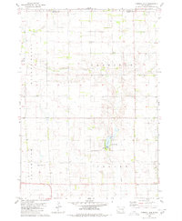
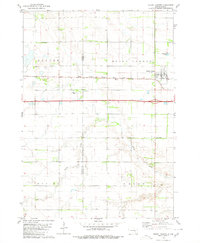
 1980 Shoemaker Dam1980 Print · USGSDavison County townships were defined by their prairie watercourses and rail connections in the late twentieth century. Genealogists and researchers can locate the New Home Cemetery and follow the path of the C M St P & P railroad past Shoemaker Dam.
 - 1980 Map of Mount Vernon
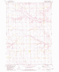
 1980 Mount Vernon1980 Print · USGSThe agricultural plains of Davison and Aurora counties are captured here in the early 1980s. Genealogists and historians can trace the intersection of the Chicago Milwaukee St Paul and Pacific rail line and local sites like Quaker Cem and Mount Vernon.
 - 1980 Map of Parkston
 1980 Parkston1980 Print · USGSHutchinson County agriculture and transport thrived in the 1970s as the rail line connected the grain-growing heartland. Researchers can locate family roots at SS Peter & Paul Cem, trace the waters of Lake Dimock, or follow the Chicago Milwaukee St Paul and Pacific tracks.
 - 1980 Map of Betts
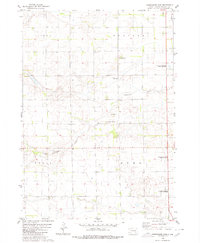
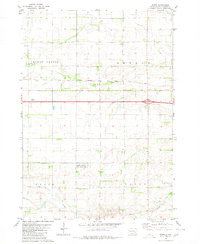 1980 Betts1980 Print · USGSThe Davison County prairie in the late seventies is defined by its rural townships and rail corridors. Trace the path of the Chicago Milwaukee St Paul and Pacific railroad past Betts and the Mt Vernon Cem.
 - 1985 Map of Salem
 1985 Salem1985 Print · USGSEastern South Dakota’s prairie landscape is showcased in the mid-eighties, highlighting a region defined by agricultural colonies and rail-linked towns. Genealogists and historians can trace the foundations of Rosedale Colony, the Buffalo Trading Post, and early hubs like Salem.
 - 1985 Map of Freeman
 1985 Freeman1985 Print · USGSThe James River valley in the mid-1980s reveals a landscape of communal farming colonies and railroad-anchored prairie towns. Researchers can trace the layout of several Hutterite settlements like Maxwell Colony or locate local landmarks like Gagna Station and Turkey Ridge.2 unique versions available
 - 1986 Map of Mitchell
 1986 Mitchell1986 Print · USGSMitchell and the surrounding prairie towns are documented in the mid-1980s as the regional rail and agricultural network matured. Genealogists can locate specific sites like the State Training Sch, Aurora Center, and the Cedar Grove Colony.2 unique versions available
 - 1986 Map of Lake Andes
 1986 Lake Andes1986 Print · USGSThe Yankton Indian Reservation and the vast Missouri River impoundments define this South Dakota landscape in the mid-eighties. Researchers can trace old township lines and the Old Railroad Grade, or locate sites like Fort Randall and the Pleasant Ridge Cem.3 unique versions available
End of results
Showing maps 1-11 of 11
Top cities of Davison County
Frequently asked questions
- What are the different types of historical maps available for Davison County?
- What is the oldest map of Davison County?
- Where can I purchase historical maps of Davison County for my home or office?
- Where can I download high-res historical maps of Davison County?
- Are there historical topographic maps available for Davison County?
- Is there historical aerial imagery available for Davison County?
- Where are historical maps of Davison County sourced from?