1950s Maps of Day County, South Dakota
Explore 9 historic maps of Day County from the 1950s. These maps offer a rare glimpse into what life looked like during the 1950s — showing old roads, neighborhoods, homes, and landmarks that have changed or disappeared over time.
Whether you're researching your family's past, planning a metal detecting trip, or studying how Day County's landscape evolved across the 1950s, these high-resolution maps are a powerful tool for exploring the history of this region.
- Focus on a specific era: All maps on this page are from the 1950s, giving you a focused view of this time period.
- See what’s changed: Compare century-old streets, trails, and buildings to today's modern landscape using overlays and satellite layers.
- Research with precision: Use these maps for genealogy, historical research, land use analysis, or educational projects.
- View, download, or print: Maps are fully viewable online in high resolution, and can be downloaded or printed for your own records.
Start exploring Day County's history through authentic maps from the 1950s. This is your window into the past.
Day County, SD maps
(9)- 1953 Map of Milbank, 1958 Print
 1953 Milbank1958 Print · USGSThe tri-state border region of South Dakota, North Dakota, and Minnesota is shown here during the early fifties, a landscape defined by glacial lakes and the Sisseton Indian Reservation. Researchers can trace the legacy of the western railroads, locating old stops along the Great Northern and settlements like Milbank, Webster, and Sisseton.3 unique versions available
 - 1958 Map of Milbank
 1958 Milbank1958 Print · USGSThe northern Great Plains in the late fifties show a landscape of glacial lakes and reservation lands shaped by the Great Northern railroad. Genealogists and local historians can trace the grid of settlements from Britton to Milbank and locate landmarks like Enemy Swim Lake and the Sisseton Indian Reservation.
 - 1958 Map of Britton 4 SW, 1959 Print
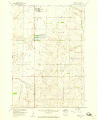
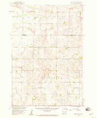 1958 Britton 4 SW1959 Print · USGSDay and Marshall Counties in the late 1950s show a landscape of prairie potholes and decentralized rural school districts. Genealogists can trace family roots through numerous local landmarks like Jandahl Sch, Highlands Ch, and Rose Hill Cem.2 unique versions available
 - 1958 Map of Andover, 1960 Print
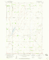
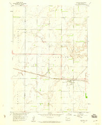 1958 Andover1960 Print · USGSAndover was a vital railroad hub in Day County during the late 1950s, centered on the Chicago Milwaukee St Paul and Pacific line. Genealogists can trace local roots at Andover Cem and All Saints Cem or locate the old Gravel Pit.2 unique versions available
 - 1958 Map of Andover SW, 1960 Print
 1958 Andover SW1960 Print · USGSAndover and Scotland townships are captured in the late fifties as a landscape of rural schoolhouses and prairie lakes. Genealogists can locate Scotland Cem and trace the proximity of family farms to School No 217 or School No 219.
 - 1958 Map of Langford, 1960 Print
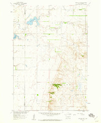
 1958 Langford1960 Print · USGSThe prairie town of Langford is shown in the late 1950s at the intersection of local agriculture and the Chicago Milwaukee St Paul and Pacific rail line. Genealogists can trace rural sites like St Peter Cem, Homer Cem, and the winding Antelope Creek.2 unique versions available
 - 1958 Map of Pierpont, 1960 Print
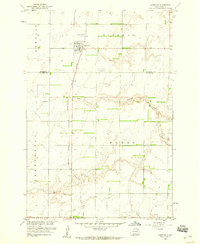
 1958 Pierpont1960 Print · USGSPierpont and the surrounding prairie of Day County are shown in detail during the late fifties. Genealogists and local historians can locate several numbered schoolhouses, including School No 180, and trace the route of the Chicago Milwaukee St Paul and Pacific railroad.
 - 1958 Map of Crandall, 1960 Print
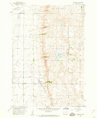 1958 Crandall1960 Print · USGSThe rural prairie of Day County is captured here in the late fifties, centered on the rail-fed town of Crandall. Genealogists and historians can trace the locations of School No 4, Sweetwater Lake, and the local Crandall Cemetery.
 - 1958 Map of Langford SW, 1960 Print
 1958 Langford SW1960 Print · USGSNortheastern South Dakota's glacial landscape is captured in the late 1950s where Brown, Marshall, and Day Counties meet. Researchers can locate the Augustana Cem, the central Town Hall, and water features like Antelope Creek.2 unique versions available
End of results
Showing maps 1-9 of 9
Top cities of Day County
- Webster historical maps
- Waubay historical maps
- Bristol historical maps
- Roslyn historical maps
- Pierpont historical maps
- Andover historical maps
See more
Frequently asked questions
- What are the different types of historical maps available for Day County?
- What is the oldest map of Day County?
- Where can I purchase historical maps of Day County for my home or office?
- Where can I download high-res historical maps of Day County?
- Are there historical topographic maps available for Day County?
- Is there historical aerial imagery available for Day County?
- Where are historical maps of Day County sourced from?