Old Maps of Day County, South Dakota for Metal Detecting
Plan your next treasure hunt with 144 historic maps of Day County. Find old homesites, ghost towns, trails, and gathering spots that may be lost to time — perfect for identifying promising metal detecting locations.
- Locate forgotten sites: Uncover places like long-lost settlements, abandoned rail lines, or gathering spots.
- Plan better hunts: Use map overlays combined with LiDAR or satellite views to narrow in on historically rich areas.
- Made for detectorists: Thousands of hobbyists use these maps to discover relics, coins, and hidden history.
Use these historic maps to boost your research and find new opportunities beneath the surface of Day County.
Day County, SD maps
(144)- 1953 Map of Milbank, 1958 Print
 1953 Milbank1958 Print · USGSThe tri-state border region of South Dakota, North Dakota, and Minnesota is shown here during the early fifties, a landscape defined by glacial lakes and the Sisseton Indian Reservation. Researchers can trace the legacy of the western railroads, locating old stops along the Great Northern and settlements like Milbank, Webster, and Sisseton.3 unique versions available
 - 1958 Map of Milbank
 1958 Milbank1958 Print · USGSThe northern Great Plains in the late fifties show a landscape of glacial lakes and reservation lands shaped by the Great Northern railroad. Genealogists and local historians can trace the grid of settlements from Britton to Milbank and locate landmarks like Enemy Swim Lake and the Sisseton Indian Reservation.
 - 1958 Map of Britton 4 SW, 1959 Print
 1958 Britton 4 SW1959 Print · USGSDay and Marshall Counties in the late 1950s show a landscape of prairie potholes and decentralized rural school districts. Genealogists can trace family roots through numerous local landmarks like Jandahl Sch, Highlands Ch, and Rose Hill Cem.2 unique versions available
 - 1958 Map of Andover, 1960 Print
 1958 Andover1960 Print · USGSAndover was a vital railroad hub in Day County during the late 1950s, centered on the Chicago Milwaukee St Paul and Pacific line. Genealogists can trace local roots at Andover Cem and All Saints Cem or locate the old Gravel Pit.2 unique versions available
 - 1958 Map of Andover SW, 1960 Print
 1958 Andover SW1960 Print · USGSAndover and Scotland townships are captured in the late fifties as a landscape of rural schoolhouses and prairie lakes. Genealogists can locate Scotland Cem and trace the proximity of family farms to School No 217 or School No 219.
 - 1958 Map of Langford, 1960 Print
 1958 Langford1960 Print · USGSThe prairie town of Langford is shown in the late 1950s at the intersection of local agriculture and the Chicago Milwaukee St Paul and Pacific rail line. Genealogists can trace rural sites like St Peter Cem, Homer Cem, and the winding Antelope Creek.2 unique versions available
 - 1958 Map of Pierpont, 1960 Print
 1958 Pierpont1960 Print · USGSPierpont and the surrounding prairie of Day County are shown in detail during the late fifties. Genealogists and local historians can locate several numbered schoolhouses, including School No 180, and trace the route of the Chicago Milwaukee St Paul and Pacific railroad.
 - 1958 Map of Crandall, 1960 Print
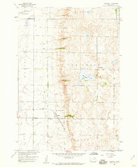 1958 Crandall1960 Print · USGSThe rural prairie of Day County is captured here in the late fifties, centered on the rail-fed town of Crandall. Genealogists and historians can trace the locations of School No 4, Sweetwater Lake, and the local Crandall Cemetery.
 - 1958 Map of Langford SW, 1960 Print
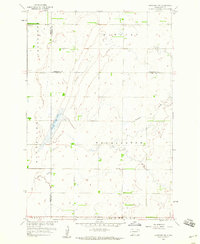 1958 Langford SW1960 Print · USGSNortheastern South Dakota's glacial landscape is captured in the late 1950s where Brown, Marshall, and Day Counties meet. Researchers can locate the Augustana Cem, the central Town Hall, and water features like Antelope Creek.2 unique versions available
 - 1970 Map of Eden, 1973 Print
 1970 Eden1973 Print · USGSThe Marshall and Day County borderlands are shown in the early 1970s, featuring the prairie wetlands around Eden and Roslyn. Researchers can trace the Old Fort Sisseton Military Reservation Boundary or locate St Michael Cem and the local Townhall.
 - 1970 Map of Lonesome Lake, 1973 Print
 1970 Lonesome Lake1973 Print · USGSThe rural landscape of eastern South Dakota in the early 1970s is meticulously captured here where Grant and Day counties meet. Genealogists and local historians can locate the Bergen Ch and Cem, alongside geographical markers like Lonesome Lake and the Big Sioux River.
 - 1970 Map of Waubay, 1973 Print
 1970 Waubay1973 Print · USGSThe glacial lake region of Day County is captured here in the early 1970s, centered on the settlement of Waubay. Genealogists and local historians can locate Old Zion Cem, trace the Sisseton Indian Reservation Boundary, and see the extent of Bitter Lake.
 - 1970 Map of Piyas Lake, 1973 Print
 1970 Piyas Lake1973 Print · USGSMarshall and Day counties in the early 1970s reveal a landscape of glacial lakes and prairie townships. Trace family roots and local landmarks from Buffalo Lake Ch to the seasonal developments at Pickerel Lake State Park and the Church Camp.
 - 1970 Map of Britton 4 SE, 1973 Print
 1970 Britton 4 SE1973 Print · USGSNortheastern South Dakota’s lake country is captured here in the 1970s, showcasing a landscape of glacial sloughs and conservation lands. Researchers can locate the historic Fort Sisseton, the Fron Church, and the winding Sisseton Military Reservation Boundary.2 unique versions available
 - 1970 Map of Florence NE, 1973 Print
 1970 Florence NE1973 Print · USGSThe Coteau des Prairies of northeastern South Dakota is captured here in the early 1970s, showing a landscape of sprawling wetlands and high-prairie townships. Researchers can locate the Egeland Cem and Egeland Ch, or trace the Sisseton Indian Reservation Boundary near Goose Lake.
 - 1970 Map of Enemy Swim Lake East, 1973 Print
 1970 Enemy Swim Lake East1973 Print · USGSRoberts and Day County lands within the Sisseton Indian Reservation are captured here during the 1970s. Local researchers can map out rural intersections like Rudebusch Corner or trace the shorelines of Enemy Swim Lake and Hurricane Lake.
 - 1970 Map of Waubay SW, 1973 Print
 1970 Waubay SW1973 Print · USGSDay County’s prairie pothole landscape is captured here in the early 1970s, showing a region defined by its vast water bodies and rail heritage. Researchers can locate Old St Ottos Cem, the Chicago Milwaukee St Paul and Pacific line, and the shores of Antelope Lake.
 - 1970 Map of Roslyn, 1973 Print
 1970 Roslyn1973 Print · USGSThe glacial lakes and rail-bound prairie towns of Day County are captured here in the early seventies. Genealogists and local researchers can trace the Soo Line between Roslyn and Grenville or locate the Roslyn Cem near the shoreline.
 - 1970 Map of Ortley, 1973 Print
 1970 Ortley1973 Print · USGSOrtley and the surrounding prairie of Roberts County are captured here in the early 1970s, as the railroad still defined the local economy. Genealogists can locate family landmarks like Hope Ch, the Townhall, and the steel rails of the Chicago Milwaukee St Paul and Pacific.
 - 1970 Map of Drywood Lakes, 1973 Print
 1970 Drywood Lakes1973 Print · USGSThe Sisseton Indian Reservation in the early 1970s is characterized by its expansive prairie lakes and rural parish communities across Marshall and Roberts counties. Genealogists and local historians can locate remote landmarks like Zuark Ch, Buffalo Lake Ch, and the Townhall site.
 - 1970 Map of Enemy Swim Lake West, 1973 Print
 1970 Enemy Swim Lake West1973 Print · USGSThe glacial lakes of the Sisseton Indian Reservation are shown in detail during the early 1970s. Researchers can locate the St Joseph Ch Cem, the Blue Dog (Grave), and the extensive Waubay National Wildlife Refuge.
 - 1973 Map of Lily, 1976 Print
 1973 Lily1976 Print · USGSThe prairie landscape around Lily is shown here in the early 1970s, as the Chicago Milwaukee St Paul and Pacific railroad still traversed the township lines. Genealogists can locate several local burial sites including St Josephs Cem, Our Saviors Cem, and Hillside Cem.
 - 1973 Map of Lynn Lake, 1976 Print
 1973 Lynn Lake1976 Print · USGSDay County's glaciated plains are captured here in the early seventies, showing a landscape shaped by conservation and rural community life. Genealogists and historians can locate the New Sweden Cem, Skudesnes Ch, and the local Townhall among the numerous lakes and waterfowl areas.
 - 1973 Map of Webster, 1976 Print
 1973 Webster1976 Print · USGSDay County transitions into a landscape of conservation and prairie industry during the early seventies. Genealogists and local historians can map the town's growth from the Courthouse to family plots in St Ottos Cem and Webster Cem.
 - 1973 Map of Bristol West, 1976 Print
 1973 Bristol West1976 Print · USGSDay County, South Dakota, is captured in the early 1970s during a period of established prairie farming and conservation. Researchers can locate Bethany Cem, the Town Hall, and trace the path of the Chicago Milwaukee St Paul and Pacific railroad.
Showing maps 1-25 of 144
Top cities of Day County
- Webster historical maps
- Waubay historical maps
- Bristol historical maps
- Roslyn historical maps
- Pierpont historical maps
- Andover historical maps
See more
Frequently asked questions
- What are the different types of historical maps available for Day County?
- What is the oldest map of Day County?
- Where can I purchase historical maps of Day County for my home or office?
- Where can I download high-res historical maps of Day County?
- Are there historical topographic maps available for Day County?
- Is there historical aerial imagery available for Day County?
- Where are historical maps of Day County sourced from?