
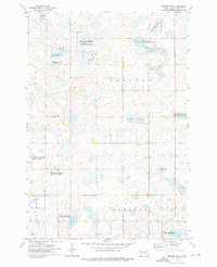
1973 Map of Lynn Lake
USGS Topo · Published 1976About this map
The prairie pothole landscape of Day County dominates this 1970s survey, defined by a dense network of seasonal wetlands and conservation lands. The central Lynn Lake is surrounded by a patchwork of designated habitat zones, including the Mydland Pass State Public Shooting Area and the Lynn Lake State Public Shooting Area. These areas, alongside numerous parcels of the National Waterfowl Production Area, reflect a regional focus on wildlife preservation and land management within the township lines of Lynn, Union, Bristol, and Kidder.
Find a feature on this map
13 named features on this map. Tap any name to fly to it.
Don’t see what you’re looking for? This feature index may not catch every label — zoom into the map to look around manually.
Map Details
Editions of this 1973 Lynn Lake Map
This is the sole edition of this map. No revisions or reprints were ever made.
Other maps of this area

1953 · Milbank
USGS Topo · 1:250,000

1958 · Milbank
USGS Topo · 1:250,000

1958 · Britton 4 SW
USGS Topo · 1:24,000

1958 · Langford
USGS Topo · 1:24,000

1958 · Pierpont
USGS Topo · 1:24,000

1970 · Britton 4 SE
USGS Topo · 1:24,000

1973 · Webster
USGS Topo · 1:24,000

1973 · Bristol West
USGS Topo · 1:24,000

1973 · Bristol East
USGS Topo · 1:24,000
1973 · Webster NE
USGS Topo · 1:24,000