
1958 Map of Pierpont
USGS Topo · Published 1960About this map
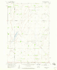
Pierpont anchors this northeastern South Dakota landscape in the late 1950s, serving as a vital rail hub where the Chicago Milwaukee St Paul and Pacific railroad cuts through the prairie. The town's grid is clearly defined just north of Pierpont Lake, which is surrounded by the Pierpont Lake Recreation Area. This map reveals a distributed rural community structure typical of the era, marked by a high density of one-room schoolhouses such as School No 180, Union Prairie Sch, and School No 142. These numbered schools, along with the numerous small ponds and depressions dotting the townships of Union, Bristol, and Andover, illustrate the post-war agricultural landscape before school consolidation and modern drainage changed the face of the Great Plains.
Find a feature on this map
12 named features on this map. Tap any name to fly to it.
Don’t see what you’re looking for? This feature index may not catch every label — zoom into the map to look around manually.
Map Details
Editions of this 1958 Pierpont Map
This is the sole edition of this map. No revisions or reprints were ever made.
Other maps of this area

1953 · Milbank
USGS Topo · 1:250,000

1958 · Milbank
USGS Topo · 1:250,000

1958 · Britton 4 SW
USGS Topo · 1:24,000

1958 · Andover
USGS Topo · 1:24,000

1958 · Andover SW
USGS Topo · 1:24,000

1958 · Langford
USGS Topo · 1:24,000
1958 · Langford SW
USGS Topo · 1:24,000

1973 · Lynn Lake
USGS Topo · 1:24,000

1973 · Bristol West
USGS Topo · 1:24,000

1973 · Bristol East
USGS Topo · 1:24,000