
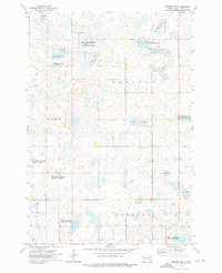
1973 Map of Webster
USGS Topo · Published 1976About this map
Webster serves as a localized hub in Day County, centered around its street grid and the Courthouse during the early 1970s. The town's economy and logistics are defined by the Chicago Milwaukee St Paul and Pacific railroad passing through its northern edge, connecting the settlement to larger regional markets. Beyond the residential blocks of 9th Ave and Main St, the landscape is heavily shaped by glacial features and conservation efforts. Large swathes of the surrounding prairie and wetlands are designated as the National Waterfowl Production Area, reflecting a mid-century emphasis on habitat preservation. Water bodies like Buchner Slough and the nearby Buchner Slough State Public Shooting Area dominate the rural sections of the quadrangle. Local infrastructure includes the Webster Municipal Airport and the town Fairground, while the Webster Cem and St Ottos Cem provide valuable touchstones for genealogical research.
Find a feature on this map
27 named features on this map. Tap any name to fly to it.
Don’t see what you’re looking for? This feature index may not catch every label — zoom into the map to look around manually.
Map Details
Editions of this 1973 Webster Map
This is the sole edition of this map. No revisions or reprints were ever made.
Other maps of this area

1953 · Milbank
USGS Topo · 1:250,000

1958 · Milbank
USGS Topo · 1:250,000

1970 · Waubay SW
USGS Topo · 1:24,000

1970 · Roslyn
USGS Topo · 1:24,000

1973 · Lily
USGS Topo · 1:24,000

1973 · Lynn Lake
USGS Topo · 1:24,000

1973 · Swan Lake
USGS Topo · 1:24,000

1973 · Bristol East
USGS Topo · 1:24,000
1973 · Webster NE
USGS Topo · 1:24,000

1973 · Florence NW
USGS Topo · 1:24,000