1900s (20th Century) Maps of Eagle Butte, District 4
Explore 9 historic maps of Eagle Butte from the 1900s (20th Century). These maps offer a rare glimpse into what life looked like during the 1900s — showing old roads, neighborhoods, homes, and landmarks that have changed or disappeared over time.
Whether you're researching your family's past, planning a metal detecting trip, or studying how Eagle Butte's landscape evolved across the 1900s, these high-resolution maps are a powerful tool for exploring the history of this region.
- Focus on a specific era: All maps on this page are from the 1900s, giving you a focused view of this time period.
- See what’s changed: Compare century-old streets, trails, and buildings to today's modern landscape using overlays and satellite layers.
- Research with precision: Use these maps for genealogy, historical research, land use analysis, or educational projects.
- View, download, or print: Maps are fully viewable online in high resolution, and can be downloaded or printed for your own records.
Start exploring Eagle Butte's history through authentic maps from the 1900s. This is your window into the past.
Eagle Butte, District 4 maps
(9)- 1953 Map of McIntosh, 1965 Print
 1953 McIntosh1965 Print · USGSThe north-central Dakota prairie is captured here during the mid-fifties, showing the vast Standing Rock Indian Reservation and the newly formed Oah E Reservoir. Genealogists and historians can trace the Chicago Milwaukee St Paul and Pacific rail line through stops like McIntosh, Walker, and Eagle Butte.3 unique versions available
 - 1954 Map of Pierre, 1968 Print
 1954 Pierre1968 Print · USGSThe Missouri River and the newly formed Oahe Reservoir define central South Dakota in the 1950s. Genealogists and local historians can trace early settlements and rail stops like Eakin Siding, Mission Ridge, and Ottumwa.2 unique versions available
 - 1958 Map of Pierre
 1958 Pierre1958 Print · USGSCentral South Dakota is documented during the mid-fifties, just as the Missouri River valley was being transformed by the massive Oahe Dam project. Researchers can trace the early Oahe Reservoir shoreline and find remote outposts like Milesville, Onida, and Giddings Flat.
 - 1958 Map of McIntosh
 1958 McIntosh1958 Print · USGSThe north-central Dakotas appear here in the mid-1950s as massive engineering projects and rail lines shaped the plains. Researchers can trace tribal lands within the Standing Rock Indian Reservation and locate local landmarks like the Keller Mine or the Virginia Siding.
 - 1981 Map of Herbert Creek
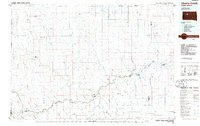
 1981 Herbert Creek1981 Print · USGSThe ranch lands of Ziebach County are captured here in the early eighties, showing a sparse landscape of family operations and vital water infrastructure. Genealogists and local historians can trace legacy holdings like the Webb Ranch and Skates Ranch or locate Shupic Park in Eagle Butte.
 - 1981 Map of Parade SW
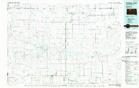
 1981 Parade SW1981 Print · USGSDewey County enters the 1980s with the expanding settlements of Eagle Butte and North Eagle Butte taking center stage. Genealogists and historians can locate community landmarks like the Civic Center and Hosp, or trace local recreation at the Rodeo Grounds and Brueschke Dam.
 - 1981 Map of High Elk Hill, 1982 Print
 1981 High Elk Hill1982 Print · USGSZiebach and Dewey counties are shown in the early eighties as they cross the high plains of the Cheyenne River Indian Reservation. Genealogists and local historians can locate St Marks Cem and trace the paths of East Fork Rudy Creek and High Elk Hill.
 - 1986 Map of Timber Lake
 1986 Timber Lake1986 Print · USGSNorth-central South Dakota in the mid-eighties reveals a landscape of ranching hubs and indigenous lands shaped by the Moreau River and Grand River. Researchers can trace old rail routes near Red Elm and locate remote prairie landmarks like St Patrick Butte or Glad Valley.2 unique versions available
 - 1986 Map of Cherry Creek
 1986 Cherry Creek1986 Print · USGSWest-central South Dakota comes to life in the mid-1980s, centered on the Cheyenne River Indian Reservation and the river's winding path. Genealogists and historians can trace the remote settlements of Red Scaffold and Milesville or locate family landmarks like Staple M Cliffs and Robbs Flat.2 unique versions available
End of results
Showing maps 1-9 of 9
Frequently asked questions
- What are the different types of historical maps available for Eagle Butte?
- What is the oldest map of Eagle Butte?
- Where can I purchase historical maps of Eagle Butte for my home or office?
- Where can I download high-res historical maps of Eagle Butte?
- Are there historical topographic maps available for Eagle Butte?
- Is there historical aerial imagery available for Eagle Butte?
- Where are historical maps of Eagle Butte sourced from?