Old Maps of Enemy Swim District, South Dakota for Metal Detecting
Plan your next treasure hunt with 77 historic maps of Enemy Swim District. Find old homesites, ghost towns, trails, and gathering spots that may be lost to time — perfect for identifying promising metal detecting locations.
- Locate forgotten sites: Uncover places like long-lost settlements, abandoned rail lines, or gathering spots.
- Plan better hunts: Use map overlays combined with LiDAR or satellite views to narrow in on historically rich areas.
- Made for detectorists: Thousands of hobbyists use these maps to discover relics, coins, and hidden history.
Use these historic maps to boost your research and find new opportunities beneath the surface of Enemy Swim District.
Enemy Swim District, SD maps
(77)- 1953 Map of Milbank, 1958 Print
 1953 Milbank1958 Print · USGSThe tri-state border region of South Dakota, North Dakota, and Minnesota is shown here during the early fifties, a landscape defined by glacial lakes and the Sisseton Indian Reservation. Researchers can trace the legacy of the western railroads, locating old stops along the Great Northern and settlements like Milbank, Webster, and Sisseton.3 unique versions available
 - 1953 Map of Watertown, 1968 Print
 1953 Watertown1968 Print · USGSEastern South Dakota and the Minnesota borderlands are captured here during the mid-twentieth century as the region's agricultural and rail-service centers thrived. Genealogists and local historians can trace family-named sites across the Coteau des Prairies and find landmarks in Watertown, De Smet, and Brookings.3 unique versions available
 - 1958 Map of Milbank
 1958 Milbank1958 Print · USGSThe northern Great Plains in the late fifties show a landscape of glacial lakes and reservation lands shaped by the Great Northern railroad. Genealogists and local historians can trace the grid of settlements from Britton to Milbank and locate landmarks like Enemy Swim Lake and the Sisseton Indian Reservation.
 - 1958 Map of Watertown
 1958 Watertown1958 Print · USGSThe eastern South Dakota prairie and the Minnesota borderlands are captured here in the late fifties, showcasing a landscape of terminal moraine lakes and burgeoning rail hubs. Genealogists and historians can trace the early paths of the Chicago and North Western railroad or locate family roots in Watertown, Clark, or the Sisseton Indian Reservation.2 unique versions available
 - 1969 Map of Watertown West, 1971 Print
 1969 Watertown West1971 Print · USGSThe glacial lakes of South Dakota's prairie country define this late-sixties landscape west of Watertown. Researchers can trace the legacy of the Old Indian Treaty Boundary or find local landmarks like McKinley Sch, the Zoo, and Camp Watymca.
 - 1970 Map of Summit, 1973 Print
 1970 Summit1973 Print · USGSThe town of Summit and the high prairie wetlands are captured here in the early 1970s. Trace the path of the CHICAGO MILWAUKEE ST PAUL AND PACIFIC railroad through the Sisseton Indian Reservation Boundary and past the Summit Cem.
 - 1970 Map of Lonesome Lake, 1973 Print
 1970 Lonesome Lake1973 Print · USGSThe rural landscape of eastern South Dakota in the early 1970s is meticulously captured here where Grant and Day counties meet. Genealogists and local historians can locate the Bergen Ch and Cem, alongside geographical markers like Lonesome Lake and the Big Sioux River.
 - 1970 Map of Summit NE, 1973 Print
 1970 Summit NE1973 Print · USGSNortheastern Roberts County in the early seventies reveals a landscape of glacial coulees and scattered prairie lakes. Genealogists can locate Old Ascension Cem and Ascension Ch near the deep drainage of Big Coulee.
 - 1970 Map of Still Lake SE, 1973 Print
 1970 Still Lake SE1973 Print · USGSCodington County in the early 1970s is shown here as a landscape of grid-patterned townships and prairie drainage. Genealogists can locate family landmarks like St Johns Ch, Townhall, and the Henricks Landing Strip along the Burlington Northern line.
 - 1970 Map of Waubay, 1973 Print
 1970 Waubay1973 Print · USGSThe glacial lake region of Day County is captured here in the early 1970s, centered on the settlement of Waubay. Genealogists and local historians can locate Old Zion Cem, trace the Sisseton Indian Reservation Boundary, and see the extent of Bitter Lake.
 - 1970 Map of Piyas Lake, 1973 Print
 1970 Piyas Lake1973 Print · USGSMarshall and Day counties in the early 1970s reveal a landscape of glacial lakes and prairie townships. Trace family roots and local landmarks from Buffalo Lake Ch to the seasonal developments at Pickerel Lake State Park and the Church Camp.
 - 1970 Map of Florence NE, 1973 Print
 1970 Florence NE1973 Print · USGSThe Coteau des Prairies of northeastern South Dakota is captured here in the early 1970s, showing a landscape of sprawling wetlands and high-prairie townships. Researchers can locate the Egeland Cem and Egeland Ch, or trace the Sisseton Indian Reservation Boundary near Goose Lake.
 - 1970 Map of Enemy Swim Lake East, 1973 Print
 1970 Enemy Swim Lake East1973 Print · USGSRoberts and Day County lands within the Sisseton Indian Reservation are captured here during the 1970s. Local researchers can map out rural intersections like Rudebusch Corner or trace the shorelines of Enemy Swim Lake and Hurricane Lake.
 - 1970 Map of Ortley, 1973 Print
 1970 Ortley1973 Print · USGSOrtley and the surrounding prairie of Roberts County are captured here in the early 1970s, as the railroad still defined the local economy. Genealogists can locate family landmarks like Hope Ch, the Townhall, and the steel rails of the Chicago Milwaukee St Paul and Pacific.
 - 1970 Map of Drywood Lakes, 1973 Print
 1970 Drywood Lakes1973 Print · USGSThe Sisseton Indian Reservation in the early 1970s is characterized by its expansive prairie lakes and rural parish communities across Marshall and Roberts counties. Genealogists and local historians can locate remote landmarks like Zuark Ch, Buffalo Lake Ch, and the Townhall site.
 - 1970 Map of Enemy Swim Lake West, 1973 Print
 1970 Enemy Swim Lake West1973 Print · USGSThe glacial lakes of the Sisseton Indian Reservation are shown in detail during the early 1970s. Researchers can locate the St Joseph Ch Cem, the Blue Dog (Grave), and the extensive Waubay National Wildlife Refuge.
 - 1970 Map of Still Lake NE, 1973 Print
 1970 Still Lake NE1973 Print · USGSThe eastern South Dakota plains come into focus in the early 1970s, showing the rural townships of Grant and Codington counties. Researchers can trace the Sisseton Indian Reservation Boundary or locate the local St Johns Ch and Townhall.
 - 1970 Map of Still Lake, 1973 Print
 1970 Still Lake1973 Print · USGSCodington County's prairie landscape is captured here in the early 1970s, showcasing a meticulously surveyed network of township sections and watercourses. Researchers can locate the Esterly Cem, trace the Sisseton Indian Reservation Boundary, and see the rural Townhall.
 - 1979 Map of Sisseton, 1980 Print
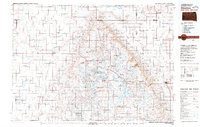 1979 Sisseton1980 Print · USGSNortheastern South Dakota and the North Dakota borderlands appear here in the late seventies, centered on the high glacial plateau. Genealogists and historians can trace the Sisseton Indian Reservation and rail-stop towns like Britton and Lake City.
 - 1985 Map of Webster
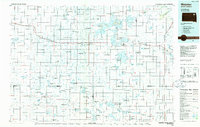 1985 Webster1985 Print · USGSNortheastern South Dakota in the mid-eighties reveals a landscape of prairie potholes and rail-line towns centered on the Webster region. Genealogists and historians can trace rail-town development along the Burlington Northern and find early conservation boundaries like the Waubay National Wildlife Refuge.2 unique versions available
 - 1985 Map of Watertown
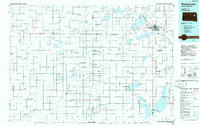 1985 Watertown1985 Print · USGSEastern South Dakota in the mid-eighties remains a landscape of expansive prairie wetlands and agricultural rail towns. Genealogists and local historians can trace the routes of the CHICAGO AND NORTH WESTERN railroad through Garden City, Vienna, and Watertown.2 unique versions available
 - 2012 Map of Waubay, 2012 Print
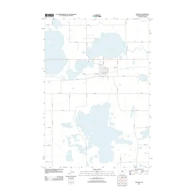 2012 Waubay2012 Print · USGSThe town of Waubay is captured here during the early twenty-first century, positioned amid the expansive glacial waters of Day County. Researchers can trace local heritage at Old Zion Cem or follow the shoreline of Bitter Lake and Blue Dog Lake as they appeared a decade ago.
 - 2012 Map of Florence NE, 2012 Print
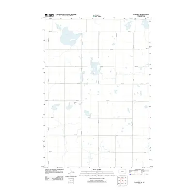 2012 Florence NE2012 Print · USGSThe glacial wetlands of Eden Township are captured here during the early twenty-first century, showing a landscape of scattered sloughs and farm roads. Local historians can locate the Egeland Cem or trace the drainage patterns of Goose Lake and Foldager Slough.
 - 2012 Map of Summit, 2012 Print
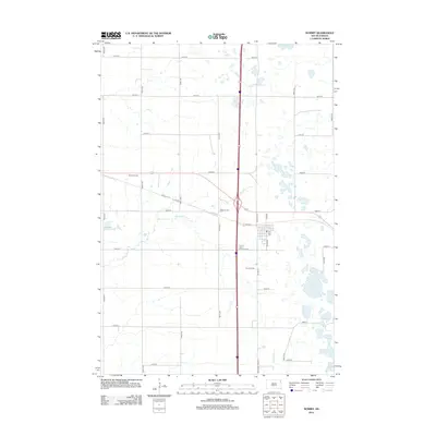 2012 Summit2012 Print · USGSRoberts County in the early twenty-first century remains a landscape of prairie wetlands and organized section lines. Genealogists and local historians can trace family ties at Summit Cem or locate the rural crossroads at Brooks Corner near the Big Sioux River.
 - 2012 Map of Enemy Swim Lake East, 2012 Print
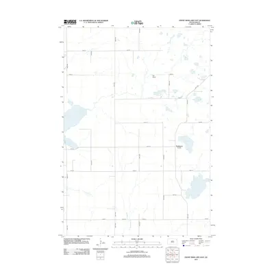 2012 Enemy Swim Lake East2012 Print · USGSThe glacial lake country of Roberts County is documented here in the early twenty-first century, showing a landscape shaped by water and agriculture. Researchers can locate Rudebusch Corner and trace the shorelines of Enemy Swim Lake and Hurricane Lake.
Showing maps 1-25 of 77
Top cities near Enemy Swim District
- Waubay historical maps
- Florence historical maps
- Summit historical maps
- Spring Grove historical maps
- Grenville historical maps
- Ortley historical maps
Top neighborhoods of Enemy Swim District
- Enemy Swim historical maps
- Sunrise Hutterite Colony historical maps
- Rudebusch Corner historical maps
- Ortley historical maps
Frequently asked questions
- What are the different types of historical maps available for Enemy Swim District?
- What is the oldest map of Enemy Swim District?
- Where can I purchase historical maps of Enemy Swim District for my home or office?
- Where can I download high-res historical maps of Enemy Swim District?
- Are there historical topographic maps available for Enemy Swim District?
- Is there historical aerial imagery available for Enemy Swim District?
- Where are historical maps of Enemy Swim District sourced from?