Old Maps of Heppner, South Dakota for Genealogy
Trace your family roots with 9 historic maps of Heppner. These high-res maps reveal old neighborhoods, homesites, landmarks, and streets — helping you uncover where your ancestors lived and how the area evolved over time.
- Explore historic neighborhoods: Identify where your relatives may have lived in the 1800s or 1900s.
- Compare maps over time: Trace the changes in streets, buildings, and landmarks for multi-generational research.
- Perfect for genealogy & ancestry research: Used by family historians and researchers to map out lineage and migration.
These maps are an incredible resource for exploring your personal connection to Heppner's past.
Heppner, SD maps
(9)- 1902 Map of Edgemont
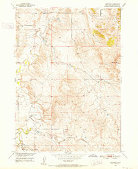
 1902 Edgemont1902 Print · USGSThe Black Hills frontier meets the Nebraska plains at the turn of the century, centered on the rail hub of Edgemont. Trace early settlements and rail stops like Minnekahta, Ardmore, and the Quarry as they appeared in this early 1902 survey.4 unique versions available
 - 1950 Map of Heppner, 1952 Print
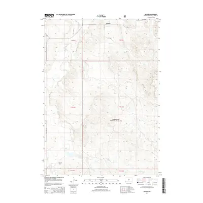
 1950 Heppner1952 Print · USGSFall River County ranch lands are captured here in the early 1950s as part of the Missouri River Basin development program. Researchers can locate specific sites like Landers Ranch, the settlement of Heppner, and rural schoolhouses such as Maitland Sch.2 unique versions available
 - 1955 Map of Hot Springs, 1958 Print
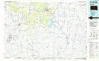
 1955 Hot Springs1958 Print · USGSThe Black Hills and South Dakota badlands are captured here in the mid-fifties, during a peak of military and industrial activity. Researchers can locate the Black Hills Ordnance Depot, early Uranium Mines, and historic rail stops like Pringle or Oglala.5 unique versions available
 - 1985 Map of Hot Springs, 1986 Print
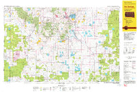
 1985 Hot Springs1986 Print · USGSThe Black Hills meet the southern grasslands in the mid-eighties as this region balances military history with ranching life. Genealogists and historians can trace the foundations of Igloo, locate the National Cem at Hot Springs, or follow the rail lines through Edgemont.2 unique versions available
 - 1993 Map of Hot Springs
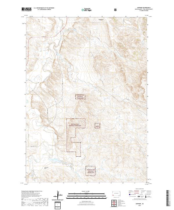
 1993 Hot Springs1993 Print · USGSThe southern Black Hills and Nebraska borderlands are captured here in the late twentieth century, showing a landscape of national forests and grasslands. You can trace the Black Hills Ordnance Depot near Igloo and follow the Burlington Northern rail lines through Edgemont.
 - 2012 Map of Heppner, 2012 Print
 2012 Heppner2012 Print · USGSCovers Heppner, including Fall River County, United States, and other nearby areas
 - 2015 Map of Heppner, 2015 Print
 2015 Heppner2015 Print · USGSCovers Heppner, including Fall River County, United States, and other nearby areas
 - 2017 Map of Heppner, 2017 Print
 2017 Heppner2017 Print · USGSCovers Heppner, including Fall River County, United States, and other nearby areas
 - 2021 Map of Heppner, 2021 Print
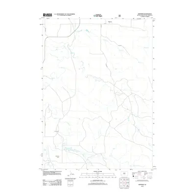
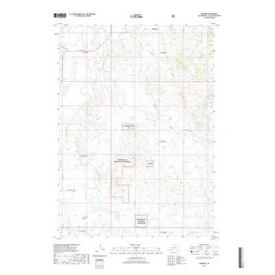
 2021 Heppner2021 Print · USGSThis part of Fall River County during the 2020s remains a vast expanse of public range and remote ranch lands. You can trace the drainage of Hat Cr through the Buffalo Gap National Grassland or locate the site of Heppner.
End of results
Showing maps 1-9 of 9
Top cities near Heppner
Frequently asked questions
- What are the different types of historical maps available for Heppner?
- What is the oldest map of Heppner?
- Where can I purchase historical maps of Heppner for my home or office?
- Where can I download high-res historical maps of Heppner?
- Are there historical topographic maps available for Heppner?
- Is there historical aerial imagery available for Heppner?
- Where are historical maps of Heppner sourced from?