Old Maps of Orient, South Dakota for Metal Detecting
Plan your next treasure hunt with 8 historic maps of Orient. Find old homesites, ghost towns, trails, and gathering spots that may be lost to time — perfect for identifying promising metal detecting locations.
- Locate forgotten sites: Uncover places like long-lost settlements, abandoned rail lines, or gathering spots.
- Plan better hunts: Use map overlays combined with LiDAR or satellite views to narrow in on historically rich areas.
- Made for detectorists: Thousands of hobbyists use these maps to discover relics, coins, and hidden history.
Use these historic maps to boost your research and find new opportunities beneath the surface of Orient.
Orient, SD maps
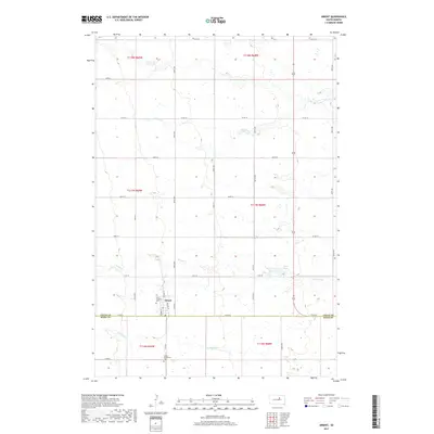
(8)- 1951 Map of Orient
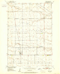 1951 Orient1951 Print · USGSThe rural agricultural landscape of Faulk County is captured here in the early fifties, centered on the rail terminus at Orient. Genealogists and local historians can locate family-named landmarks and essential community sites like Selting Sch and the Orient-Prairieview Cem.2 unique versions available
 - 1953 Map of Huron, 1959 Print
 1953 Huron1959 Print · USGSCentral South Dakota comes alive in the mid-1950s as a thriving rail and agricultural corridor between the Missouri and James Rivers. Trace the legacy of family farms and prairie towns like Huron, Faulkton, and Wessington Springs along the historic Chicago and North Western rail lines.3 unique versions available
 - 1954 Map of Huron, 1977 Print
 1954 Huron1977 Print · USGSCentral South Dakota was a landscape of grain elevators and river bends during the mid-fifties. Genealogists and historians can trace the development of the James River valley through railroad towns like Redfield and the sprawling Crow Creek Indian Reservation.
 - 1985 Map of Highmore, 1986 Print
 1985 Highmore1986 Print · USGSThe central South Dakota plains in the mid-1980s are defined by the Chicago and North Western rail line and a mosaic of waterfowl production areas. Researchers can trace the layout of prairie towns like Blunt, Holabird, and Highmore, and find family-named landmarks such as Schaefer Lake and Huss Spring.3 unique versions available
 - 2012 Map of Orient, 2012 Print
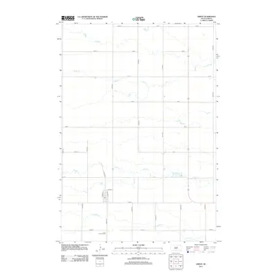 2012 Orient2012 Print · USGSCovers Orient, including Faulk County, Hand County, and other nearby areas
 - 2015 Map of Orient, 2015 Print
 2015 Orient2015 Print · USGSCovers Orient, including Faulk County, Hand County, and other nearby areas
 - 2017 Map of Orient, 2017 Print
 2017 Orient2017 Print · USGSCovers Orient, including Faulk County, Hand County, and other nearby areas
 - 2021 Map of Orient, 2021 Print
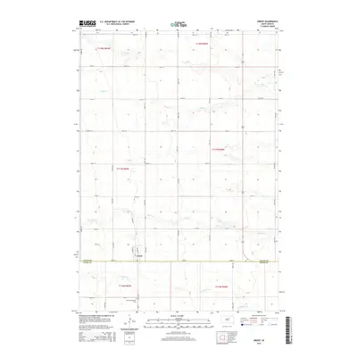
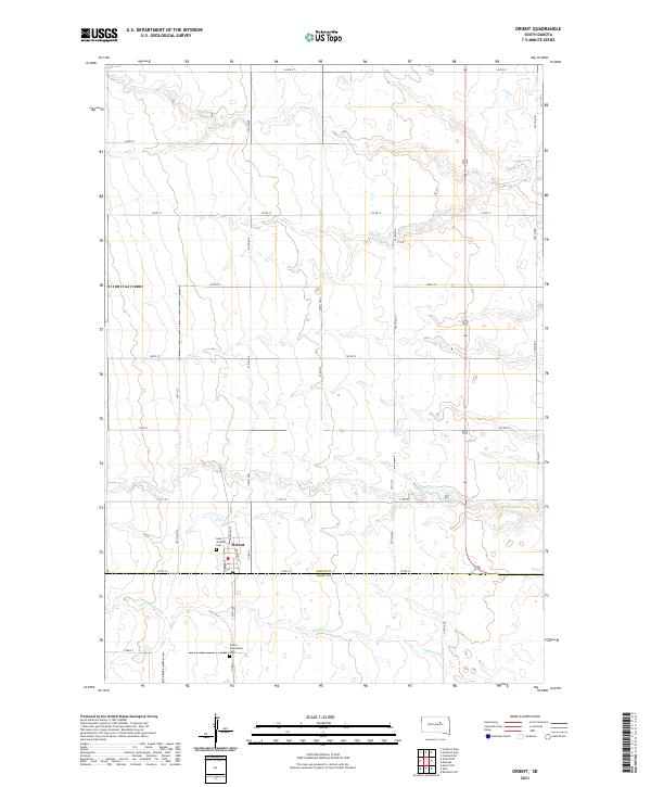 2021 Orient2021 Print · USGSThe rural town of Orient and its surrounding prairie homesteads are captured here during the early twenty-first century. Genealogists can trace family sites near Saint Josephs Cem and follow the winding courses of Gooder Cr and Lake Nora across the county line.
End of results
Showing maps 1-8 of 8
Top cities near Orient
Frequently asked questions
- What are the different types of historical maps available for Orient?
- What is the oldest map of Orient?
- Where can I purchase historical maps of Orient for my home or office?
- Where can I download high-res historical maps of Orient?
- Are there historical topographic maps available for Orient?
- Is there historical aerial imagery available for Orient?
- Where are historical maps of Orient sourced from?