
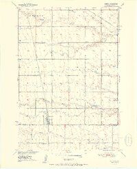
1951 Map of Orient
USGS Topo · Published 1951About this map
The town of Orient serves as the primary hub in this mid-century portrait of Faulk County, situated where the Chicago Milwaukee St Paul and Pacific railroad reaches its terminus. The landscape is defined by the prairie drainages of Bryant Creek and Gooder Creek, with Lake Nora providing a rare permanent water feature in the eastern reaches.
Find a feature on this map
18 named features on this map. Tap any name to fly to it.
Don’t see what you’re looking for? This feature index may not catch every label — zoom into the map to look around manually.
Map Details
Editions of this 1951 Orient Map
2 editions found
Other maps of this area

1899 · Northville
USGS Topo · 1:125,000

1899 · Redfield
USGS Topo · 1:125,000

1951 · Orient SW
USGS Topo · 1:24,000

1951 · Polo
USGS Topo · 1:24,000

1951 · Orient NW
USGS Topo · 1:24,000

1952 · Faulkton West
USGS Topo · 1:24,000

1952 · Faulkton East
USGS Topo · 1:24,000

1953 · Huron
USGS Topo · 1:250,000

1954 · Aberdeen
USGS Topo · 1:250,000

1954 · Huron
USGS Topo · 1:250,000