2020s Maps of Estelline Township, South Dakota
Explore 4 historic maps of Estelline Township from the 2020s. These maps offer a rare glimpse into what life looked like during the 2020s — showing old roads, neighborhoods, homes, and landmarks that have changed or disappeared over time.
Whether you're researching your family's past, planning a metal detecting trip, or studying how Estelline Township's landscape evolved across the 2020s, these high-resolution maps are a powerful tool for exploring the history of this region.
- Focus on a specific era: All maps on this page are from the 2020s, giving you a focused view of this time period.
- See what’s changed: Compare century-old streets, trails, and buildings to today's modern landscape using overlays and satellite layers.
- Research with precision: Use these maps for genealogy, historical research, land use analysis, or educational projects.
- View, download, or print: Maps are fully viewable online in high resolution, and can be downloaded or printed for your own records.
Start exploring Estelline Township's history through authentic maps from the 2020s. This is your window into the past.
Estelline Township, SD maps
(4)- 2021 Map of Dempster, 2021 Print
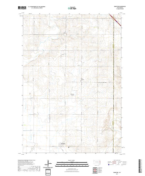 2021 Dempster2021 Print · USGSHamlin County in the early twenty-first century reveals a landscape defined by the rolling Coteau des Prairies and agricultural heritage. Genealogists can trace local roots at the Dempster Cem and the Hamlin Reformed Church Cem near Dempster.
 - 2021 Map of Estelline, 2021 Print
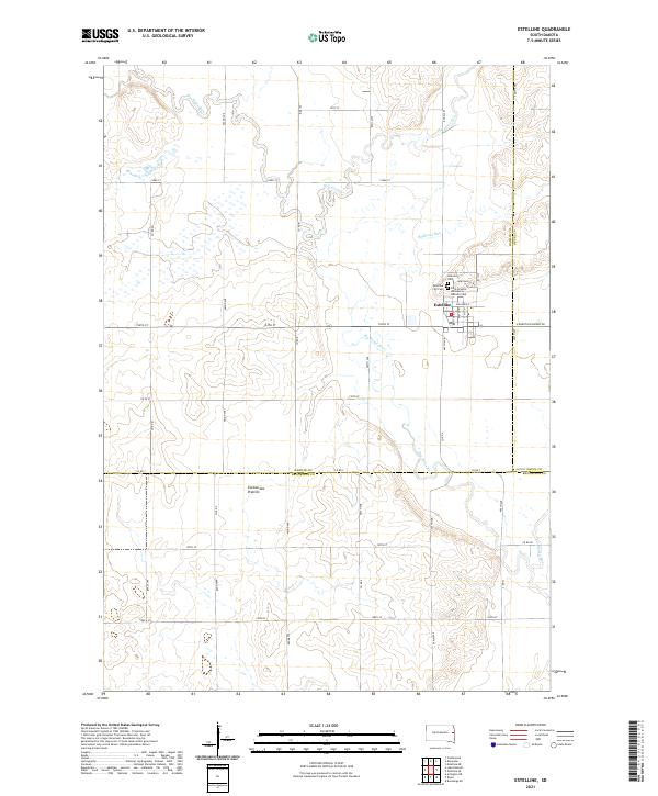 2021 Estelline2021 Print · USGSThe community of Estelline and the eastern edge of the Coteau des Prairies are captured in this modern survey. Genealogists can locate family sites at Hillcrest Cem and Saint Francis de Sales Catholic Cem while tracing the winding path of the Big Sioux River.
 - 2021 Map of Lake Poinsett, 2021 Print
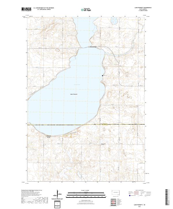 2021 Lake Poinsett2021 Print · USGSLake Poinsett sits at the heart of the glacial plateau in the early twenty-first century, straddling the line between Hamlin and Brookings Counties. Genealogists and local historians can locate Bakke Cem or trace the development of lakeside sites like Arlington Beach and Stone Bridge.
 - 2021 Map of Castlewood, 2021 Print
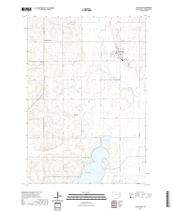 2021 Castlewood2021 Print · USGSCastlewood and the Big Sioux River valley are captured in this recent survey of Hamlin County. Local researchers can trace the shorelines of Lake Poinsett and Lake Florence, or locate burial sites at Saint John's Catholic Cem and Castlewood Cem.
End of results
Showing maps 1-4 of 4
Top cities near Estelline Township
- Arlington historical maps
- Estelline historical maps
- Castlewood historical maps
- Lake Norden historical maps
- Hayti historical maps
- Dempster historical maps
See more
Top neighborhoods of Estelline Township
Frequently asked questions
- What are the different types of historical maps available for Estelline Township?
- What is the oldest map of Estelline Township?
- Where can I purchase historical maps of Estelline Township for my home or office?
- Where can I download high-res historical maps of Estelline Township?
- Are there historical topographic maps available for Estelline Township?
- Is there historical aerial imagery available for Estelline Township?
- Where are historical maps of Estelline Township sourced from?