1900s (20th Century) Maps of Harding, South Dakota
Explore 6 historic maps of Harding from the 1900s (20th Century). These maps offer a rare glimpse into what life looked like during the 1900s — showing old roads, neighborhoods, homes, and landmarks that have changed or disappeared over time.
Whether you're researching your family's past, planning a metal detecting trip, or studying how Harding's landscape evolved across the 1900s, these high-resolution maps are a powerful tool for exploring the history of this region.
- Focus on a specific era: All maps on this page are from the 1900s, giving you a focused view of this time period.
- See what’s changed: Compare century-old streets, trails, and buildings to today's modern landscape using overlays and satellite layers.
- Research with precision: Use these maps for genealogy, historical research, land use analysis, or educational projects.
- View, download, or print: Maps are fully viewable online in high resolution, and can be downloaded or printed for your own records.
Start exploring Harding's history through authentic maps from the 1900s. This is your window into the past.
Harding, SD maps
(6)- 1935 Map of Harding
 1935 Harding1935 Print · USGSNorthwestern South Dakota in the mid-1930s was a vast expanse of range land where local life centered on the Custer National Forest and isolated outposts. Genealogists and historians can trace the early road networks and rural hubs like Harding, Gustave, and Mud Butte along the banks of the North Fork Moreau River.
 - 1954 Map of Lemmon, 1964 Print
 1954 Lemmon1964 Print · USGSThe high plains of South Dakota and North Dakota are documented here during the mid-twentieth century. Family researchers can trace dozens of country school sites like Green Cabin School and Bierke School alongside landmarks like The Castles.2 unique versions available
 - 1957 Map of Lemmon
 1957 Lemmon1957 Print · USGSThe northwestern plains of South Dakota and North Dakota are captured here in the mid-fifties, centered on the rail hub of Lemmon. Genealogists and historians can trace dozens of rural schoolhouses and vanished sites like Imogene and the Shadehill Reservoir area.
 - 1977 Map of Harding
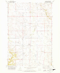 1977 Harding1977 Print · USGSHarding and the West Short Pine Hills are captured in the late seventies during a period of steady ranching and rural life. Researchers can find precise locations for the Brant School, Short Pine Cem, and the distinctive terrain of The Jump Off.
 - 1980 Map of Redig
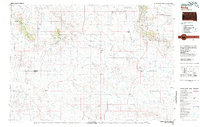 1980 Redig1980 Print · USGSNorthwest South Dakota is captured in the early eighties as a landscape of isolated ranges and sprawling ranchland. Researchers can locate remote outposts like Redig and Harding, or trace the rugged geography of Slim Buttes and the Short Pine Hills.
 - 1993 Map of Harding, 1996 Print
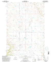 1993 Harding1996 Print · USGSHarding and the northwestern plains of South Dakota appear here in the early nineties, just as the landscape was being revised via aerial study. You can trace the rural landmarks of the period, from the Brant School and Short Pine Cem to the terrain at The Jump Off.
End of results
Showing maps 1-6 of 6
Top cities near Harding
Frequently asked questions
- What are the different types of historical maps available for Harding?
- What is the oldest map of Harding?
- Where can I purchase historical maps of Harding for my home or office?
- Where can I download high-res historical maps of Harding?
- Are there historical topographic maps available for Harding?
- Is there historical aerial imagery available for Harding?
- Where are historical maps of Harding sourced from?