1970s Maps of Hutchinson County, South Dakota
Explore 9 historic maps of Hutchinson County from the 1970s. These maps offer a rare glimpse into what life looked like during the 1970s — showing old roads, neighborhoods, homes, and landmarks that have changed or disappeared over time.
Whether you're researching your family's past, planning a metal detecting trip, or studying how Hutchinson County's landscape evolved across the 1970s, these high-resolution maps are a powerful tool for exploring the history of this region.
- Focus on a specific era: All maps on this page are from the 1970s, giving you a focused view of this time period.
- See what’s changed: Compare century-old streets, trails, and buildings to today's modern landscape using overlays and satellite layers.
- Research with precision: Use these maps for genealogy, historical research, land use analysis, or educational projects.
- View, download, or print: Maps are fully viewable online in high resolution, and can be downloaded or printed for your own records.
Start exploring Hutchinson County's history through authentic maps from the 1970s. This is your window into the past.
Hutchinson County, SD maps
(9)- 1970 Map of Clayton NE, 1972 Print
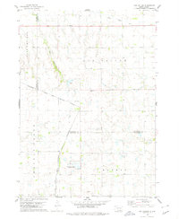
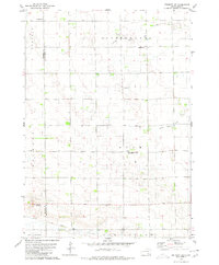
 1970 Clayton NE1972 Print · USGSHutchinson County agriculture and community life are well-documented in the early seventies, featuring the rolling prairie around Wolf Creek. Genealogists can trace local roots through landmarks like Stern Cem, New Hutterthal Ch, and the shores of Silver Lake.
 - 1970 Map of Freeman, 1972 Print
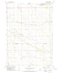
 1970 Freeman1972 Print · USGSHutchinson County agriculture and education are centered here in the early 1970s as the rail line still serves the prairie. Genealogists can trace family landmarks like Knodel Cem, Brookside Sch, and the campus of Freeman Jr College.
 - 1970 Map of Dolton, 1972 Print
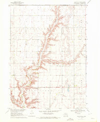
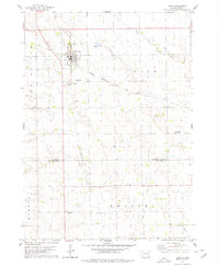
 1970 Dolton1972 Print · USGSSoutheast South Dakota's prairie landscape is documented here in the early seventies at the intersection of three counties. Genealogists and local historians can locate specific family landmarks such as Tschetter Cem and Hutterthal Ch near the waters of Silver Lake.
 - 1977 Map of Oak Hollow
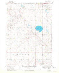
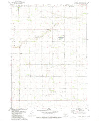
 1977 Oak Hollow1977 Print · USGSHutchinson County farmland is captured in sharp aerial detail during the late seventies, showing the precise layout of local agriculture. Genealogists and historians can locate specific farmsteads and water features like Tripp Lake and the drainage of Oak Hollow.
 - 1978 Map of Oak Hollow, 1979 Print
 1978 Oak Hollow1979 Print · USGSHutchinson and Douglas counties meet along the Yankton Indian Reservation line in the late seventies. Family historians can locate rural landmarks like Oak Hollow Cem, Zion Cem, and the local Townhall near Tripp Lake.
 - 1978 Map of Kaylor, 1979 Print
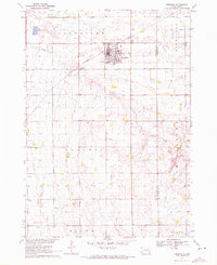
 1978 Kaylor1979 Print · USGSThe rural landscape around the settlement of Kaylor in the late 1970s is defined by its rail-linked economy and creek-fed pastures. Genealogists and researchers can trace the locations of Dennewitz Cem and St Johns Cem near the Chicago Milwaukee St Paul and Pacific line.
 - 1978 Map of Tripp, 1979 Print
 1978 Tripp1979 Print · USGSHutchinson and Bon Homme Counties are captured here in the late seventies, centered on the rail-side town of Tripp. Genealogists can trace a remarkable number of family burial sites, including Hoffnungstal Cem, Zion Cem, and Holy Rosary Cem.
 - 1979 Map of Delmont NE, 1980 Print
 1979 Delmont NE1980 Print · USGSHutchinson County during the late 1970s reveals a quiet landscape of prairie townships and conserved wetlands. Genealogists and historians can trace family roots near Miller Cem or explore the drainage of Twelvemile Creek and the Starr National Waterfowl Production Area.
 - 1979 Map of Delmont SE, 1980 Print
 1979 Delmont SE1980 Print · USGSThe prairie of Hutchinson and Douglas counties is captured in the late seventies as a landscape of structured farmsteads and quiet townships. Researchers can trace family history at Hoffnungsberg Cem or follow the path of the Old Railroad Grade near Townhall.
End of results
Showing maps 1-9 of 9
Top cities of Hutchinson County
Frequently asked questions
- What are the different types of historical maps available for Hutchinson County?
- What is the oldest map of Hutchinson County?
- Where can I purchase historical maps of Hutchinson County for my home or office?
- Where can I download high-res historical maps of Hutchinson County?
- Are there historical topographic maps available for Hutchinson County?
- Is there historical aerial imagery available for Hutchinson County?
- Where are historical maps of Hutchinson County sourced from?