
1970 Map of Clayton NE
USGS Topo · Published 1972About this map
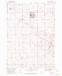
Wolf Creek carves a winding path through the southeastern corner of Hutchinson County, defining a landscape of deep drainage and expansive prairie. This 1970 survey captures the rural character of the region, where community life centered around local congregations like New Hutterthal Ch, Salem Ch, and Unity Ch. To the east, the large basin of Silver Lake stands out as a significant water body in an otherwise agricultural expanse. The map includes specific genealogical markers such as the Stern Cem, alongside indicators of local industry like a Gravel Pit. The terrain transition from the high ground of Pleasant and Grandview down toward the creek beds highlights the subtle but distinct topography of the eastern South Dakota plains during the late twentieth century.
Find a feature on this map
11 named features on this map. Tap any name to fly to it.
Don’t see what you’re looking for? This feature index may not catch every label — zoom into the map to look around manually.
Map Details
Editions of this 1970 Clayton NE Map
This is the sole edition of this map. No revisions or reprints were ever made.
Other maps of this area

1898 · Olivet
USGS Topo · 1:125,000

1898 · Parker
USGS Topo · 1:125,000

1899 · Alexandria
USGS Topo · 1:125,000

1955 · Sioux Falls
USGS Topo · 1:250,000

1957 · Tschetter Colony
USGS Topo · 1:24,000

1957 · Clayton
USGS Topo · 1:24,000

1957 · Wolf Creek
USGS Topo · 1:24,000

1958 · Sioux Falls
USGS Topo · 1:250,000

1964 · Bridgewater East
USGS Topo · 1:24,000
1970 · Freeman
USGS Topo · 1:24,000
Featured Places
- Taylor Township, SD
- Grandview Township, SD
- Bridgewater Township, SD
- Silver Lake Township, SD
- Wolf Creek Township, SD