
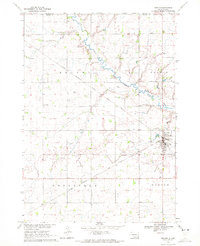
1964 Map of Bridgewater East
USGS Topo · Published 1966About this map
The agricultural landscape of McCook County is captured here in detail, centered on the diagonal passage of the Chicago Milwaukee St Paul and Pacific railroad. The settlement of Bridgewater sits on the western edge of the sheet, serving as a vital hub for the surrounding townships of Jefferson, Bridgewater, Emery, and Union. The terrain is characterized by the winding path of the West Fork Vermillion River in the northeast and a series of small, intermittent prairie potholes that dot the landscape.
Find a feature on this map
16 named features on this map. Tap any name to fly to it.
Don’t see what you’re looking for? This feature index may not catch every label — zoom into the map to look around manually.
Map Details
Editions of this 1964 Bridgewater East Map
This is the sole edition of this map. No revisions or reprints were ever made.
Other maps of this area

1898 · Olivet
USGS Topo · 1:125,000

1898 · Parker
USGS Topo · 1:125,000

1899 · Alexandria
USGS Topo · 1:125,000

1955 · Sioux Falls
USGS Topo · 1:250,000

1958 · Sioux Falls
USGS Topo · 1:250,000

1964 · Canistota
USGS Topo · 1:24,000

1964 · Salem NE
USGS Topo · 1:24,000

1964 · Salem
USGS Topo · 1:24,000

1970 · Clayton NE
USGS Topo · 1:24,000
1970 · Marion
USGS Topo · 1:24,000
Featured Places
- Bridgewater, SD
- Meadow View Hutterite Colony, SD
- Stanley Corner, SD
- Bridgewater Township, SD
- Emery Township, SD