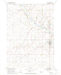
1970 Map of Marion
USGS Topo · Published 1972About this map
Marion serves as the primary hub in this portion of Turner Co, where the Chicago Milwaukee St Paul and Pacific railroad lines intersect the prairie landscape. The town is marked by a concentration of civic life, featuring a central Park, Grain Storage Bins, and the Greenwood Cem on its eastern edge. Outside the main settlement, the land is defined by the winding course of the West Vermillion River, which carves through the townships of Dolton, Monroe, and Rosefield.
Find a feature on this map
25 named features on this map. Tap any name to fly to it.
Don’t see what you’re looking for? This feature index may not catch every label — zoom into the map to look around manually.
Map Details
Editions of this 1970 Marion Map
This is the sole edition of this map. No revisions or reprints were ever made.
Other maps of this area

1898 · Parker
USGS Topo · 1:125,000

1955 · Sioux Falls
USGS Topo · 1:250,000

1958 · Sioux Falls
USGS Topo · 1:250,000

1964 · Canistota
USGS Topo · 1:24,000

1964 · Bridgewater East
USGS Topo · 1:24,000

1964 · East Vermillion Lake
USGS Topo · 1:24,000

1968 · Parker SW
USGS Topo · 1:24,000
1968 · Parker
USGS Topo · 1:24,000

1970 · Freeman SE
USGS Topo · 1:24,000
1970 · Freeman
USGS Topo · 1:24,000