
1957 Map of Tschetter Colony
USGS Topo · Published 1958About this map
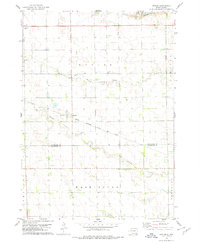
Tschetter Colony sits along a dramatic bend of the James River in this mid-century survey of Hutchinson County. The landscape is defined by the prairie's gradual descent toward the river valley, where Wolf Creek and Lonetree Creek drain into the main channel. The map reveals a highly organized rural social structure, evidenced by the regular distribution of country schools and churches that served the agricultural community during this era.
Find a feature on this map
19 named features on this map. Tap any name to fly to it.
Don’t see what you’re looking for? This feature index may not catch every label — zoom into the map to look around manually.
Map Details
Editions of this 1957 Tschetter Colony Map
This is the sole edition of this map. No revisions or reprints were ever made.
Other maps of this area

1898 · Olivet
USGS Topo · 1:125,000

1955 · Sioux Falls
USGS Topo · 1:250,000

1957 · Menno
USGS Topo · 1:24,000

1957 · Milltown
USGS Topo · 1:24,000

1957 · Clayton
USGS Topo · 1:24,000

1957 · Wolf Creek
USGS Topo · 1:24,000

1957 · Scotland
USGS Topo · 1:24,000

1958 · Sioux Falls
USGS Topo · 1:250,000

1970 · Clayton NE
USGS Topo · 1:24,000
1978 · Kaylor
USGS Topo · 1:24,000
Featured Places
- Clayton Township, SD
- Wittenberg Township, SD
- Tschetter Hutterite Colony, SD
- Capital Township, SD
- Kassel Township, SD