
1957 Map of Clayton
USGS Topo · Published 1958About this map
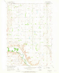
The James River meanders through the southwestern corner of this mid-century prairie landscape, creating a distinct topographical contrast to the surrounding tablelands of Clayton and Wittenberg townships. This 1957 field-checked survey reveals a rural society organized around a dense network of country schools, including Werning Sch, Highland Sch, and School No 52. The small settlement of Clayton serves as a central hub, flanked by the Clayton Cem and Rademacher Cem. Toward the south, the Congregational Ch stands near the headwaters of Wolf Creek, illustrating the dispersal of community life across the Hutchinson County plains. The presence of numerous Gravel Pits near the river bluffs suggests local aggregate extraction was a significant secondary activity to the dominant agricultural economy of the era.
Find a feature on this map
24 named features on this map. Tap any name to fly to it.
Don’t see what you’re looking for? This feature index may not catch every label — zoom into the map to look around manually.
Map Details
Editions of this 1957 Clayton Map
2 editions found
Other maps of this area

1898 · Olivet
USGS Topo · 1:125,000

1899 · Alexandria
USGS Topo · 1:125,000

1955 · Sioux Falls
USGS Topo · 1:250,000

1957 · Tschetter Colony
USGS Topo · 1:24,000

1957 · Milltown
USGS Topo · 1:24,000

1957 · Wolf Creek
USGS Topo · 1:24,000

1957 · Rockport Colony
USGS Topo · 1:24,000

1958 · Sioux Falls
USGS Topo · 1:250,000

1970 · Clayton NE
USGS Topo · 1:24,000

1973 · Spencer SW
USGS Topo · 1:24,000