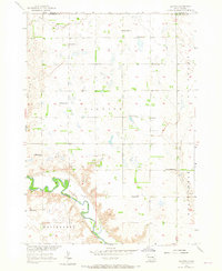
1957 Map of Clayton
USGS Topo · Published 1965About this map
The James River meanders through the southern portion of this landscape, cutting a sharp valley through the surrounding plains of Clayton and Wittenberg townships. This 1957 field check documents a rural South Dakota community organized around a dense network of country schools and churches. The small settlement of Clayton serves as a central point, anchored by the Clayton Sch and nearby Clayton Cem.
Find a feature on this map
21 named features on this map. Tap any name to fly to it.
Don’t see what you’re looking for? This feature index may not catch every label — zoom into the map to look around manually.
Map Details
Editions of this 1957 Clayton Map
2 editions found
Other maps of this area

1898 · Olivet
USGS Topo · 1:125,000

1899 · Alexandria
USGS Topo · 1:125,000

1955 · Sioux Falls
USGS Topo · 1:250,000

1957 · Tschetter Colony
USGS Topo · 1:24,000

1957 · Milltown
USGS Topo · 1:24,000

1957 · Clayton
USGS Topo · 1:24,000

1957 · Wolf Creek
USGS Topo · 1:24,000

1957 · Rockport Colony
USGS Topo · 1:24,000

1958 · Sioux Falls
USGS Topo · 1:250,000

1970 · Clayton NE
USGS Topo · 1:24,000