1960s Maps of Hyde County, South Dakota
Explore 8 historic maps of Hyde County from the 1960s. These maps offer a rare glimpse into what life looked like during the 1960s — showing old roads, neighborhoods, homes, and landmarks that have changed or disappeared over time.
Whether you're researching your family's past, planning a metal detecting trip, or studying how Hyde County's landscape evolved across the 1960s, these high-resolution maps are a powerful tool for exploring the history of this region.
- Focus on a specific era: All maps on this page are from the 1960s, giving you a focused view of this time period.
- See what’s changed: Compare century-old streets, trails, and buildings to today's modern landscape using overlays and satellite layers.
- Research with precision: Use these maps for genealogy, historical research, land use analysis, or educational projects.
- View, download, or print: Maps are fully viewable online in high resolution, and can be downloaded or printed for your own records.
Start exploring Hyde County's history through authentic maps from the 1960s. This is your window into the past.
Hyde County, SD maps
(8)- 1966 Map of Lower Brule NW, 1967 Print
 1966 Lower Brule NW1967 Print · USGSThe Missouri River valley in the mid-1960s shows a landscape transformed by the waters of Lake Sharpe. Researchers can locate rural landmarks like the Boot Bar Sch and Hidden Valley Sch alongside the West Bend Recreation Area.
 - 1966 Map of Big Bend Dam NE, 1967 Print
 1966 Big Bend Dam NE1967 Print · USGSThe Missouri River Basin in the mid-1960s reveals a sparse ranching landscape divided by the Crow Creek Indian Reservation Boundary. Genealogists and researchers can locate landmarks like the Knippling Ranch, Como, and Curtis Sch among the forks of Elm Creek.
 - 1966 Map of Stephan, 1967 Print
 1966 Stephan1967 Print · USGSThe borderlands of Hyde and Buffalo counties are captured in the mid-1960s, showing the settlement of Stephan and the Indian Reservation Boundary. Researchers can locate community anchors like the Stephan Sch and trace the headwaters of Campbell Creek.
 - 1966 Map of Lower Brule NE, 1967 Print
 1966 Lower Brule NE1967 Print · USGSThe Missouri River valley in the mid-sixties reveals a landscape reshaped by the rising waters of Missouri River Lake Sharpe. Local historians can trace the borders of the Lower Brule Indian Reservation Boundary and locate a small Cem near the bluffs.
 - 1968 Map of Harrold NW, 1971 Print
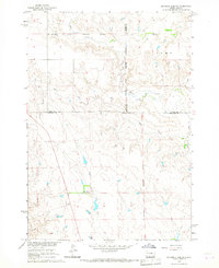
 1968 Harrold NW1971 Print · USGSThe South Dakota prairie comes into focus in the late sixties, showing a landscape defined by agricultural fencing and the drainage of Medicine Creek. Genealogists and local historians can locate Pleasant Sch and trace the boundary line between Sully Co and Hyde Co.
 - 1968 Map of Harrold, 1971 Print
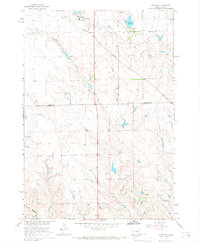
 1968 Harrold1971 Print · USGSThe rail-and-prairie town of Harrold is shown in the late sixties as the hub of a developing agricultural landscape. Researchers can trace the Chicago and North Western tracks, find family roots at St John Cem, or locate landmarks like the Harrold Municipal Airport.
 - 1968 Map of Holabird, 1971 Print
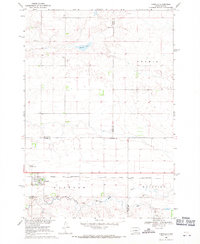
 1968 Holabird1971 Print · USGSHyde County ranching country is documented here in the late sixties, centered on the Chicago and North Western rail line. Researchers can trace local landmarks like the Loomis Sch and the course of South Fork Medicine Knoll Creek.
 - 1968 Map of Harrold NE, 1971 Print
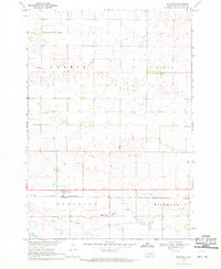
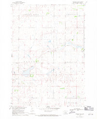 1968 Harrold NE1971 Print · USGSHyde County, South Dakota, is captured in the late 1960s as a landscape of broad basins and prairie schools. Researchers can locate the Valley Sch and trace the contours of the Spring Lake Valley and Lincoln Valley.
End of results
Showing maps 1-8 of 8
Top cities of Hyde County
Frequently asked questions
- What are the different types of historical maps available for Hyde County?
- What is the oldest map of Hyde County?
- Where can I purchase historical maps of Hyde County for my home or office?
- Where can I download high-res historical maps of Hyde County?
- Are there historical topographic maps available for Hyde County?
- Is there historical aerial imagery available for Hyde County?
- Where are historical maps of Hyde County sourced from?