2020s Maps of Hetland, South Dakota
Explore 2 historic maps of Hetland from the 2020s. These maps offer a rare glimpse into what life looked like during the 2020s — showing old roads, neighborhoods, homes, and landmarks that have changed or disappeared over time.
Whether you're researching your family's past, planning a metal detecting trip, or studying how Hetland's landscape evolved across the 2020s, these high-resolution maps are a powerful tool for exploring the history of this region.
- Focus on a specific era: All maps on this page are from the 2020s, giving you a focused view of this time period.
- See what’s changed: Compare century-old streets, trails, and buildings to today's modern landscape using overlays and satellite layers.
- Research with precision: Use these maps for genealogy, historical research, land use analysis, or educational projects.
- View, download, or print: Maps are fully viewable online in high resolution, and can be downloaded or printed for your own records.
Start exploring Hetland's history through authentic maps from the 2020s. This is your window into the past.
Hetland, SD maps
(2)- 2021 Map of Arlington, 2021 Print
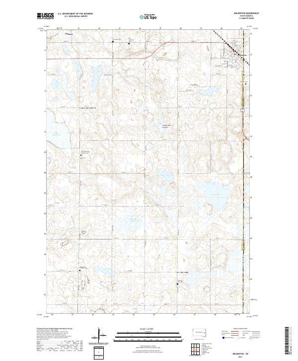 2021 Arlington2021 Print · USGSEastern Kingsbury County and the town of Arlington are mapped here in the modern era, showing the intersection of local agriculture and glacial geology. Researchers can locate many rural burial sites like Old Nordland Cem and Bangor Cem among the wetlands of Tenneboe Slough.
 - 2021 Map of Badger, 2021 Print
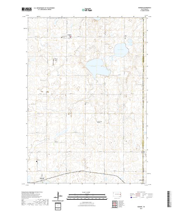 2021 Badger2021 Print · USGSSettlement patterns in eastern South Dakota are captured here in the early twenty-first century. Genealogists can trace family history through several rural sites like Nielsen Cem, Hetland Cem, and the village of Badger.
End of results
Showing maps 1-2 of 2
Top cities near Hetland
- Arlington historical maps
- Lake Preston historical maps
- Lake Norden historical maps
- Bryant historical maps
- Oldham historical maps
- Badger historical maps
See more
Frequently asked questions
- What are the different types of historical maps available for Hetland?
- What is the oldest map of Hetland?
- Where can I purchase historical maps of Hetland for my home or office?
- Where can I download high-res historical maps of Hetland?
- Are there historical topographic maps available for Hetland?
- Is there historical aerial imagery available for Hetland?
- Where are historical maps of Hetland sourced from?