1900s (20th Century) Maps of Manchester Township, South Dakota
Explore 9 historic maps of Manchester Township from the 1900s (20th Century). These maps offer a rare glimpse into what life looked like during the 1900s — showing old roads, neighborhoods, homes, and landmarks that have changed or disappeared over time.
Whether you're researching your family's past, planning a metal detecting trip, or studying how Manchester Township's landscape evolved across the 1900s, these high-resolution maps are a powerful tool for exploring the history of this region.
- Focus on a specific era: All maps on this page are from the 1900s, giving you a focused view of this time period.
- See what’s changed: Compare century-old streets, trails, and buildings to today's modern landscape using overlays and satellite layers.
- Research with precision: Use these maps for genealogy, historical research, land use analysis, or educational projects.
- View, download, or print: Maps are fully viewable online in high resolution, and can be downloaded or printed for your own records.
Start exploring Manchester Township's history through authentic maps from the 1900s. This is your window into the past.
Manchester Township, SD maps
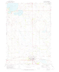
(9)- 1953 Map of Watertown, 1968 Print
 1953 Watertown1968 Print · USGSEastern South Dakota and the Minnesota borderlands are captured here during the mid-twentieth century as the region's agricultural and rail-service centers thrived. Genealogists and local historians can trace family-named sites across the Coteau des Prairies and find landmarks in Watertown, De Smet, and Brookings.3 unique versions available
 - 1958 Map of Watertown
 1958 Watertown1958 Print · USGSThe eastern South Dakota prairie and the Minnesota borderlands are captured here in the late fifties, showcasing a landscape of terminal moraine lakes and burgeoning rail hubs. Genealogists and historians can trace the early paths of the Chicago and North Western railroad or locate family roots in Watertown, Clark, or the Sisseton Indian Reservation.2 unique versions available
 - 1971 Map of Iroquois, 1973 Print
 1971 Iroquois1973 Print · USGSIroquois and the surrounding prairie are captured here in the early seventies as established agricultural and rail hubs. Genealogists and local historians can trace the town layouts of Iroquois and Esmond or locate the Cemetery and Lake Iroquois campground.
 - 1971 Map of Bancroft East, 1973 Print
 1971 Bancroft East1973 Print · USGSKingsbury County agriculture and transit meet in the early seventies as the grain-hauling era reaches its peak. Genealogists and rail historians can trace the Burlington Northern near Bancroft or locate the shoreline of Spirit Lake.
 - 1971 Map of De Smet, 1973 Print
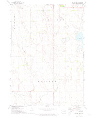
 1971 De Smet1973 Print · USGSDe Smet and the surrounding Kingsbury County prairie are captured here during the early seventies. Genealogists and local historians can locate the West Bethany Ch, Spirit Lake Cem, and the path of the Chicago and North Western railroad.
 - 1971 Map of Bancroft West, 1973 Print
 1971 Bancroft West1973 Print · USGSThe agricultural plains of Kingsbury and Beadle counties are captured here in the early 1970s, as the railroad still connected these rural townships. Researchers can trace land details near Bancroft and Osceola, or locate landmarks like the Cem and Osceola Lake.
 - 1971 Map of De Smet SE, 1973 Print
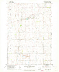
 1971 De Smet SE1973 Print · USGSKingsbury County agriculture and rural infrastructure are captured here in the early seventies. Genealogists and local historians can locate family burial sites at De Smet Cem and Johnson Cem or trace the path of Rock Creek.
 - 1971 Map of Manchester, 1973 Print
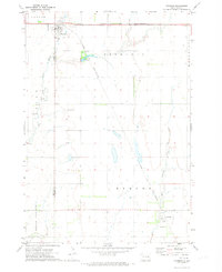
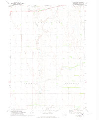 1971 Manchester1973 Print · USGSThe prairie landscape of Kingsbury County in the early seventies centers on the rail-side settlement of Manchester. Genealogists and historians can trace family farmsteads along Redstone Creek and the Chicago and North Western line.
 - 1985 Map of De Smet, 1986 Print
 1985 De Smet1986 Print · USGSEastern South Dakota in the mid-eighties shows a landscape of prairie rail towns and sprawling glacial lakes. Researchers can trace the routes of the Chicago and North Western through De Smet or locate communal sites like Pearl Creek Colony and Cloverleaf Colony.3 unique versions available
End of results
Showing maps 1-9 of 9
Top cities near Manchester Township
- De Smet historical maps
- Bryant historical maps
- Iroquois historical maps
- Carthage historical maps
- Esmond historical maps
- Bancroft historical maps
Frequently asked questions
- What are the different types of historical maps available for Manchester Township?
- What is the oldest map of Manchester Township?
- Where can I purchase historical maps of Manchester Township for my home or office?
- Where can I download high-res historical maps of Manchester Township?
- Are there historical topographic maps available for Manchester Township?
- Is there historical aerial imagery available for Manchester Township?
- Where are historical maps of Manchester Township sourced from?