Old Maps of Lake County, South Dakota for Metal Detecting
Plan your next treasure hunt with 88 historic maps of Lake County. Find old homesites, ghost towns, trails, and gathering spots that may be lost to time — perfect for identifying promising metal detecting locations.
- Locate forgotten sites: Uncover places like long-lost settlements, abandoned rail lines, or gathering spots.
- Plan better hunts: Use map overlays combined with LiDAR or satellite views to narrow in on historically rich areas.
- Made for detectorists: Thousands of hobbyists use these maps to discover relics, coins, and hidden history.
Use these historic maps to boost your research and find new opportunities beneath the surface of Lake County.
Lake County, SD maps
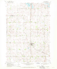
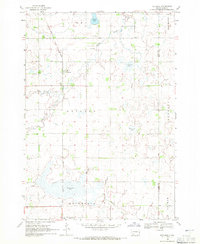
(88)- 1953 Map of Watertown, 1968 Print
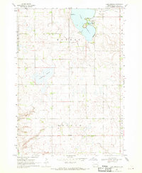
 1953 Watertown1968 Print · USGSEastern South Dakota and the Minnesota borderlands are captured here during the mid-twentieth century as the region's agricultural and rail-service centers thrived. Genealogists and local historians can trace family-named sites across the Coteau des Prairies and find landmarks in Watertown, De Smet, and Brookings.3 unique versions available
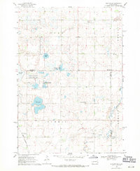
 - 1955 Map of Sioux Falls, 1967 Print
 1955 Sioux Falls1967 Print · USGSThe eastern South Dakota and western Minnesota borderlands come alive in the mid-fifties, showing the vital rail-to-river connections of the era. Genealogists can trace family footprints across townships like Madison and Pipestone, while following the paths of the Big Sioux River and the Chicago and North Western line.3 unique versions available
 - 1958 Map of Sioux Falls
 1958 Sioux Falls1958 Print · USGSThe tri-state borderlands of South Dakota, Minnesota, and Iowa are captured here during the mid-century peak of the regional rail network. Genealogists and historians can trace local landmarks like Augustana Academy, the St Marys Cem, and the path of the Illinois Central through Rock Rapids.
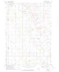
 - 1958 Map of Watertown
 1958 Watertown1958 Print · USGSThe eastern South Dakota prairie and the Minnesota borderlands are captured here in the late fifties, showcasing a landscape of terminal moraine lakes and burgeoning rail hubs. Genealogists and historians can trace the early paths of the Chicago and North Western railroad or locate family roots in Watertown, Clark, or the Sisseton Indian Reservation.2 unique versions available
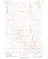
 - 1968 Map of Lake Madison, 1970 Print
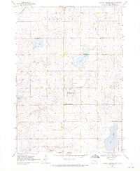
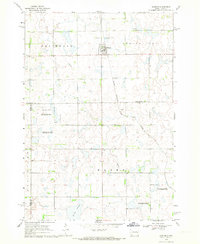
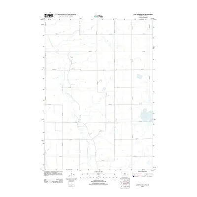
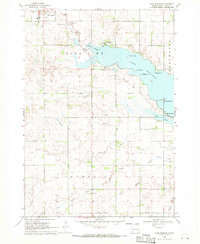 1968 Lake Madison1970 Print · USGSLake County's shoreline and prairie townships are captured here in the late sixties as the area's recreational and rural identity solidified. Genealogists and local researchers can locate St Thomas Cem, the settlement of Franklin, and the path of the Old Railroad Grade.
 - 1968 Map of Wentworth, 1970 Print
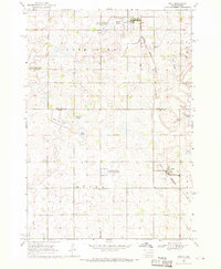
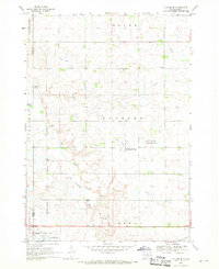
 1968 Wentworth1970 Print · USGSLake County at the end of the sixties reveals a transition from rail-dependent prairie towns to a landscape of conservation and recreation. Researchers can trace family plots at Rose Hill Cem and explore the historic rail corridors of the Great Northern and the C M ST P & P.
 - 1968 Map of Ramona, 1970 Print
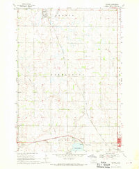 1968 Ramona1970 Print · USGSLake County agriculture and the rail-side life of the late sixties are preserved on this survey of the eastern South Dakota plains. Researchers can trace family sites near Ramona or locate local landmarks like the Drive-in Theater and Prairie Village.
 - 1968 Map of Madison, 1970 Print
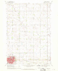 1968 Madison1970 Print · USGSMadison is shown as a thriving regional hub in the late sixties, centered on its college campus and railroad connections. Researchers can trace family roots through mapped landmarks like Graceland Cem, General Beadle State College, and Lake Madison Ch.
 - 1968 Map of Colton, 1970 Print
 1968 Colton1970 Print · USGSMinnehaha and Lake counties are shown here in the late sixties as the agricultural landscape of southeastern South Dakota continued its steady growth. Researchers can find numerous family-history sites like Taopi Cem and Huntimer or trace the Great Northern rail line.
 - 1968 Map of Sinai, 1970 Print
 1968 Sinai1970 Print · USGSThe prairie wetlands of Brookings and Lake Counties are captured here in the late sixties as agricultural life centered on the local rail line. Genealogists and historians can trace the foundations of Sinai and Nunda, locating rural landmarks like Ash Grove Cem and the central Townhall.
 - 1968 Map of Buffalo Trading Post, 1970 Print
 1968 Buffalo Trading Post1970 Print · USGSThe prairie lake country of Lake and Minnehaha counties is captured here in the late sixties, showing a landscape of rural homesteads and glacial waters. Genealogists can locate family landmarks like St Jacobs Cem, Bethany Cem, and the historic Buffalo Trading Post.
 - 1968 Map of Lake Madison SW, 1970 Print
 1968 Lake Madison SW1970 Print · USGSEastern McCook County and neighboring Lake County are shown in the late sixties as a landscape of river bends and rural townships. Researchers can find St Peters Ch, Ramsey Cem, and the old Townhall along the East Fork Vermillion River.
 - 1968 Map of Lake Herman, 1970 Print
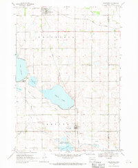
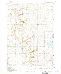
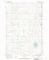
 1968 Lake Herman1970 Print · USGSLake County, South Dakota, is captured here in the late sixties, showing a landscape defined by glacial sloughs and prairie agriculture. Genealogists and local historians can trace the rural infrastructure around Lake Herman, including Orland, Camp Lakodia, and the Cem near the banks of Silver Creek.
 - 1968 Map of Oldham, 1970 Print
 1968 Oldham1970 Print · USGSKingsbury County and the town of Oldham are shown during the late 1960s, capturing a traditional South Dakota prairie community linked by rail. Researchers can trace family sites at St Andreas Cem or Toles Cem and locate landmarks like the Townhall.
 - 1968 Map of Oldham SE, 1970 Print
 1968 Oldham SE1970 Print · USGSLake County prairie life in the late sixties is centered on the railroad town of Winifred and its surrounding wetlands. Genealogists and local historians can trace family locations near St Johns Ch, the Winfred Cem, and the winding East Fork Vermillion River.
 - 1968 Map of Madison NW, 1971 Print
 1968 Madison NW1971 Print · USGSLake County and Kingsbury County are captured in the late sixties at the height of their rail-and-water prairie character. Researchers can trace the Milwaukee Road rail line and locate St Anns Cem near the shores of Lake Badus.
 - 1968 Map of Rutland, 1971 Print
 1968 Rutland1971 Print · USGSThe prairie townships of Lake County were dominated by the rail-and-water landscape of the late sixties. Researchers can trace the Great Northern line through Rutland, locate the Lake Park Cem, and map the shores of Milwaukee Lake.
 - 1968 Map of Rutland NW, 1971 Print
 1968 Rutland NW1971 Print · USGSEastern South Dakota’s agricultural and wetland landscape is captured here in the late sixties, where the border of Lake and Brookings Counties meets. Genealogists can locate family landmarks such as Oslo Ch, Prairie Queen Cem, and the Townhall.2 unique versions available
 - 1971 Map of Winfred, 1974 Print
 1971 Winfred1974 Print · USGSLake County and the surrounding prairies are captured in the early seventies, centered on the rail-side settlement of Winfred. Researchers can trace the path of the East Fork Vermillion River past Graceville Colony and the local Township Cem.
 - 1971 Map of Winfred SE, 1974 Print
 1971 Winfred SE1974 Print · USGSThe prairie townships of McCook and Lake County are captured here in the early seventies, showing a landscape defined by water management and rural governance. Genealogists and researchers can locate the Center settlement and Townhall, or trace the winding paths of the Little Vermillion River and the Fk Vermillion R.
 - 1985 Map of Sioux Falls
 1985 Sioux Falls1985 Print · USGSIn the mid-1980s, the borderlands of South Dakota, Minnesota, and Iowa reveal a landscape shaped by the Big Sioux River and a growing urban hub. Researchers can trace the development of Sioux Falls and locate smaller communities like Dell Rapids, Garretson, and Valley Springs.2 unique versions available
 - 1985 Map of Brookings
 1985 Brookings1985 Print · USGSThe South Dakota and Minnesota borderlands in the mid-1980s are defined here by a network of prairie lakes and bustling rail corridors. Researchers can trace the path of the Chicago and North Western through Brookings or explore the numerous wetlands of Oakwood Lakes State Park.2 unique versions available
 - 1985 Map of Salem
 1985 Salem1985 Print · USGSEastern South Dakota’s prairie landscape is showcased in the mid-eighties, highlighting a region defined by agricultural colonies and rail-linked towns. Genealogists and historians can trace the foundations of Rosedale Colony, the Buffalo Trading Post, and early hubs like Salem.
 - 1985 Map of De Smet, 1986 Print
 1985 De Smet1986 Print · USGSEastern South Dakota in the mid-eighties shows a landscape of prairie rail towns and sprawling glacial lakes. Researchers can trace the routes of the Chicago and North Western through De Smet or locate communal sites like Pearl Creek Colony and Cloverleaf Colony.3 unique versions available
 - 2012 Map of Lake Madison SW, 2012 Print
 2012 Lake Madison SW2012 Print · USGSCovers Lake County, including Richland Township, Montrose Township, and other nearby areas
Showing maps 1-25 of 88
Frequently asked questions
- What are the different types of historical maps available for Lake County?
- What is the oldest map of Lake County?
- Where can I purchase historical maps of Lake County for my home or office?
- Where can I download high-res historical maps of Lake County?
- Are there historical topographic maps available for Lake County?
- Is there historical aerial imagery available for Lake County?
- Where are historical maps of Lake County sourced from?