1900s (20th Century) Maps of Lincoln Township, South Dakota
Explore 8 historic maps of Lincoln Township from the 1900s (20th Century). These maps offer a rare glimpse into what life looked like during the 1900s — showing old roads, neighborhoods, homes, and landmarks that have changed or disappeared over time.
Whether you're researching your family's past, planning a metal detecting trip, or studying how Lincoln Township's landscape evolved across the 1900s, these high-resolution maps are a powerful tool for exploring the history of this region.
- Focus on a specific era: All maps on this page are from the 1900s, giving you a focused view of this time period.
- See what’s changed: Compare century-old streets, trails, and buildings to today's modern landscape using overlays and satellite layers.
- Research with precision: Use these maps for genealogy, historical research, land use analysis, or educational projects.
- View, download, or print: Maps are fully viewable online in high resolution, and can be downloaded or printed for your own records.
Start exploring Lincoln Township's history through authentic maps from the 1900s. This is your window into the past.
Lincoln Township, SD maps
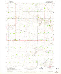
(8)- 1900 Map of Canton
 1900 Canton1900 Print · USGSSoutheastern South Dakota and the Iowa borderlands are captured here at a peak of late-nineteenth-century rail expansion. Genealogists can trace the early foundations of towns like Canton, Centerville, and Beresford along the Big Sioux River.2 unique versions available
 - 1955 Map of Sioux Falls, 1967 Print
 1955 Sioux Falls1967 Print · USGSThe eastern South Dakota and western Minnesota borderlands come alive in the mid-fifties, showing the vital rail-to-river connections of the era. Genealogists can trace family footprints across townships like Madison and Pipestone, while following the paths of the Big Sioux River and the Chicago and North Western line.3 unique versions available
 - 1958 Map of Sioux Falls
 1958 Sioux Falls1958 Print · USGSThe tri-state borderlands of South Dakota, Minnesota, and Iowa are captured here during the mid-century peak of the regional rail network. Genealogists and historians can trace local landmarks like Augustana Academy, the St Marys Cem, and the path of the Illinois Central through Rock Rapids.
 - 1964 Map of Canton SW, 1965 Print
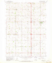
 1964 Canton SW1965 Print · USGSLincoln County townships such as Lynn and Dayton are shown here in the mid-1960s, still defined by a dense network of country schools and rail lines. Genealogists can locate family landmarks like Grand Valley Church, Forest Hill Cemetery, and Kerley School.
 - 1964 Map of Worthing, 1965 Print
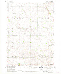
 1964 Worthing1965 Print · USGSLincoln County farmland is documented here in the mid-1960s as Interstate 29 began to reshape the local travel landscape. Genealogists and historians can locate numerous rural schools like Gedstad Sch and early landmarks including the Skie Air Service Landing Field.
 - 1968 Map of Alcester NW, 1970 Print
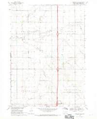
 1968 Alcester NW1970 Print · USGSLincoln County farmland in the late sixties is defined by its dense network of rural schools and country churches. Genealogists can trace family footprints near the Tuntland Cem, Norway Center, and several local landmarks like Sundy Sch.2 unique versions available
 - 1968 Map of Beresford NE, 1971 Print
 1968 Beresford NE1971 Print · USGSThe rural landscape of Lincoln County in the late sixties shows a traditional farming community at the dawn of the Interstate era. Researchers can trace the placement of local schoolhouses like Burney Sch and early burial sites including Skresfrud Cem.
 - 1985 Map of Rock Rapids
 1985 Rock Rapids1985 Print · USGSThe borderlands of South Dakota and Iowa come into focus in the mid-1980s, centered on the fertile valleys of the Big Sioux River. Genealogists and researchers can trace rural homesteads near Rock Rapids, find Dordt College in Sioux Center, or locate old burial sites like Grace Hill Cem.2 unique versions available
End of results
Showing maps 1-8 of 8
Top cities near Lincoln Township
- Harrisburg historical maps
- Tea historical maps
- Canton historical maps
- Lennox historical maps
- Beresford historical maps
- Worthing historical maps
See more
Frequently asked questions
- What are the different types of historical maps available for Lincoln Township?
- What is the oldest map of Lincoln Township?
- Where can I purchase historical maps of Lincoln Township for my home or office?
- Where can I download high-res historical maps of Lincoln Township?
- Are there historical topographic maps available for Lincoln Township?
- Is there historical aerial imagery available for Lincoln Township?
- Where are historical maps of Lincoln Township sourced from?