Old Maps of Britton, South Dakota for Academic Research
Study the evolution of Britton with 13 high-resolution historic maps. Whether you're teaching, researching, or modeling changes in land use, these maps provide essential visual documentation of urban, environmental, and geographic change.
- Analyze long-term change: Track patterns in development, transportation, and natural features.
- Ideal for environmental or urban studies: Support academic projects with primary historical map data.
- Use in the classroom or lab: Educators and researchers rely on these maps to bring historical context to life.
These maps are a powerful tool for teaching, research, and visualizing how Britton has changed over the decades.
Britton, SD maps
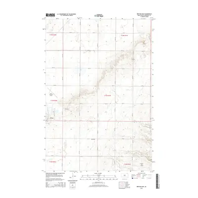
(13)- 1953 Map of Britton East, 1954 Print
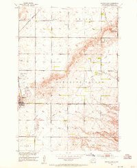 1953 Britton East1954 Print · USGSIn the early fifties, the hub of Britton sat at a vital crossroads for the Great Northern and Milwaukee Road railways. Researchers can find rural landmarks like Pleasant Hill Cem, three numbered schools, and the White Lake State Game Refuge.2 unique versions available
 - 1953 Map of Milbank, 1958 Print
 1953 Milbank1958 Print · USGSThe tri-state border region of South Dakota, North Dakota, and Minnesota is shown here during the early fifties, a landscape defined by glacial lakes and the Sisseton Indian Reservation. Researchers can trace the legacy of the western railroads, locating old stops along the Great Northern and settlements like Milbank, Webster, and Sisseton.3 unique versions available
 - 1956 Map of Britton West, 1957 Print
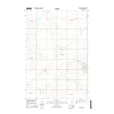
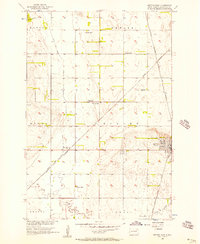 1956 Britton West1957 Print · USGSMarshall County's agricultural and rail heartland is captured here in the mid-1950s. Genealogists and rail historians can trace the paths of the Great Northern and Milwaukee Road through Britton and find School No 1.2 unique versions available
 - 1958 Map of Milbank
 1958 Milbank1958 Print · USGSThe northern Great Plains in the late fifties show a landscape of glacial lakes and reservation lands shaped by the Great Northern railroad. Genealogists and local historians can trace the grid of settlements from Britton to Milbank and locate landmarks like Enemy Swim Lake and the Sisseton Indian Reservation.
 - 1979 Map of Sisseton, 1980 Print
 1979 Sisseton1980 Print · USGSNortheastern South Dakota and the North Dakota borderlands appear here in the late seventies, centered on the high glacial plateau. Genealogists and historians can trace the Sisseton Indian Reservation and rail-stop towns like Britton and Lake City.
 - 2012 Map of Britton East, 2012 Print
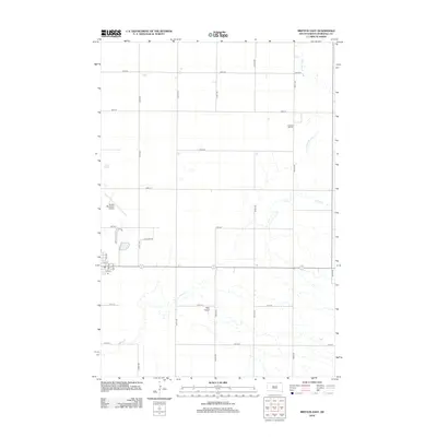 2012 Britton East2012 Print · USGSCovers Britton, including Marshall County, United States, and other nearby areas
 - 2012 Map of Britton West, 2012 Print
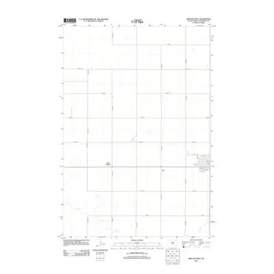 2012 Britton West2012 Print · USGSCovers Britton, including West Britton, Marshall County, and other nearby areas
 - 2015 Map of Britton East, 2015 Print
 2015 Britton East2015 Print · USGSCovers Britton, including Marshall County, United States, and other nearby areas
 - 2015 Map of Britton West, 2015 Print
 2015 Britton West2015 Print · USGSCovers Britton, including West Britton, Marshall County, and other nearby areas
 - 2017 Map of Britton East, 2017 Print
 2017 Britton East2017 Print · USGSCovers Britton, including Marshall County, United States, and other nearby areas
 - 2017 Map of Britton West, 2017 Print
 2017 Britton West2017 Print · USGSCovers Britton, including West Britton, Marshall County, and other nearby areas
 - 2021 Map of Britton East, 2021 Print
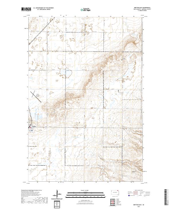 2021 Britton East2021 Print · USGSIn Marshall County during the early 2020s, the landscape around the town of Britton remains a structured grid of prairie farms and prairie waterways. Genealogists and local historians can trace legacy sites like Pleasant Hill Cem or the winding path of Wild Rice Cr.
 - 2021 Map of Britton West, 2021 Print
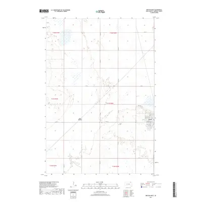
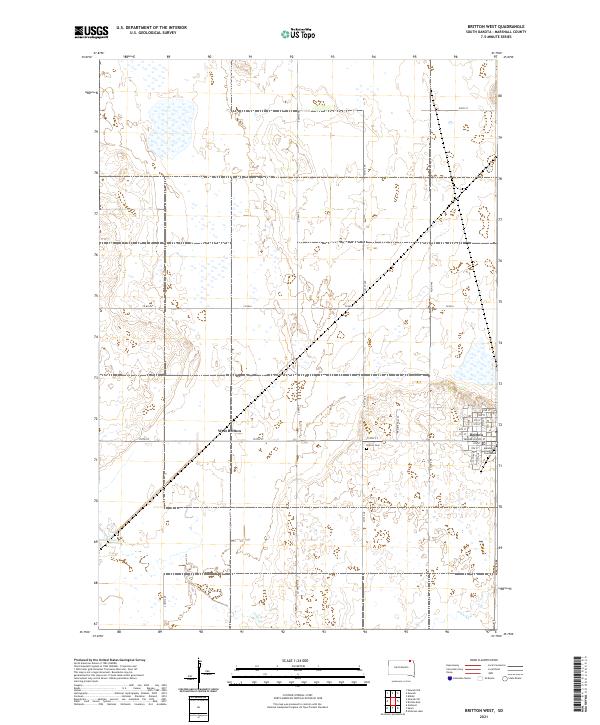 2021 Britton West2021 Print · USGSMarshall County in the early twenty-first century reveals the organized grid of a prairie county seat. Researchers can locate civic landmarks like the Marshall County Courthouse, the Britton Cem, and follow the path of Crow Cr.
End of results
Showing maps 1-13 of 13
Top cities near Britton
- Langford historical maps
- Havana historical maps
- Brampton Township historical maps
- Newark historical maps
Frequently asked questions
- What are the different types of historical maps available for Britton?
- What is the oldest map of Britton?
- Where can I purchase historical maps of Britton for my home or office?
- Where can I download high-res historical maps of Britton?
- Are there historical topographic maps available for Britton?
- Is there historical aerial imagery available for Britton?
- Where are historical maps of Britton sourced from?