1900s (20th Century) Maps of Eureka, South Dakota
Explore 5 historic maps of Eureka from the 1900s (20th Century). These maps offer a rare glimpse into what life looked like during the 1900s — showing old roads, neighborhoods, homes, and landmarks that have changed or disappeared over time.
Whether you're researching your family's past, planning a metal detecting trip, or studying how Eureka's landscape evolved across the 1900s, these high-resolution maps are a powerful tool for exploring the history of this region.
- Focus on a specific era: All maps on this page are from the 1900s, giving you a focused view of this time period.
- See what’s changed: Compare century-old streets, trails, and buildings to today's modern landscape using overlays and satellite layers.
- Research with precision: Use these maps for genealogy, historical research, land use analysis, or educational projects.
- View, download, or print: Maps are fully viewable online in high resolution, and can be downloaded or printed for your own records.
Start exploring Eureka's history through authentic maps from the 1900s. This is your window into the past.
Eureka, SD maps
(5)- 1954 Map of Aberdeen, 1964 Print
 1954 Aberdeen1964 Print · USGSNortheastern South Dakota in the mid-fifties remains a world of rail-dependent prairie towns and sweeping waterfowl refuges. Genealogists can trace family roots through settlements like Eureka and Ipswich or locate rural landmarks near Richmond Lake.2 unique versions available
 - 1956 Map of Aberdeen
 1956 Aberdeen1956 Print · USGSUpper South Dakota during the mid-fifties remains a landscape of rail-connected farming towns and expansive glacial lake basins. Genealogists and historians can trace the paths of the Minneapolis and St Louis railroad through Gettysburg or locate vanished stops near Elm Lake and Richmond Lake.
 - 1978 Map of Eureka West, 1979 Print
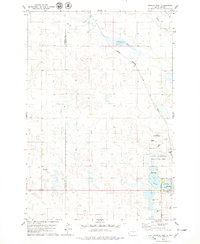 1978 Eureka West1979 Print · USGSMcPherson County was a landscape of rail-connected prairie towns and protected wetlands in the late 1970s. Trace the diagonal route of the Chicago Milwaukee St Paul and Pacific railroad or locate family sites at Zion Cem and Ch of God Cem.
 - 1978 Map of Eureka East, 1979 Print
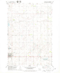 1978 Eureka East1979 Print · USGSEureka and its surrounding prairie wetlands are captured in the late 1970s as the railroad still connected this agricultural community to the wider region. Researchers can trace family history through Aman Cem or map the boundaries of the National Waterfowl Production Area.
 - 1985 Map of Eureka, 1986 Print
 1985 Eureka1986 Print · USGSThe northern plains of the mid-eighties come alive in this survey of the border country between South Dakota and North Dakota. Researchers can trace the rail-side growth of Eureka and Hosmer or locate local landmarks like the Plainview Colony and Lake Hiddenwood State Park.3 unique versions available
End of results
Showing maps 1-5 of 5
Top cities near Eureka
- Hosmer historical maps
- Zeeland historical maps
- Venturia historical maps
- Artas historical maps
- Hillsview historical maps
Frequently asked questions
- What are the different types of historical maps available for Eureka?
- What is the oldest map of Eureka?
- Where can I purchase historical maps of Eureka for my home or office?
- Where can I download high-res historical maps of Eureka?
- Are there historical topographic maps available for Eureka?
- Is there historical aerial imagery available for Eureka?
- Where are historical maps of Eureka sourced from?