
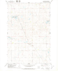
1978 Map of Eureka West
USGS Topo · Published 1979About this map
The Campbell Co MC Pherson Co boundary line bisects this prairie landscape, where the iron rails of the Chicago Milwaukee St Paul and Pacific railroad cut a diagonal path toward the regional hub of Eureka. The town's western edge is defined by a cluster of civic and industrial sites, including the Eureka Municipal Airport and several Gravel Pits. Water is a central theme of this terrain, ranging from the recreational Park and Picnic Areas at Eureka Lake to the protected wetlands of the National Waterfowl Production Area. Local genealogy is anchored by the Zion Cem and the Ch of God Cem located near the Ch of God. The map captures a transition in land use, balancing traditional agriculture and transport with conservation areas and municipal infrastructure like the Sewage Disposal Ponds.
Find a feature on this map
17 named features on this map. Tap any name to fly to it.
Don’t see what you’re looking for? This feature index may not catch every label — zoom into the map to look around manually.
Map Details
Editions of this 1978 Eureka West Map
This is the sole edition of this map. No revisions or reprints were ever made.
Other maps of this area

1954 · Aberdeen
USGS Topo · 1:250,000

1956 · Aberdeen
USGS Topo · 1:250,000

1978 · Greenway
USGS Topo · 1:24,000

1978 · Zeeland
USGS Topo · 1:24,000

1978 · Venturia
USGS Topo · 1:24,000

1978 · Flat Lake
USGS Topo · 1:24,000

1978 · Feinstein Lake
USGS Topo · 1:24,000

1978 · Eureka East
USGS Topo · 1:24,000

1978 · Mutske Lake
USGS Topo · 1:24,000
1978 · Hillsview
USGS Topo · 1:24,000