1970s Maps of Wetonka, South Dakota
Explore 2 historic maps of Wetonka from the 1970s. These maps offer a rare glimpse into what life looked like during the 1970s — showing old roads, neighborhoods, homes, and landmarks that have changed or disappeared over time.
Whether you're researching your family's past, planning a metal detecting trip, or studying how Wetonka's landscape evolved across the 1970s, these high-resolution maps are a powerful tool for exploring the history of this region.
- Focus on a specific era: All maps on this page are from the 1970s, giving you a focused view of this time period.
- See what’s changed: Compare century-old streets, trails, and buildings to today's modern landscape using overlays and satellite layers.
- Research with precision: Use these maps for genealogy, historical research, land use analysis, or educational projects.
- View, download, or print: Maps are fully viewable online in high resolution, and can be downloaded or printed for your own records.
Start exploring Wetonka's history through authentic maps from the 1970s. This is your window into the past.
Wetonka, SD maps
(2)- 1970 Map of Wetonka South, 1973 Print
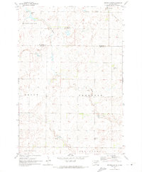 1970 Wetonka South1973 Print · USGSEdmunds County at the start of the 1970s reveals a quiet agricultural landscape organized by established township lines. Genealogists and local historians can trace the community history of Wetonka while locating the Pembrook Cem and an Old Railroad Grade.
 - 1970 Map of Wetonka North, 1973 Print
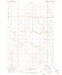 1970 Wetonka North1973 Print · USGSMcPherson County grain country is captured here in the early 1970s, centered on the settlement of Wetonka. Researchers can trace the path of the Old Railroad Grade and locate water features like Foot Creek and Crompton Lake.
End of results
Showing maps 1-2 of 2
Top cities near Wetonka
Frequently asked questions
- What are the different types of historical maps available for Wetonka?
- What is the oldest map of Wetonka?
- Where can I purchase historical maps of Wetonka for my home or office?
- Where can I download high-res historical maps of Wetonka?
- Are there historical topographic maps available for Wetonka?
- Is there historical aerial imagery available for Wetonka?
- Where are historical maps of Wetonka sourced from?