
1970 Map of Wetonka South
USGS Topo · Published 1973About this map
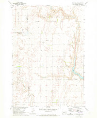
Snake Creek meanders through the heart of this North Central South Dakota landscape, defining a terrain shaped by glacial depressions and agricultural township boundaries. The northern edge of the map features the small settlement of Wetonka, accompanied by the nearby Wetonka Cem. To the south, the Pembrook Cem sits within the township of Pembrook, indicating the long-standing rural community centers of Edmunds County.
Find a feature on this map
17 named features on this map. Tap any name to fly to it.
Don’t see what you’re looking for? This feature index may not catch every label — zoom into the map to look around manually.
Map Details
Editions of this 1970 Wetonka South Map
This is the sole edition of this map. No revisions or reprints were ever made.
Other maps of this area

1899 · Ellendale
USGS Topo · 1:125,000

1899 · Northville
USGS Topo · 1:125,000

1954 · Aberdeen
USGS Topo · 1:250,000

1956 · Aberdeen
USGS Topo · 1:250,000

1970 · Lake Parmley
USGS Topo · 1:24,000

1970 · Mina NW
USGS Topo · 1:24,000

1970 · Leola
USGS Topo · 1:24,000
1970 · Richmond SW
USGS Topo · 1:24,000
1970 · Mina
USGS Topo · 1:24,000
1970 · Wetonka North
USGS Topo · 1:24,000