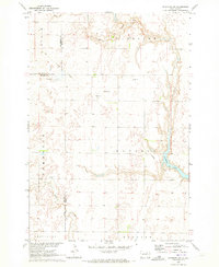
1970 Map of Richmond SW
USGS Topo · Published 1973About this map
Richmond Lake anchors the eastern edge of this 1970 South Dakota landscape, where the prairie begins its transition toward the James River valley. The geography is defined by a series of low-lying townships, including Ravina, Carlisle, Cortlandt, and Mercier, which span the border of Brown and Edmunds counties. The map captures a moment when the regional infrastructure was shifting, evidenced by the prominent Old Railroad Grade cutting diagonally through the northern sections, marking a legacy of early steam-era transport that once linked these isolated townships.
Find a feature on this map
15 named features on this map. Tap any name to fly to it.
Don’t see what you’re looking for? This feature index may not catch every label — zoom into the map to look around manually.
Map Details
Editions of this 1970 Richmond SW Map
This is the sole edition of this map. No revisions or reprints were ever made.
Other maps of this area

1899 · Ellendale
USGS Topo · 1:125,000

1899 · Northville
USGS Topo · 1:125,000

1952 · Richmond NE
USGS Topo · 1:24,000

1954 · Aberdeen
USGS Topo · 1:250,000

1956 · Aberdeen
USGS Topo · 1:250,000

1960 · Aberdeen West
USGS Topo · 1:24,000

1970 · Lake Parmley
USGS Topo · 1:24,000
1970 · Richmond
USGS Topo · 1:24,000

1970 · Wetonka South
USGS Topo · 1:24,000
1970 · Mina
USGS Topo · 1:24,000