
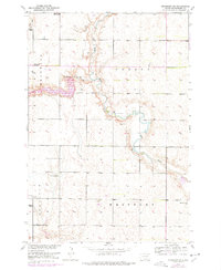
1952 Map of Richmond NE
USGS Topo · Published 1954About this map
Elm River meanders through the central plains of Brown County, defining the agricultural landscape in this mid-century survey. The region is marked by a shifting rural infrastructure, where several community hubs are already noted as inactive, including the Union Sch (Abandoned) and Franklyn Son (Abandoned). These notations provide critical data for genealogists and local historians tracking the consolidation of rural South Dakota districts during the 1950s.
Find a feature on this map
17 named features on this map. Tap any name to fly to it.
Don’t see what you’re looking for? This feature index may not catch every label — zoom into the map to look around manually.
Map Details
Editions of this 1952 Richmond NE Map
2 editions found
Other maps of this area

1894 · Ellendale
USGS Topo · 1:62,500

1894 · Columbia
USGS Topo · 1:62,500

1894 · Savo
USGS Topo · 1:62,500

1896 · Columbia
USGS Topo · 1:125,000

1899 · Ellendale
USGS Topo · 1:125,000

1952 · Ordway
USGS Topo · 1:24,000

1952 · Westport
USGS Topo · 1:24,000

1953 · Savo SW
USGS Topo · 1:24,000

1953 · Frederick
USGS Topo · 1:24,000

1954 · Aberdeen
USGS Topo · 1:250,000