Old Maps of Meade County, South Dakota for Hiking & Exploration
Hike through history with 179 historic maps of Meade County. Explore old trails, ghost towns, and forgotten backroads — perfect for outdoor adventurers and local explorers.
- Rediscover forgotten places: Map out old mining camps, roads, and footpaths that no longer exist on modern maps.
- Layer with modern tools: Combine with LiDAR or satellite views to plan hikes through historical terrain.
- Made for exploration: Popular among hikers, overlanders, and local history lovers.
Use these maps to find adventure and explore the hidden past of Meade County.
Meade County, SD maps
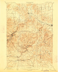
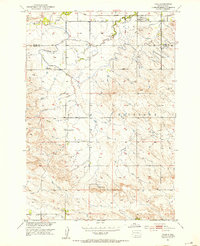
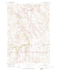
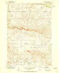
(179)- 1893 Map of Rapid
 1893 Rapid1893 Print · USGSThe Black Hills frontier comes alive in the late nineteenth century as rail lines and military outposts shape the territory. Genealogists and researchers can trace the early layout of Rapid, locate Fort Meade, and find family-named landmarks like Doe Dotie Ranch or Piedmont.2 unique versions available
 - 1894 Map of Deadwood
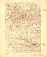
 1894 Deadwood1894 Print · USGSThe Black Hills gold mining region is documented here in the early 1890s, capturing the industrial density of Deadwood and Lead. Researchers can trace early rail lines and find specific mountain locations like the Normal School in Spearfish, Bull Dog Ranch, and Lookout Mill.2 unique versions available
 - 1898 Map of Rapid
 1898 Rapid1898 Print · USGSThe Black Hills foothills come alive in the 1890s, where early railroads meet military outposts and pioneer settlements. Trace the early streets of Rapid City, the grounds of Fort Meade, and localized landmarks like Crystal Cave.2 unique versions available
 - 1899 Map of Sturgis
 1899 Sturgis1899 Print · USGSThe Black Hills region thrives in the late nineteenth century as mining and rail lines connect the foothills to the mountains. Trace the early growth of Sturgis and Deadwood alongside landmarks like the Fort Meade Timber Reservation and Whitewood.2 unique versions available
 - 1901 Map of Deadwood
 1901 Deadwood1901 Print · USGSThe Black Hills gold mining region and the bustling camps of Lawrence County are captured here just before the modern era. Genealogists and historians can trace the early rail networks of the Burlington and Missouri River Railroad through remote outposts like Bulldog Ranch and Rochford.2 unique versions available
 - 1903 Map of Rapid
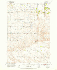
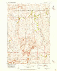
 1903 Rapid1903 Print · USGSThe Black Hills transition from mountains to plains at the turn of the century, centered on the growing rail hub of Rapid. Researchers can trace the early rail corridor of the Fremont Elkhorn and Missouri Valley through Fort Meade and Piedmont.4 unique versions available
 - 1905 Map of Saint Onge
 1905 Saint Onge1905 Print · USGSWestern South Dakota's ranching and rail landscape comes into focus at the dawn of the twentieth century. Researchers can trace the Chicago and Northwestern Ry through Saint Onge or locate early water projects like the Redwater Ditch and the settlement at Snoma.2 unique versions available
 - 1906 Map of Vale
 1906 Vale1906 Print · USGSThe high plains of western South Dakota are captured here in the early twentieth century as ranching and river-fed agriculture began to take root. Researchers can trace the early footprints of Vale and Butte Hall along the winding Belle Fourche River.2 unique versions available
 - 1907 Map of Belle Fourche
 1907 Belle Fourche1907 Print · USGSEarly ranching and rail development in the Black Hills foothills appear here in the first decade of the 1900s. Researchers can trace the legacy of cattle country through family-named sites like O Connors Ranch and the early settlements of Minnesela and Saint Onge.2 unique versions available
 - 1913 Map of Newell
 1913 Newell1913 Print · USGSButte and Meade Counties were being reshaped by new rails and irrigation projects in the decade before the Great War. Researchers can trace the path of the Chicago and Northwestern Ry and locate early settlements like Newell, Vale, and Station Elm.2 unique versions available
 - 1915 Map of Sturgis
 1915 Sturgis1915 Print · USGSThe Black Hills were a hub of mining and military activity in the early twentieth century. Researchers can trace the rail lines of the Chicago and Northwestern and locate specialized sites like the Golden Crest Mine and the Fort Meade Military Reservation.2 unique versions available
 - 1916 Map of Deadwood
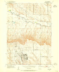
 1916 Deadwood1916 Print · USGSThe Black Hills mining district at the peak of its early industrial era shows a dense network of rail and timber camps. Researchers can trace the narrow-gauge C B & Q RR lines to the Queen Bee Mine and the Fort Meade Military Reservation.3 unique versions available
 - 1951 Map of Volunteer, 1953 Print
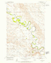 1951 Volunteer1953 Print · USGSWestern South Dakota's river country is documented here in the early fifties during the Missouri River Basin development era. Genealogists and historians can locate rural schoolhouses like Wetz Sch and Meyer Sch or the riverside settlement of Volunteer.3 unique versions available
 - 1951 Map of Cedar Canyon, 1953 Print
 1951 Cedar Canyon1953 Print · USGSThe Perkins and Meade County borderlands come into focus during the early fifties, showing a remote prairie landscape defined by deep draws and ranching infrastructure. Genealogists can locate family landmarks like the Prairie Home Ch, Horse Butte Sch, and the Ben Ash Historical Monument.2 unique versions available
 - 1951 Map of Vale, 1953 Print
 1951 Vale1953 Print · USGSVale and the surrounding Butte County ranchlands are captured in the early fifties during the expansion of the Missouri River Basin irrigation network. Researchers can trace the Chicago and North Western rail line and locate early landmarks like Old Vale Cem and the Wagner Historical Monument.3 unique versions available
 - 1951 Map of Maurine, 1953 Print
 1951 Maurine1953 Print · USGSPerkins and Meade counties meet on this early 1950s survey of the South Dakota high plains near Maurine. Genealogists and local historians can locate several country schoolhouses, such as Mildrew Sch and Fox Ridge Sch, alongside the winding Deep Creek.
 - 1951 Map of Volunteer SE, 1953 Print
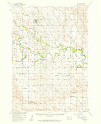
 1951 Volunteer SE1953 Print · USGSMeade County prairie and river breaks are captured here in the early fifties during the Missouri River Basin development program. Trace rural landmarks like the Volunteer Sch and topographic features such as Englishman Butte and the Belle Fourche River.2 unique versions available
 - 1951 Map of Vale SE, 1953 Print
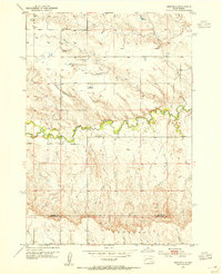
 1951 Vale SE1953 Print · USGSMeade and Butte counties are captured here in the early fifties, showing a rural landscape defined by the Belle Fourche River and intensive irrigation. Genealogists and researchers can locate numerous local landmarks including Empire Ch, the Chicago and North Western rail line, and South Highland Sch (Abandoned).3 unique versions available
 - 1951 Map of Vale, 1959 Print
 1951 Vale1959 Print · USGSThe Butte and Meade county line in the early fifties shows a landscape of irrigated prairies and river bends shaped by the Belle Fourche River. Genealogists and local historians can trace rural school districts like Plainview Sch and find family sites near Vale Cem or the Chicago and North Western rail line.
 - 1952 Map of Deep Creek SE
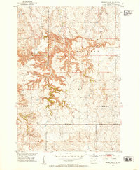
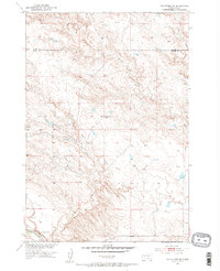
 1952 Deep Creek SE1952 Print · USGSThe Perkins and Meade county line in the early 1950s showcases the remote ranching character of western South Dakota. Researchers can trace the winding paths of Deep Creek and Flint Rock Creek or locate isolated range landmarks like the Windmill.2 unique versions available
 - 1952 Map of Signal Butte, 1954 Print
 1952 Signal Butte1954 Print · USGSThe Perkins and Meade county line in the early fifties shows a sparsely settled ranching landscape dominated by Signal Butte. Researchers can trace the early educational and travel geography of the plains through the Cottonwood Sch and a creek Ford.2 unique versions available
 - 1953 Map of Bend, 1954 Print
 1953 Bend1954 Print · USGSMeade and Pennington Counties were undergoing significant change in the early fifties as military infrastructure expanded into the rural landscape. Researchers can trace the development of Ellsworth Air Force Base and locate community landmarks like Bend Sch and Elk Dale Sch.2 unique versions available
 - 1953 Map of Viewfield, 1954 Print
 1953 Viewfield1954 Print · USGSThe West River ranchlands of Meade and Pennington counties are captured here in the early fifties, centered on the small community of Viewfield. Genealogists and local historians can trace rural infrastructure like Lost Nation Sch, Red Top Sch, and the Viewfield Cem.2 unique versions available
 - 1953 Map of Hereford SE, 1954 Print
 1953 Hereford SE1954 Print · USGSMeade County ranching country is captured here during the early fifties, showing the isolated schoolhouses and river bends of the northern plains. Local researchers can trace the historic locations of Doyle Sch, Walthall Sch, and the winding Belle Fourche River.
 - 1953 Map of Rapid City 1 SW, 1954 Print
 1953 Rapid City 1 SW1954 Print · USGSMeade County ranching and grazing lands are captured here in the early fifties, following a comprehensive field check. Genealogists and historians can locate the Hall Sch and trace the seasonal watercourses of Antelope Creek and Elk Creek.3 unique versions available
Showing maps 1-25 of 179
Top cities of Meade County
Frequently asked questions
- What are the different types of historical maps available for Meade County?
- What is the oldest map of Meade County?
- Where can I purchase historical maps of Meade County for my home or office?
- Where can I download high-res historical maps of Meade County?
- Are there historical topographic maps available for Meade County?
- Is there historical aerial imagery available for Meade County?
- Where are historical maps of Meade County sourced from?