2020s Maps of Hartford Township, South Dakota
Explore 4 historic maps of Hartford Township from the 2020s. These maps offer a rare glimpse into what life looked like during the 2020s — showing old roads, neighborhoods, homes, and landmarks that have changed or disappeared over time.
Whether you're researching your family's past, planning a metal detecting trip, or studying how Hartford Township's landscape evolved across the 2020s, these high-resolution maps are a powerful tool for exploring the history of this region.
- Focus on a specific era: All maps on this page are from the 2020s, giving you a focused view of this time period.
- See what’s changed: Compare century-old streets, trails, and buildings to today's modern landscape using overlays and satellite layers.
- Research with precision: Use these maps for genealogy, historical research, land use analysis, or educational projects.
- View, download, or print: Maps are fully viewable online in high resolution, and can be downloaded or printed for your own records.
Start exploring Hartford Township's history through authentic maps from the 2020s. This is your window into the past.
Hartford Township, SD maps
(4)- 2021 Map of Hartford North, 2021 Print
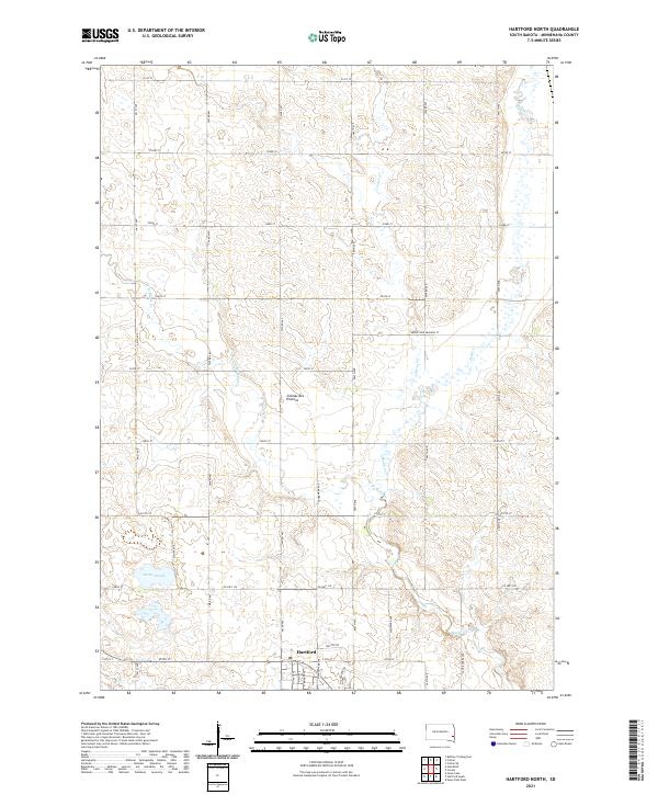 2021 Hartford North2021 Print · USGSMinnehaha County's high glacial plateau is documented here as the town of Hartford expands northward into the surrounding farmland. Genealogists and local historians can trace family land along Skunk Cr, Scotts Slough, and the rural roads branching off Co Hwy 130.
 - 2021 Map of Hartford South, 2021 Print
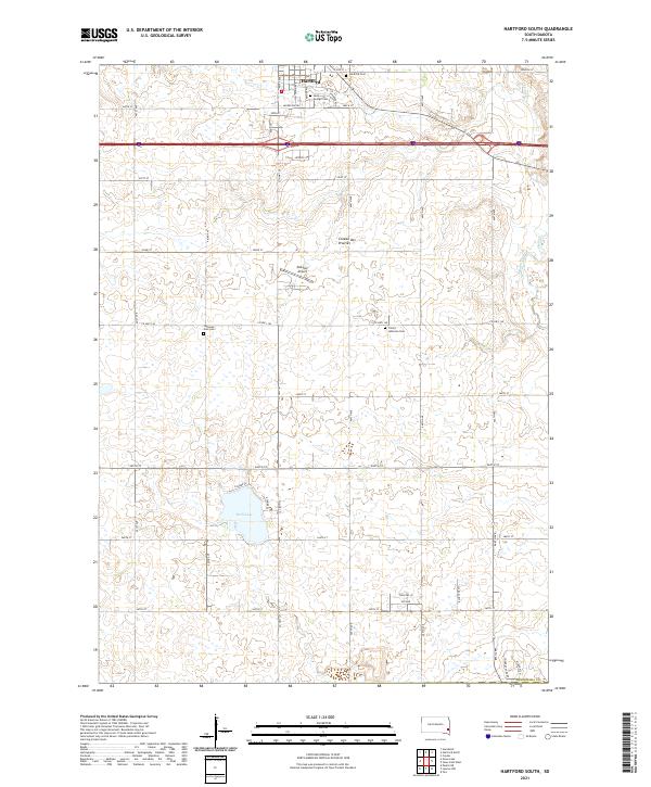 2021 Hartford South2021 Print · USGSMinnehaha County in the 2020s shows a mix of growing prairie settlements and deep-rooted rural landmarks. Genealogists and local historians can trace family sites at Saint George Cem, Lutheran Zion Cem, and the recreational shores of Wall Lake.
 - 2021 Map of Humboldt, 2021 Print
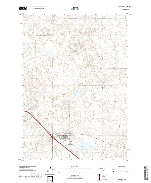 2021 Humboldt2021 Print · USGSHumboldt and the surrounding Minnehaha County countryside are documented here in the early twenty-first century. Genealogists can locate family burial sites at Saint Paul Lutheran Cem and Saint Ann's Cem near the shores of Beaver Lake.
 - 2021 Map of Grass Lake, 2021 Print
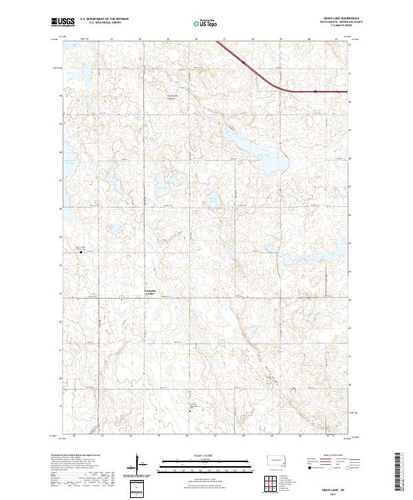 2021 Grass Lake2021 Print · USGSThe Minnehaha County prairie is captured here in the early twenty-first century, showing a landscape shaped by glacial history and the homesteaders' grid. Researchers can trace rural lineages at Saint Joseph Catholic Cem or explore the hydrology of Grass Lake and Long Cr.
End of results
Showing maps 1-4 of 4
Top cities near Hartford Township
- Sioux Falls historical maps
- Harrisburg historical maps
- Tea historical maps
- Hartford historical maps
- Dell Rapids historical maps
- Crooks historical maps
See more
Top neighborhoods of Hartford Township
Frequently asked questions
- What are the different types of historical maps available for Hartford Township?
- What is the oldest map of Hartford Township?
- Where can I purchase historical maps of Hartford Township for my home or office?
- Where can I download high-res historical maps of Hartford Township?
- Are there historical topographic maps available for Hartford Township?
- Is there historical aerial imagery available for Hartford Township?
- Where are historical maps of Hartford Township sourced from?