Old Maps of Moody County, South Dakota for Academic Research
Study the evolution of Moody County with 110 high-resolution historic maps. Whether you're teaching, researching, or modeling changes in land use, these maps provide essential visual documentation of urban, environmental, and geographic change.
- Analyze long-term change: Track patterns in development, transportation, and natural features.
- Ideal for environmental or urban studies: Support academic projects with primary historical map data.
- Use in the classroom or lab: Educators and researchers rely on these maps to bring historical context to life.
These maps are a powerful tool for teaching, research, and visualizing how Moody County has changed over the decades.
Moody County, SD maps
(110)- 1953 Map of Watertown, 1968 Print
 1953 Watertown1968 Print · USGSEastern South Dakota and the Minnesota borderlands are captured here during the mid-twentieth century as the region's agricultural and rail-service centers thrived. Genealogists and local historians can trace family-named sites across the Coteau des Prairies and find landmarks in Watertown, De Smet, and Brookings.3 unique versions available
 - 1955 Map of Sioux Falls, 1967 Print
 1955 Sioux Falls1967 Print · USGSThe eastern South Dakota and western Minnesota borderlands come alive in the mid-fifties, showing the vital rail-to-river connections of the era. Genealogists can trace family footprints across townships like Madison and Pipestone, while following the paths of the Big Sioux River and the Chicago and North Western line.3 unique versions available
 - 1958 Map of Sioux Falls
 1958 Sioux Falls1958 Print · USGSThe tri-state borderlands of South Dakota, Minnesota, and Iowa are captured here during the mid-century peak of the regional rail network. Genealogists and historians can trace local landmarks like Augustana Academy, the St Marys Cem, and the path of the Illinois Central through Rock Rapids.
 - 1958 Map of Watertown
 1958 Watertown1958 Print · USGSThe eastern South Dakota prairie and the Minnesota borderlands are captured here in the late fifties, showcasing a landscape of terminal moraine lakes and burgeoning rail hubs. Genealogists and historians can trace the early paths of the Chicago and North Western railroad or locate family roots in Watertown, Clark, or the Sisseton Indian Reservation.2 unique versions available
 - 1962 Map of Colton SE, 1963 Print
 1962 Colton SE1963 Print · USGSMinnehaha County's rural townships are captured in the early sixties as they balanced traditional agriculture with evolving transport. Trace local genealogy and infrastructure through the Willow Creek Ch, Burk Cem, and an Old Railroad Grade.2 unique versions available
 - 1962 Map of Dell Rapids, 1963 Print
 1962 Dell Rapids1963 Print · USGSDell Rapids and the Big Sioux River valley are captured in the early sixties, showing a landscape shaped by water and rail. Trace family roots at Nelson Cem and St Olaf Cem, or locate the rural Carothers Sch No 86 and the local Quarry.2 unique versions available
 - 1963 Map of Trent, 1964 Print
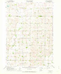
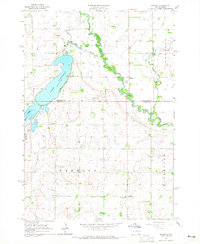
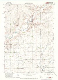
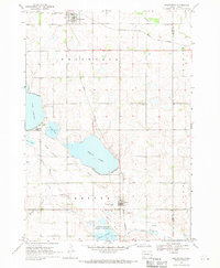
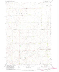
 1963 Trent1964 Print · USGSMoody County's rail and river landscape is captured here in the early sixties as the Big Sioux valley remained a vital transport corridor. Genealogists can trace family footprints at Gale Ridge Sch and several local burial grounds like Hillside Cem and Trent Cem.2 unique versions available
 - 1963 Map of Colman, 1964 Print
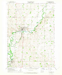
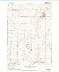
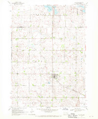
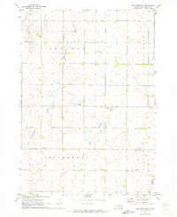
 1963 Colman1964 Print · USGSThe prairie landscape of Moody County comes into focus in the early sixties, centered on the rail-linked town of Colman. Genealogists can trace rural family roots through several local landmarks like Devaney Sch, West Ch, and Molskness Cem.3 unique versions available
 - 1964 Map of Medary, 1965 Print
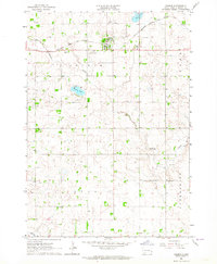
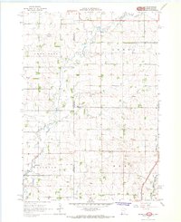
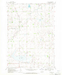
 1964 Medary1965 Print · USGSThe Brookings and Moody County borderlands are seen here in the mid-1960s, centered on the river-cut prairies of eastern South Dakota. Genealogists and researchers can locate several rural schools and landmarks like Lake Campbell Cem, Galla Sch, and the historic settlement of Medary.4 unique versions available
 - 1964 Map of Rutland SE, 1965 Print
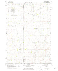
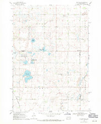
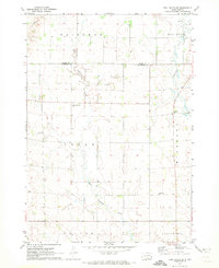
 1964 Rutland SE1965 Print · USGSPrairie townships in Moody County are shown in detail during the 1960s, capturing a rural landscape of family farms and section roads. Researchers can locate community landmarks like Whaley Sch, Mt Auburn Cem, and the Wellman Ch.2 unique versions available
 - 1964 Map of Flandreau SW, 1965 Print
 1964 Flandreau SW1965 Print · USGSMoody County's agricultural landscape is seen here in the early 1960s, centered on the railroad town of Egan. Genealogists can trace a dense network of country schoolhouses and churches including Tidd Sch, Clare Ch, and Bell Sch.2 unique versions available
 - 1964 Map of Flandreau NW, 1965 Print
 1964 Flandreau NW1965 Print · USGSThe Brookings and Moody county line comes alive in the mid-1960s, showing a prairie landscape shaped by the Big Sioux River. Genealogists and historians can locate rural landmarks like Wellman Sch, Riverview Cem, and Coleman Sch.
 - 1967 Map of Elkton SW, 1968 Print
 1967 Elkton SW1968 Print · USGSThe Minnesota and South Dakota borderlands come alive in this mid-sixties survey of Pipestone and Moody Counties. Researchers can trace the path of the Milwaukee Road through Airlie or locate the rural Fletcher Sch.2 unique versions available
 - 1967 Map of Jasper, 1968 Print
 1967 Jasper1968 Print · USGSThe tri-state border region of Minnesota and South Dakota was a busy rail and quarrying hub in the late sixties. Researchers can trace the Great Northern rail lines and locate family sites at Rosendal Cem or the village of Sherman.
 - 1967 Map of Jasper NW, 1968 Print
 1967 Jasper NW1968 Print · USGSThe borderlands of Minnesota and South Dakota are captured here in the late sixties, showing a landscape of family farms and rural townships. Researchers can trace local history at Lone Rock Ch, Eden Cem, and the old Townhall near Pipestone Creek.2 unique versions available
 - 1967 Map of Elkton, 1978 Print
 1967 Elkton1978 Print · USGSElkton sits at a bustling prairie rail junction on the South Dakota and Minnesota border during the late sixties. Genealogists and local researchers can locate St Marys Cem, trace the C & N W line, or follow the winding course of Medary Creek.
 - 1968 Map of Wentworth, 1970 Print
 1968 Wentworth1970 Print · USGSLake County at the end of the sixties reveals a transition from rail-dependent prairie towns to a landscape of conservation and recreation. Researchers can trace family plots at Rose Hill Cem and explore the historic rail corridors of the Great Northern and the C M ST P & P.
 - 1968 Map of Colton, 1970 Print
 1968 Colton1970 Print · USGSMinnehaha and Lake counties are shown here in the late sixties as the agricultural landscape of southeastern South Dakota continued its steady growth. Researchers can find numerous family-history sites like Taopi Cem and Huntimer or trace the Great Northern rail line.
 - 1968 Map of Rutland, 1971 Print
 1968 Rutland1971 Print · USGSThe prairie townships of Lake County were dominated by the rail-and-water landscape of the late sixties. Researchers can trace the Great Northern line through Rutland, locate the Lake Park Cem, and map the shores of Milwaukee Lake.
 - 1968 Map of Rutland NW, 1971 Print
 1968 Rutland NW1971 Print · USGSEastern South Dakota’s agricultural and wetland landscape is captured here in the late sixties, where the border of Lake and Brookings Counties meets. Genealogists can locate family landmarks such as Oslo Ch, Prairie Queen Cem, and the Townhall.2 unique versions available
 - 1972 Map of Flandreau NE, 1973 Print
 1972 Flandreau NE1973 Print · USGSThe rural townships of eastern South Dakota are captured here in the early seventies as the agricultural landscape matured. Genealogists and historians can locate the local Townhall, trace the Chicago and North Western rail line, and find old Gravel Pits.
 - 1972 Map of Dell Rapids NE, 1973 Print
 1972 Dell Rapids NE1973 Print · USGSMoody County in the early seventies reveals a landscape of deep-rooted prairie settlements and family-run townships. Genealogists and local historians can trace legacy sites like the Swedish Augustana Cem, Oslo Cem, and Trinity Ch along the waters of Brookfield Creek.
 - 1972 Map of Dell Rapids SE, 1973 Print
 1972 Dell Rapids SE1973 Print · USGSThe rural border between Moody and Minnehaha Counties comes into focus during the early 1970s, showcasing a landscape of prairie townships and creek valleys. Researchers can locate burial sites like Reformed Church Cem and trace the paths of Pipestone Creek and West Pipestone Creek.2 unique versions available
 - 1972 Map of Flandreau, 1973 Print
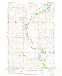
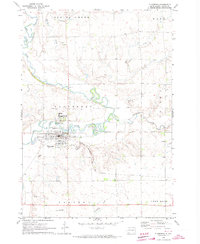 1972 Flandreau1973 Print · USGSMoody County in the early seventies centers on the meanders of the Big Sioux River and the bustling rail hub at Flandreau. Family historians can locate specific sites like the Flandreau Indian Sch, Catholic Cem, and the old Chicago Milwaukee St Paul and Pacific rail line.
 - 1985 Map of Sioux Falls
 1985 Sioux Falls1985 Print · USGSIn the mid-1980s, the borderlands of South Dakota, Minnesota, and Iowa reveal a landscape shaped by the Big Sioux River and a growing urban hub. Researchers can trace the development of Sioux Falls and locate smaller communities like Dell Rapids, Garretson, and Valley Springs.2 unique versions available
Showing maps 1-25 of 110
Top cities of Moody County
Frequently asked questions
- What are the different types of historical maps available for Moody County?
- What is the oldest map of Moody County?
- Where can I purchase historical maps of Moody County for my home or office?
- Where can I download high-res historical maps of Moody County?
- Are there historical topographic maps available for Moody County?
- Is there historical aerial imagery available for Moody County?
- Where are historical maps of Moody County sourced from?