Old Maps of Conata, South Dakota for Academic Research
Study the evolution of Conata with 8 high-resolution historic maps. Whether you're teaching, researching, or modeling changes in land use, these maps provide essential visual documentation of urban, environmental, and geographic change.
- Analyze long-term change: Track patterns in development, transportation, and natural features.
- Ideal for environmental or urban studies: Support academic projects with primary historical map data.
- Use in the classroom or lab: Educators and researchers rely on these maps to bring historical context to life.
These maps are a powerful tool for teaching, research, and visualizing how Conata has changed over the decades.
Conata, SD maps
(8)- 1950 Map of Conata
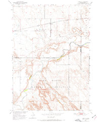 1950 Conata1950 Print · USGSThe Pine Ridge Indian Reservation and the northern prairies meet here in the early fifties. Genealogists and historians can trace the Chicago Milwaukee St Paul and Pacific rail line through Conata and locate an early Oil Well.2 unique versions available
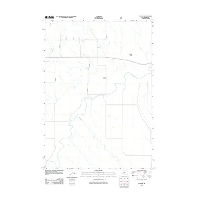
 - 1952 Map of Conata
 1952 Conata1952 Print · USGSThe northern edge of the Oglala Lakota lands meets the rail-line economy of the early fifties, centered on the Milwaukee Road. Researchers can trace the winding White River through the Pine Ridge Indian Reservation past Conata and Hurley Butte.
 - 1955 Map of Hot Springs, 1958 Print
 1955 Hot Springs1958 Print · USGSThe Black Hills and South Dakota badlands are captured here in the mid-fifties, during a peak of military and industrial activity. Researchers can locate the Black Hills Ordnance Depot, early Uranium Mines, and historic rail stops like Pringle or Oglala.5 unique versions available
 - 1981 Map of Wall
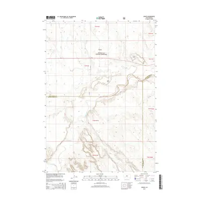
 1981 Wall1981 Print · USGSWestern South Dakota in the early eighties reveals a landscape of high tables and deep draws where the prairie meets the Badlands. Researchers can trace the path of the Chicago and North Western rail line and locate rural outposts like Scenic, Conata, and Interior.
 - 2012 Map of Conata, 2012 Print
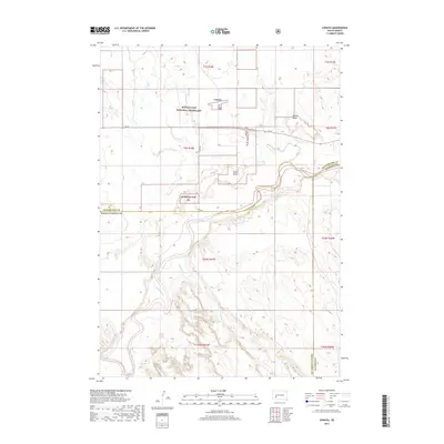
 2012 Conata2012 Print · USGSCovers Conata, including Kyle, Pennington County, and other nearby areas
 - 2015 Map of Conata, 2015 Print
 2015 Conata2015 Print · USGSCovers Conata, including Kyle, Pennington County, and other nearby areas
 - 2017 Map of Conata, 2017 Print
 2017 Conata2017 Print · USGSCovers Conata, including Kyle, Pennington County, and other nearby areas
 - 2021 Map of Conata, 2021 Print
 2021 Conata2021 Print · USGSThe high plains and river breaks of Oglala Lakota County are mapped here during the early twenty-first century. Researchers can trace the winding course of the White River through the Buffalo Gap National Grassland and locate the small settlement of Conata.
End of results
Showing maps 1-8 of 8
Top cities near Conata
Frequently asked questions
- What are the different types of historical maps available for Conata?
- What is the oldest map of Conata?
- Where can I purchase historical maps of Conata for my home or office?
- Where can I download high-res historical maps of Conata?
- Are there historical topographic maps available for Conata?
- Is there historical aerial imagery available for Conata?
- Where are historical maps of Conata sourced from?