Old Maps of Roberts County, South Dakota for Metal Detecting
Plan your next treasure hunt with 206 historic maps of Roberts County. Find old homesites, ghost towns, trails, and gathering spots that may be lost to time — perfect for identifying promising metal detecting locations.
- Locate forgotten sites: Uncover places like long-lost settlements, abandoned rail lines, or gathering spots.
- Plan better hunts: Use map overlays combined with LiDAR or satellite views to narrow in on historically rich areas.
- Made for detectorists: Thousands of hobbyists use these maps to discover relics, coins, and hidden history.
Use these historic maps to boost your research and find new opportunities beneath the surface of Roberts County.
Roberts County, SD maps
(206)- 1915 Map of White Rock, 1954 Print
 1915 White Rock1954 Print · USGSThe tri-state border region of the Dakotas and Minnesota comes alive in the early twentieth century as a hub of rail lines and prairie schools. Trace early settlements like White Rock and Rosholt or locate family landmarks such as Knutson School and Teare School.2 unique versions available
 - 1916 Map of Peever, 1954 Print
 1916 Peever1954 Print · USGSThe borderlands of South Dakota and Minnesota come alive in this survey of the early twentieth century. Genealogists and local historians can trace the paths of the Great Northern railroad and locate rural landmarks like Windom School, Peever, and the Erdman School.
 - 1916 Map of Beardsley, 1968 Print
 1916 Beardsley1968 Print · USGSWestern Minnesota and the South Dakota border are captured here during the height of the steam-rail era. Genealogists and researchers can trace dozens of early rural schoolhouses, including Hilo School and Twingrove School, alongside the Great Northern line.2 unique versions available
 - 1917 Map of New Effington
 1917 New Effington1917 Print · USGSThe Dakota borderlands come alive in this survey from the mid-1910s, capturing the early rail-and-reservation era. Genealogists can locate family-named landmarks like Shafts School and Wymen School along the Minneapolis St Paul and Sault Ste Marie line.2 unique versions available
 - 1918 Map of Peever
 1918 Peever1918 Print · USGSThe borderlands of South Dakota and Minnesota are captured here during the First World War, centered on the strategic divide at Browns Valley. Genealogists and local historians can trace rural school locations like Morehead School and Becker School alongside the tracks of the Great Northern railroad.4 unique versions available
 - 1918 Map of White Rock
 1918 White Rock1918 Print · USGSThe tri-state borderlands of South Dakota, Minnesota, and North Dakota are frozen in time just before the end of the Great War. Researchers can trace the Sisseton and Wahpeton Indian Reservation boundary or locate early schools like Teare School and Knutson School.4 unique versions available
 - 1918 Map of Beardsley
 1918 Beardsley1918 Print · USGSWestern Minnesota and the South Dakota borderlands appear here during the height of the steam rail era. Genealogists can trace family footprints across dozens of local districts, from Round Mound School to the village streets of Beardsley.3 unique versions available
 - 1953 Map of Ortonville, 1955 Print
 1953 Ortonville1955 Print · USGSThe Minnesota-South Dakota borderlands come alive in this mid-century survey of the lake-rich prairie. Genealogists and historians can locate numerous rural landmarks like Greenwood Cem, Pleasant Valley Ch, and the many numbered schools scattered between Clinton and Odessa.
 - 1953 Map of Milbank, 1958 Print
 1953 Milbank1958 Print · USGSThe tri-state border region of South Dakota, North Dakota, and Minnesota is shown here during the early fifties, a landscape defined by glacial lakes and the Sisseton Indian Reservation. Researchers can trace the legacy of the western railroads, locating old stops along the Great Northern and settlements like Milbank, Webster, and Sisseton.3 unique versions available
 - 1954 Map of Big Stone Lake, 1956 Print
 1954 Big Stone Lake1956 Print · USGSThe borderlands of Roberts County and Minnesota come into focus in the mid-1950s as rural school districts began to fade from the prairie. Trace the disappearance of early education at Golden Prairie Sch and School No 19, or locate family plots at Lakeside Cem and Effm Cem.2 unique versions available
 - 1958 Map of Milbank
 1958 Milbank1958 Print · USGSThe northern Great Plains in the late fifties show a landscape of glacial lakes and reservation lands shaped by the Great Northern railroad. Genealogists and local historians can trace the grid of settlements from Britton to Milbank and locate landmarks like Enemy Swim Lake and the Sisseton Indian Reservation.
 - 1964 Map of Claire City NE, 1966 Print
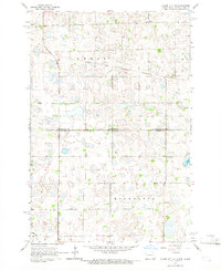 1964 Claire City NE1966 Print · USGSRichland and Roberts counties meet along the Dakotas' border in the mid-1960s, a landscape defined by prairie wetlands and small rural parishes. Genealogists can locate family landmarks like St Pauls Cem, Ferkingstad Ch, and School No 2.
 - 1964 Map of Claire City NW, 1966 Print
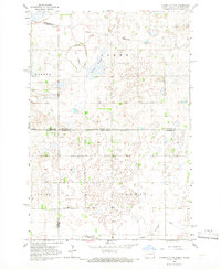 1964 Claire City NW1966 Print · USGSCrossing the North Dakota-South Dakota border in the mid-1960s, this area shows the intersection of the Sisseton Indian Reservation and various county lines. Genealogists can locate family landmarks like Bergen Ch Cem and the Nidaros Ch among the prairie sloughs.
 - 1964 Map of Claire City, 1966 Print
 1964 Claire City1966 Print · USGSNortheastern South Dakota's glacial prairie and rail-side settlements are captured here in the mid-1960s. Genealogists and local historians can trace the foundations of Claire City and Hammer, along with several rural burial grounds like St Boniface Cem.
 - 1964 Map of Claire City SW, 1967 Print
 1964 Claire City SW1967 Print · USGSThe northern Roberts County prairie meets the Marshall County line in the mid-1960s, showing a landscape defined by glacial coulees and the SOO LINE railroad. Genealogists can locate family landmarks like Bethel Ch, Mayason Ch, and a local Cem.
 - 1970 Map of Whitestone Lake, 1973 Print
 1970 Whitestone Lake1973 Print · USGSThe Sisseton Indian Reservation during the 1970s shows a landscape of deep coulees and prairie lakes on the Coteau des Prairies. Researchers can trace rural cemetery sites like Spring Valley Cem and Roy Cem or locate local landmarks like St Benedict Ch.
 - 1970 Map of Summit, 1973 Print
 1970 Summit1973 Print · USGSThe town of Summit and the high prairie wetlands are captured here in the early 1970s. Trace the path of the CHICAGO MILWAUKEE ST PAUL AND PACIFIC railroad through the Sisseton Indian Reservation Boundary and past the Summit Cem.
 - 1970 Map of Sisseton, 1973 Print
 1970 Sisseton1973 Print · USGSThe Sisseton Indian Reservation during the early 1970s shows a landscape of rail-linked prairie towns and local landmarks. Trace family history at Saron Ch Cem or follow the Chicago Milwaukee St Paul and Pacific line past Dry Wood Lake.
 - 1970 Map of Summit NE, 1973 Print
 1970 Summit NE1973 Print · USGSNortheastern Roberts County in the early seventies reveals a landscape of glacial coulees and scattered prairie lakes. Genealogists can locate Old Ascension Cem and Ascension Ch near the deep drainage of Big Coulee.
 - 1970 Map of Marvin, 1973 Print
 1970 Marvin1973 Print · USGSThe Marvin area and the coteau landscape of South Dakota appear in this 1970s survey as a mix of religious sites and rail corridors. Genealogists and local historians can trace the Milwaukee Road route past Blue Cloud Abbey and the Eastman Cem.
 - 1970 Map of Wilmot NW, 1973 Print
 1970 Wilmot NW1973 Print · USGSRoberts County's prairie landscape was recorded in the early seventies, showing the intersection of rail history and reservation lands. You can trace the Chicago Milwaukee St Paul and Pacific line or locate the remote Boe Cem and Big Coulee.2 unique versions available
 - 1970 Map of Enemy Swim Lake East, 1973 Print
 1970 Enemy Swim Lake East1973 Print · USGSRoberts and Day County lands within the Sisseton Indian Reservation are captured here during the 1970s. Local researchers can map out rural intersections like Rudebusch Corner or trace the shorelines of Enemy Swim Lake and Hurricane Lake.
 - 1970 Map of Ortley, 1973 Print
 1970 Ortley1973 Print · USGSOrtley and the surrounding prairie of Roberts County are captured here in the early 1970s, as the railroad still defined the local economy. Genealogists can locate family landmarks like Hope Ch, the Townhall, and the steel rails of the Chicago Milwaukee St Paul and Pacific.
 - 1970 Map of Goodwill, 1973 Print
 1970 Goodwill1973 Print · USGSThe Sisseton Indian Reservation in the 1970s reveals a landscape of deep coulees and historic tribal centers. Genealogists can trace the Old Sisseton Indian Agency and the Goodwill Cem, or locate landmarks along the Chicago Milwaukee St Paul and Pacific line.
 - 1970 Map of Drywood Lakes, 1973 Print
 1970 Drywood Lakes1973 Print · USGSThe Sisseton Indian Reservation in the early 1970s is characterized by its expansive prairie lakes and rural parish communities across Marshall and Roberts counties. Genealogists and local historians can locate remote landmarks like Zuark Ch, Buffalo Lake Ch, and the Townhall site.
Showing maps 1-25 of 206
Top cities of Roberts County
- Wilmot historical maps
- Old Agency District historical maps
- Corona historical maps
- White Rock historical maps
Frequently asked questions
- What are the different types of historical maps available for Roberts County?
- What is the oldest map of Roberts County?
- Where can I purchase historical maps of Roberts County for my home or office?
- Where can I download high-res historical maps of Roberts County?
- Are there historical topographic maps available for Roberts County?
- Is there historical aerial imagery available for Roberts County?
- Where are historical maps of Roberts County sourced from?