2020s Maps of Woonsocket Township, South Dakota
Explore 2 historic maps of Woonsocket Township from the 2020s. These maps offer a rare glimpse into what life looked like during the 2020s — showing old roads, neighborhoods, homes, and landmarks that have changed or disappeared over time.
Whether you're researching your family's past, planning a metal detecting trip, or studying how Woonsocket Township's landscape evolved across the 2020s, these high-resolution maps are a powerful tool for exploring the history of this region.
- Focus on a specific era: All maps on this page are from the 2020s, giving you a focused view of this time period.
- See what’s changed: Compare century-old streets, trails, and buildings to today's modern landscape using overlays and satellite layers.
- Research with precision: Use these maps for genealogy, historical research, land use analysis, or educational projects.
- View, download, or print: Maps are fully viewable online in high resolution, and can be downloaded or printed for your own records.
Start exploring Woonsocket Township's history through authentic maps from the 2020s. This is your window into the past.
Woonsocket Township, SD maps
(2)- 2021 Map of Woonsocket, 2021 Print
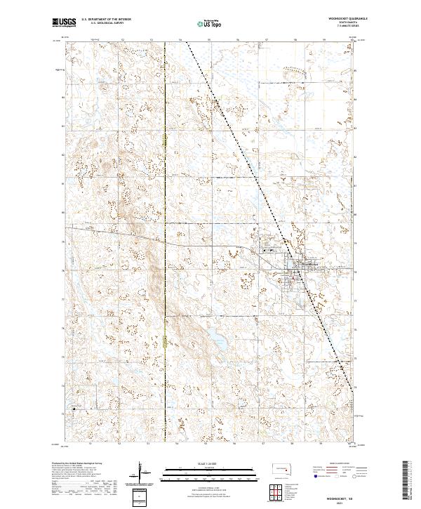 2021 Woonsocket2021 Print · USGSThe town of Woonsocket and its surrounding agricultural plains are meticulously documented in this recent survey. Researchers can trace local history through the Sanborn County Courthouse and burial sites like Saint Wilfrid Cem and Feistner Cem.
 - 2021 Map of Forestburg SW, 2021 Print
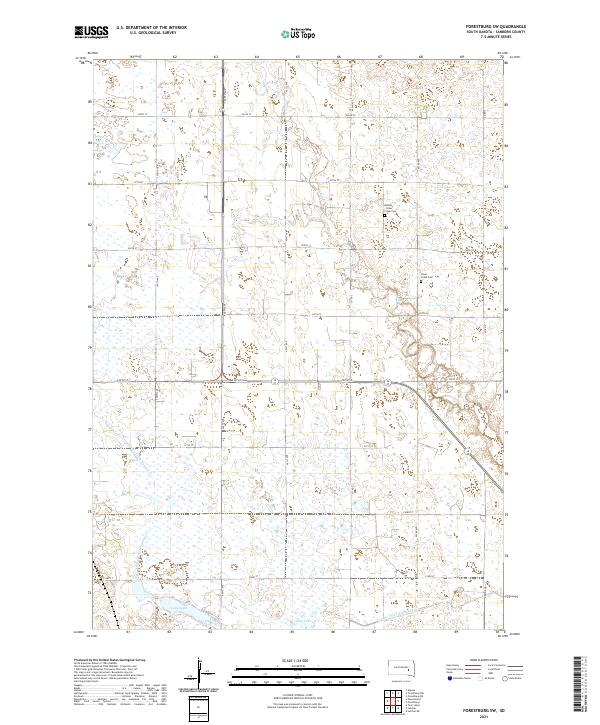 2021 Forestburg SW2021 Print · USGSSanborn County is captured in the early 2020s as a landscape of structured prairie and critical water management. Genealogists and local historians can locate the Bethany - Silver Creek Cem and trace the paths of Sand Cr and Long Lake.
End of results
Showing maps 1-2 of 2
Top cities near Woonsocket Township
- Woonsocket historical maps
- Alpena historical maps
- Letcher historical maps
- Lane historical maps
- Virgil historical maps
Top neighborhoods of Woonsocket Township
Frequently asked questions
- What are the different types of historical maps available for Woonsocket Township?
- What is the oldest map of Woonsocket Township?
- Where can I purchase historical maps of Woonsocket Township for my home or office?
- Where can I download high-res historical maps of Woonsocket Township?
- Are there historical topographic maps available for Woonsocket Township?
- Is there historical aerial imagery available for Woonsocket Township?
- Where are historical maps of Woonsocket Township sourced from?