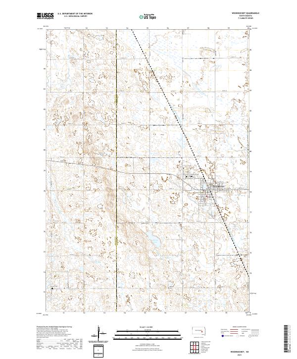
2021 Map of Woonsocket
USGS Topo · Published 2021About this map
Woonsocket serves as the central hub of this prairie landscape, where the Sanborn County Courthouse stands as a prominent local landmark. The surrounding terrain is defined by a sophisticated water management system designed for agricultural stability, featuring several significant artificial waterways such as County Ditch Number 8, County Ditch Number 16, and County Ditch Number 21. These channels coordinate with natural features like McCoy Lake and the intermittent Dry Run to drain the low-lying fields. For genealogists and local historians, the sheet identifies several important burial sites, including Saint Wilfrid Cem and Eventide Cem situated near the town center, as well as the more remote Feistner Cem located further south. The map illustrates a strictly organized section-line road grid that crosses the Jerauld Co Sanborn Co border, reflecting the area's continued reliance on a structured rural infrastructure.
Find a feature on this map
49 named features on this map. Tap any name to fly to it.
Don’t see what you’re looking for? This feature index may not catch every label — zoom into the map to look around manually.
Map Details
Editions of this 2021 Woonsocket Map
This is the sole edition of this map. No revisions or reprints were ever made.
Other maps of this area

1898 · Huron
USGS Topo · 1:125,000

1899 · Mitchell
USGS Topo · 1:125,000

1953 · Huron
USGS Topo · 1:250,000

1954 · Huron
USGS Topo · 1:250,000

1955 · Mitchell
USGS Topo · 1:250,000

1958 · Forestburg NW
USGS Topo · 1:24,000

1959 · Mitchell
USGS Topo · 1:250,000

1973 · Alpena
USGS Topo · 1:24,000
1973 · Forestburg SW
USGS Topo · 1:24,000
1973 · Woonsocket
USGS Topo · 1:24,000