2020s Maps of Spring Creek Segment, South Dakota
Explore 9 historic maps of Spring Creek Segment from the 2020s. These maps offer a rare glimpse into what life looked like during the 2020s — showing old roads, neighborhoods, homes, and landmarks that have changed or disappeared over time.
Whether you're researching your family's past, planning a metal detecting trip, or studying how Spring Creek Segment's landscape evolved across the 2020s, these high-resolution maps are a powerful tool for exploring the history of this region.
- Focus on a specific era: All maps on this page are from the 2020s, giving you a focused view of this time period.
- See what’s changed: Compare century-old streets, trails, and buildings to today's modern landscape using overlays and satellite layers.
- Research with precision: Use these maps for genealogy, historical research, land use analysis, or educational projects.
- View, download, or print: Maps are fully viewable online in high resolution, and can be downloaded or printed for your own records.
Start exploring Spring Creek Segment's history through authentic maps from the 2020s. This is your window into the past.
Spring Creek Segment, SD maps
(9)- 2021 Map of Nenzel, 2021 Print
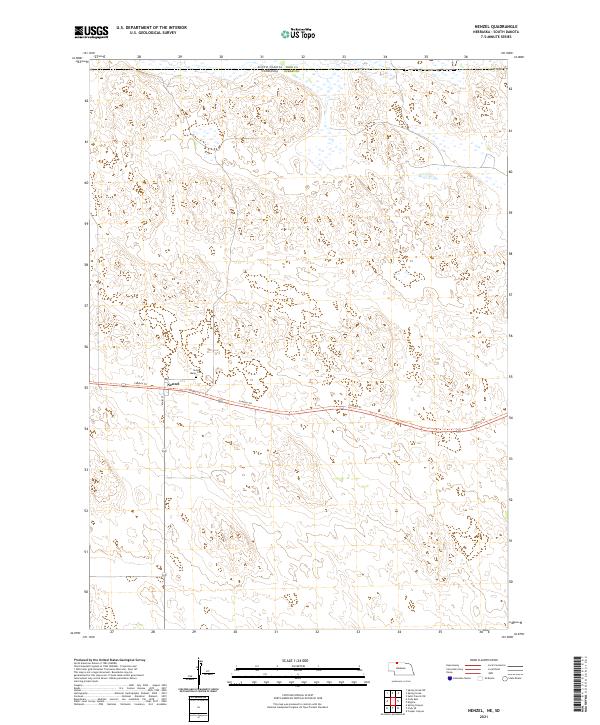 2021 Nenzel2021 Print · USGSThe village of Nenzel and the surrounding Sandhills are captured here at the start of the 2020s. Researchers can trace local history through the Saint Marys Cem and the path of the Cowboy Trl following the old rail corridor.
 - 2021 Map of Cody East, 2021 Print
 2021 Cody East2021 Print · USGSThe Nebraska Sandhills meet the South Dakota border in this recent survey of eastern Cherry County. Genealogists and local historians can trace the town grid along Cody Ave and locate burials at Prairie Lawn Cem or follow the path of the Cowboy Trl.
 - 2021 Map of Kilgore, 2021 Print
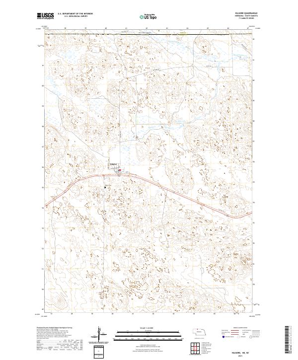 2021 Kilgore2021 Print · USGSThe Nebraska-South Dakota border region near Kilgore comes into focus during this modern era of ranching and recreation. Genealogists and hikers can trace the Cowboy Trl past the Kilgore Cem and through the drainages of Spring Cr.
 - 2021 Map of Saint Francis SW, 2021 Print
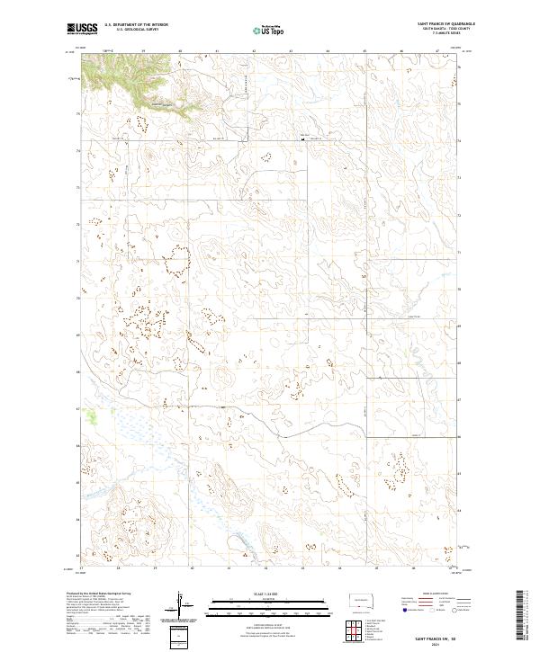 2021 Saint Francis SW2021 Print · USGSTodd County ranchlands and reservation territory are documented in this recent survey of the Rosebud region. Genealogists and local historians can trace family land ties near Star Cem or follow the paths of BIA HWY 13 and Horse Looking Rd.
 - 2021 Map of Saint Francis, 2021 Print
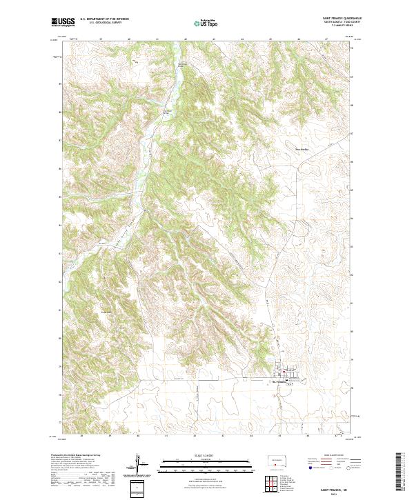 2021 Saint Francis2021 Print · USGSTodd County's high plains and river breaks are documented here in the early twenty-first century. Researchers can trace the community of St. Francis, locate the Saint Charles Catholic Cem, and identify crossings like the Iron Shell Bridge.
 - 2021 Map of Spring Creek, 2021 Print
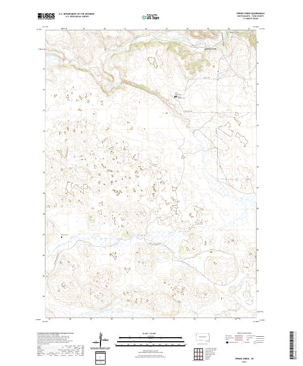 2021 Spring Creek2021 Print · USGSTodd County’s river valleys and plateaus come into focus in the early 2020s, showing the settlement of Spring Creek and its surrounding lands. Researchers can trace rural lineages through the Saint Angelo Cem or follow the waters of the Little White River.
 - 2021 Map of Spring Creek SW, 2021 Print
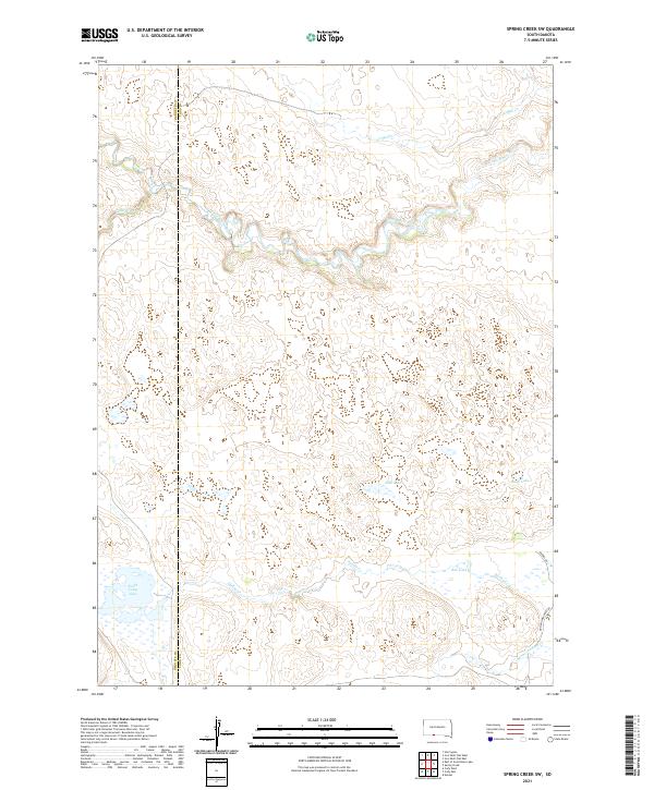 2021 Spring Creek SW2021 Print · USGSThe Todd County prairie at the start of the 2020s is defined by its winding waterways and isolated upland basins. Researchers can trace the path of the Little White River or locate remote water features like North Cody Lake and Bob Lake.
 - 2021 Map of Iron Shell Flat East, 2021 Print
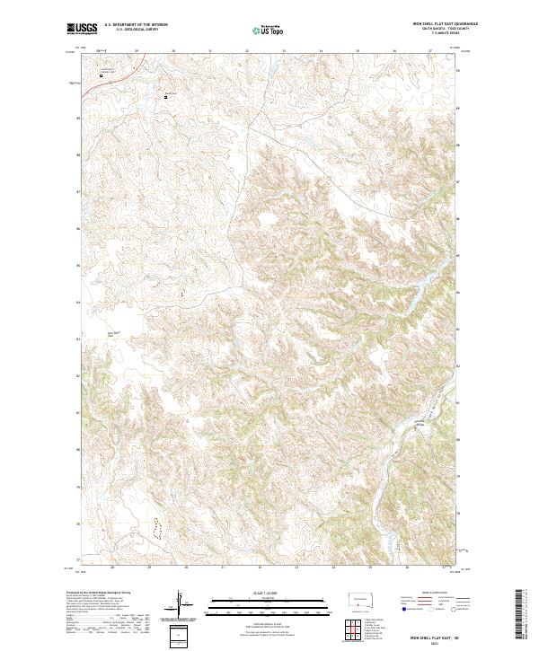 2021 Iron Shell Flat East2021 Print · USGSTodd County's high plains and river breaks are documented here in the early twenty-first century. Researchers can locate family landmarks such as the Sacred Heart Catholic Cem or trace the geography of Crazy Horse Canyon and the Valandra Bridge.
 - 2021 Map of Iron Shell Flat West, 2021 Print
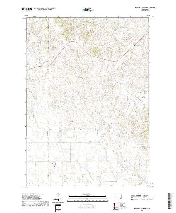 2021 Iron Shell Flat West2021 Print · USGSTodd County's high plains and winding creek valleys are documented here during the early twenty-first century. Researchers can locate the Saint Mary's Cem near Iron Shell Flat and trace the paths of Coffee Cr and Running Enemy Cr.
End of results
Showing maps 1-9 of 9
Top cities near Spring Creek Segment
- Rosebud historical maps
- Martin historical maps
- Cody historical maps
- Kilgore historical maps
- Nenzel historical maps
Top neighborhoods of Spring Creek Segment
Frequently asked questions
- What are the different types of historical maps available for Spring Creek Segment?
- What is the oldest map of Spring Creek Segment?
- Where can I purchase historical maps of Spring Creek Segment for my home or office?
- Where can I download high-res historical maps of Spring Creek Segment?
- Are there historical topographic maps available for Spring Creek Segment?
- Is there historical aerial imagery available for Spring Creek Segment?
- Where are historical maps of Spring Creek Segment sourced from?