Old Maps of Turner County, South Dakota for Academic Research
Study the evolution of Turner County with 103 high-resolution historic maps. Whether you're teaching, researching, or modeling changes in land use, these maps provide essential visual documentation of urban, environmental, and geographic change.
- Analyze long-term change: Track patterns in development, transportation, and natural features.
- Ideal for environmental or urban studies: Support academic projects with primary historical map data.
- Use in the classroom or lab: Educators and researchers rely on these maps to bring historical context to life.
These maps are a powerful tool for teaching, research, and visualizing how Turner County has changed over the decades.
Turner County, SD maps
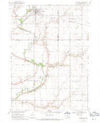
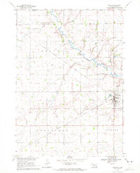
(103)- 1897 Map of Canton, 1954 Print
 1897 Canton1954 Print · USGSSoutheastern South Dakota and the Iowa borderlands were undergoing a railway-driven expansion during the 1890s. Genealogists and historians can trace early settlements like Beloit, Centerville, and Lennox as they grew along the Big Sioux River.
 - 1898 Map of Parker
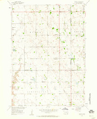
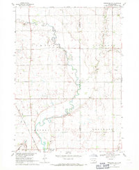
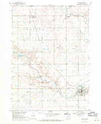
 1898 Parker1898 Print · USGSSoutheastern South Dakota in the late nineteenth century shows a landscape defined by the expansion of the Chicago and Northwestern railroad. Genealogists and local historians can trace early settlements and pioneer-era post offices like Idylwilde, Hurley, and the prominent rise of Turkey Ridge.4 unique versions available
 - 1900 Map of Canton
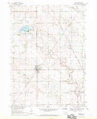
 1900 Canton1900 Print · USGSSoutheastern South Dakota and the Iowa borderlands are captured here at a peak of late-nineteenth-century rail expansion. Genealogists can trace the early foundations of towns like Canton, Centerville, and Beresford along the Big Sioux River.2 unique versions available
 - 1955 Map of Sioux Falls, 1967 Print
 1955 Sioux Falls1967 Print · USGSThe eastern South Dakota and western Minnesota borderlands come alive in the mid-fifties, showing the vital rail-to-river connections of the era. Genealogists can trace family footprints across townships like Madison and Pipestone, while following the paths of the Big Sioux River and the Chicago and North Western line.3 unique versions available
 - 1957 Map of Midway, 1958 Print
 1957 Midway1958 Print · USGSSoutheastern South Dakota in the late fifties is captured here as a landscape of section-line roads and prairie townships. Researchers can trace rural genealogy through numerous family-named landmarks and local institutions like Ulmer Cem, Bender Sch, and Bethlehem Ch.2 unique versions available
 - 1958 Map of Sioux Falls
 1958 Sioux Falls1958 Print · USGSThe tri-state borderlands of South Dakota, Minnesota, and Iowa are captured here during the mid-century peak of the regional rail network. Genealogists and historians can trace local landmarks like Augustana Academy, the St Marys Cem, and the path of the Illinois Central through Rock Rapids.
 - 1962 Map of Hartford South, 1964 Print
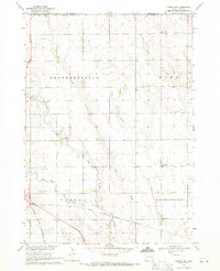
 1962 Hartford South1964 Print · USGSMinnehaha County in the early sixties shows a rural landscape on the cusp of change as the interstate highway system reaches the prairie. Researchers can trace dozens of family-named landmarks and country schools like Muchow Sch, Sunshine Sch, and Lakeview Sch.2 unique versions available
 - 1962 Map of Lennox NW, 1964 Print
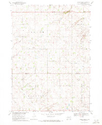
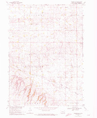
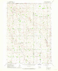 1962 Lennox NW1964 Print · USGSThe rural landscape of Turner County comes into focus in the early sixties, showing a region of dense family farms and township schools. Researchers can locate many local landmarks, from the Norwegian Cem and Chancellor Cem to the tracks of the Great Northern railroad.2 unique versions available
 - 1964 Map of Lennox, 1966 Print
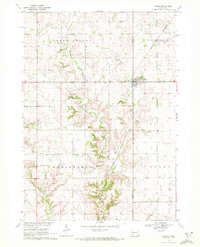
 1964 Lennox1966 Print · USGSThe rural prairie of Lincoln and Turner Counties comes alive in the 1960s, showing a well-established network of rail towns and country school districts. Researchers can trace family roots through sites like Delaware Ch, Lennox Cem, and several schoolhouses including Sunny Side Sch.
 - 1968 Map of Beresford NW, 1971 Print
 1968 Beresford NW1971 Print · USGSSoutheast South Dakota's farm country comes alive in the late sixties, centered on the river valley and rail corridor near Centerville. Genealogists and historians can trace rural roots through landmarks like Mt Zion Cem, Ash Grove Sch, and the winding Vermillion River.
 - 1968 Map of Parker NE, 1971 Print
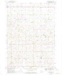
 1968 Parker NE1971 Print · USGSTurner County farm country and the river forks near Parker are captured here in the late sixties. Genealogists can locate family landmarks like Wellington Cem or rural schoolhouses including Stanford Sch and Sletten Sch.
 - 1968 Map of Hurley, 1971 Print
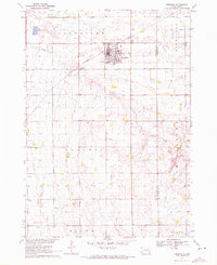
 1968 Hurley1971 Print · USGSTurner County at the end of the sixties reveals a landscape of railroad towns and prairie rivers. Genealogists and local historians can trace family roots near Hurley, locate the Stoddard Sch, or follow the Chicago and North Western rail line.
 - 1968 Map of Parker SW, 1971 Print
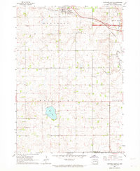
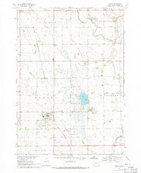
 1968 Parker SW1971 Print · USGSTurner County's agricultural heartland is documented in the late sixties, showing a landscape of established farmsteads and rural townships. Researchers can locate vanished landmarks like Dedrick Sch, Zion Cem, and the waters of Swan Lake.
 - 1968 Map of Wakonda, 1971 Print
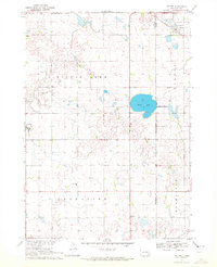
 1968 Wakonda1971 Print · USGSDakota farmland near Wakonda comes into focus during the late sixties, revealing the organized grid of townships and rural waterways. Genealogists and historians can trace family locations near Columkill Cem, Holland Cem, and the quiet crossroads of Colfax Corner.
 - 1968 Map of Centerville, 1971 Print
 1968 Centerville1971 Print · USGSCenterville was a bustling agricultural hub in the late sixties, where the railroad and the Vermillion River intersect. Genealogists can trace family roots through the rural townships to find Ivey Sch, Komstad Ch, and Hovde Cem.
 - 1968 Map of Viborg, 1971 Print
 1968 Viborg1971 Print · USGSSoutheast South Dakota's farm country comes into focus in the late 1960s, showing a landscape shaped by rail lines and prairie drainages. Genealogists can trace family roots through sites like Hattervig Cem, Rosefield Sch, and the rail junction at Viborg.
 - 1968 Map of Parker, 1971 Print
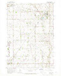
 1968 Parker1971 Print · USGSParker and Monroe are captured in the late sixties at the convergence of two major rail lines and the forks of the Vermillion River. Researchers can locate the Thunder Valley Drag Strip, the Parker Valley Country Club, and several local cemeteries like Rose Hill Cem.
 - 1970 Map of Turkey Ridge, 1972 Print
 1970 Turkey Ridge1972 Print · USGSThe Turner and Yankton county lines meet at the dawn of the 1970s in this detailed survey of South Dakota's farm country. Researchers can trace rural life through a network of one-room school sites like Lowell Sch and local burial grounds such as Bang Cem.
 - 1970 Map of Freeman SE, 1972 Print
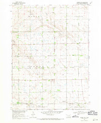
 1970 Freeman SE1972 Print · USGSTurner County's agricultural heartland is documented in the early seventies, showing a landscape defined by the township grid and the elevations of Turkey Ridge. Genealogists and historians can locate rural landmarks like Salem Zion Ch, North Star Sch, and Schlosser Cem.
 - 1970 Map of Irene, 1972 Print
 1970 Irene1972 Print · USGSIrene and the surrounding townships of Turner and Yankton counties are captured in the early 1970s during a period of steady agricultural tradition. Researchers can trace local history through landmarks like Trondhjem Ch, Salem Cem, and the Burlington Northern rail line.
 - 1970 Map of Freeman, 1972 Print
 1970 Freeman1972 Print · USGSHutchinson County agriculture and education are centered here in the early 1970s as the rail line still serves the prairie. Genealogists can trace family landmarks like Knodel Cem, Brookside Sch, and the campus of Freeman Jr College.
 - 1970 Map of Center Point, 1972 Print
 1970 Center Point1972 Print · USGSThe Turner and Yankton County line in the early seventies reveals a landscape of rural schoolhouses and family cemeteries. Genealogists can trace the history of Center Point and locate several burial sites including Meldal Cemetery and Evergreen Cemetery.
 - 1970 Map of Marion, 1972 Print
 1970 Marion1972 Print · USGSThe prairie landscape of southeastern South Dakota is captured here in the early seventies, centered on the rail hub of Marion. Genealogists and local historians can locate numerous rural landmarks like Dicks Sch, Bethesda Ch, and Tieszen Cem.
 - 1970 Map of Dolton, 1972 Print
 1970 Dolton1972 Print · USGSSoutheast South Dakota's prairie landscape is documented here in the early seventies at the intersection of three counties. Genealogists and local historians can locate specific family landmarks such as Tschetter Cem and Hutterthal Ch near the waters of Silver Lake.
 - 1985 Map of Sioux Falls
 1985 Sioux Falls1985 Print · USGSIn the mid-1980s, the borderlands of South Dakota, Minnesota, and Iowa reveal a landscape shaped by the Big Sioux River and a growing urban hub. Researchers can trace the development of Sioux Falls and locate smaller communities like Dell Rapids, Garretson, and Valley Springs.2 unique versions available
Showing maps 1-25 of 103
Top cities of Turner County
Frequently asked questions
- What are the different types of historical maps available for Turner County?
- What is the oldest map of Turner County?
- Where can I purchase historical maps of Turner County for my home or office?
- Where can I download high-res historical maps of Turner County?
- Are there historical topographic maps available for Turner County?
- Is there historical aerial imagery available for Turner County?
- Where are historical maps of Turner County sourced from?