2020s Maps of Parker Township, South Dakota
Explore 4 historic maps of Parker Township from the 2020s. These maps offer a rare glimpse into what life looked like during the 2020s — showing old roads, neighborhoods, homes, and landmarks that have changed or disappeared over time.
Whether you're researching your family's past, planning a metal detecting trip, or studying how Parker Township's landscape evolved across the 2020s, these high-resolution maps are a powerful tool for exploring the history of this region.
- Focus on a specific era: All maps on this page are from the 2020s, giving you a focused view of this time period.
- See what’s changed: Compare century-old streets, trails, and buildings to today's modern landscape using overlays and satellite layers.
- Research with precision: Use these maps for genealogy, historical research, land use analysis, or educational projects.
- View, download, or print: Maps are fully viewable online in high resolution, and can be downloaded or printed for your own records.
Start exploring Parker Township's history through authentic maps from the 2020s. This is your window into the past.
Parker Township, SD maps
(4)- 2021 Map of Parker NE, 2021 Print
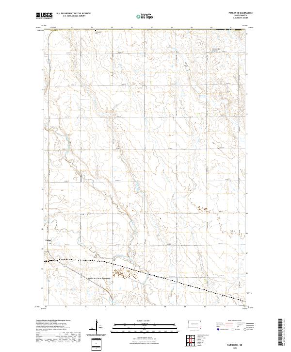 2021 Parker NE2021 Print · USGSThe town of Parker is captured during the early 2020s, showing a landscape defined by traditional South Dakota section lines and prairie drainage. Researchers can trace the path of Beaver Cr and the river systems that have shaped this agricultural heartland for generations.
 - 2021 Map of Hurley, 2021 Print
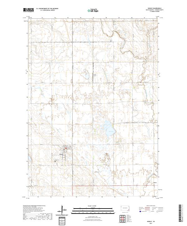 2021 Hurley2021 Print · USGSModern Hurley and the nearby settlement of Davis are captured here within their Turner County agricultural setting. Genealogists and local historians can locate Hurley Cem and Catholic Cem, or trace the path of the Vermillion River.
 - 2021 Map of Parker, 2021 Print
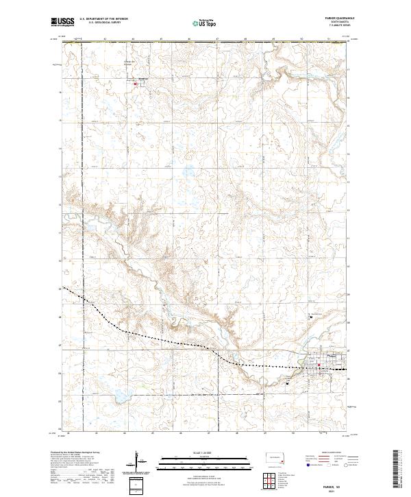 2021 Parker2021 Print · USGSThe convergence of the Vermillion River forks in Turner County defines this prairie landscape during the early 2020s. Genealogists and local historians can trace the streets of Parker and Monroe, or locate the Turner County Courthouse and Rose Hill Cem.
 - 2021 Map of Parker SW, 2021 Print
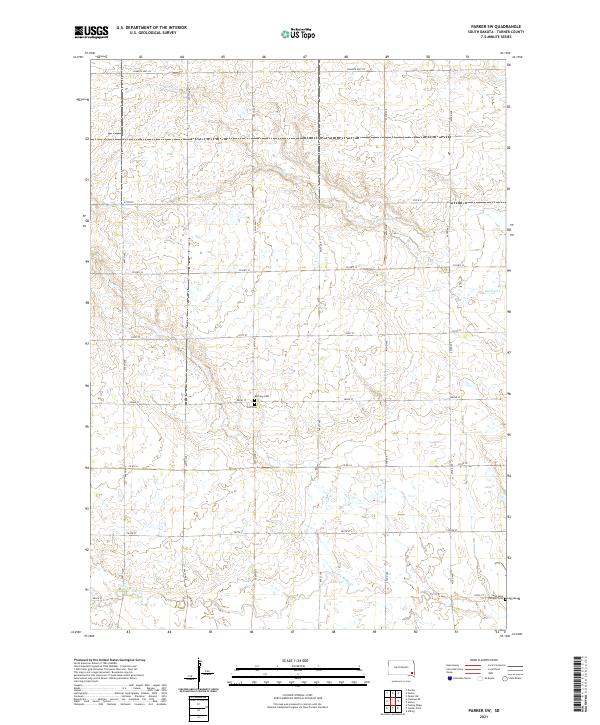 2021 Parker SW2021 Print · USGSThe rural stretches of Turner County are documented here in the early twenty-first century, showing a landscape defined by prairie creeks and section-line roads. Genealogists can locate specific burial sites like Bethany Cem and the Swan Lake Catholic Cem.
End of results
Showing maps 1-4 of 4
Top cities near Parker Township
- Hartford historical maps
- Lennox historical maps
- Parker historical maps
- Marion historical maps
- Viborg historical maps
- Canistota historical maps
See more
Top neighborhoods of Parker Township
Frequently asked questions
- What are the different types of historical maps available for Parker Township?
- What is the oldest map of Parker Township?
- Where can I purchase historical maps of Parker Township for my home or office?
- Where can I download high-res historical maps of Parker Township?
- Are there historical topographic maps available for Parker Township?
- Is there historical aerial imagery available for Parker Township?
- Where are historical maps of Parker Township sourced from?