Old Maps of Eagle Creek, Tennessee for Genealogy
Trace your family roots with 9 historic maps of Eagle Creek. These high-res maps reveal old neighborhoods, homesites, landmarks, and streets — helping you uncover where your ancestors lived and how the area evolved over time.
- Explore historic neighborhoods: Identify where your relatives may have lived in the 1800s or 1900s.
- Compare maps over time: Trace the changes in streets, buildings, and landmarks for multi-generational research.
- Perfect for genealogy & ancestry research: Used by family historians and researchers to map out lineage and migration.
These maps are an incredible resource for exploring your personal connection to Eagle Creek's past.
Eagle Creek, TN maps
(9)- 1936 Map of Hustburg
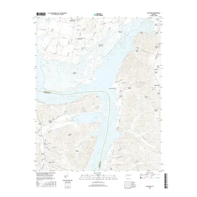
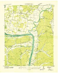 1936 Hustburg1936 Print · USGSHumphreys and Benton Counties are shown in the mid-1930s just as the Tennessee Valley Authority began its extensive survey work along the river. Genealogists can trace family connections through river landings like Dixie Landing and rural landmarks such as Oak Grove Ch or Pavatt Sch.
 - 1949 Map of Hustburg, 1953 Print
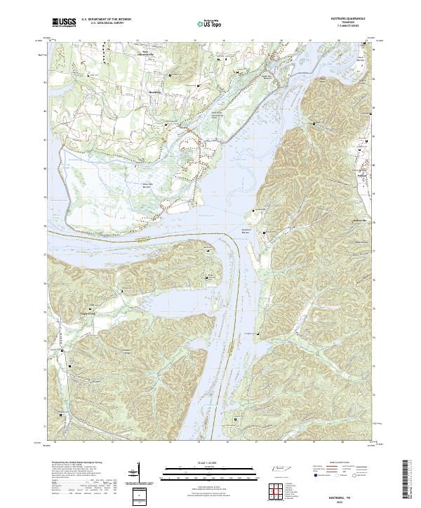
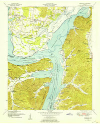 1949 Hustburg1953 Print · USGSHumphreys and Benton Counties are shown here during the transformative years following the filling of Kentucky Lake. Genealogists and local historians can locate dozens of family cemeteries and rural school sites like Tribble Sch and Byrd Sch.4 unique versions available
 - 1956 Map of Columbia, 1960 Print
 1956 Columbia1960 Print · USGSMiddle Tennessee in the mid-fifties presents a landscape of established river towns and critical rail hubs before the arrival of the modern interstate system. Researchers can trace the routes of the Louisville and Nashville railroad or locate historic landmarks like Stones River National Military Park and the Tennessee National Wildlife Refuge.6 unique versions available
 - 1986 Map of Hohenwald
 1986 Hohenwald1986 Print · USGSThe Western Highland Rim of Tennessee comes into focus during the mid-eighties, showing the deep river valleys and high ridges of Lewis and Perry counties. Researchers can trace the path of the Natchez Trace Parkway or locate interior settlements like Chestnut Grove, Farmers Exchange, and Hustburg.3 unique versions available
 - 2010 Map of Hustburg, 2010 Print
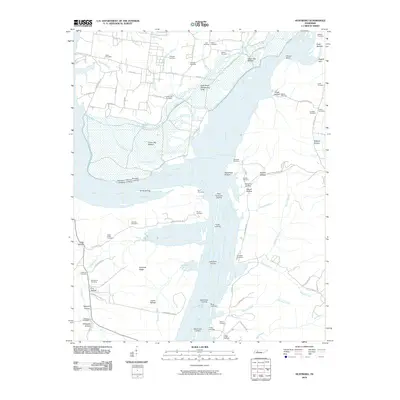 2010 Hustburg2010 Print · USGSCovers Eagle Creek, including New Johnsonville, Polecat, and other nearby areas
 - 2013 Map of Hustburg, 2013 Print
 2013 Hustburg2013 Print · USGSCovers Eagle Creek, including New Johnsonville, Polecat, and other nearby areas
 - 2016 Map of Hustburg, 2016 Print
 2016 Hustburg2016 Print · USGSCovers Eagle Creek, including New Johnsonville, Polecat, and other nearby areas
 - 2019 Map of Hustburg, 2019 Print
 2019 Hustburg2019 Print · USGSCovers Eagle Creek, including New Johnsonville, Polecat, and other nearby areas
 - 2022 Map of Hustburg, 2022 Print
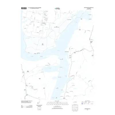
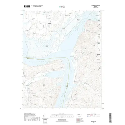
 2022 Hustburg2022 Print · USGSThe Tennessee River and Kentucky Lake shoreline come into focus in this recent survey of Humphreys County. Genealogists and local historians can trace family names across numerous sites like Pavatt Whitfield Cem, Hustburg, and the communities of Bakerville and Polecat.
End of results
Showing maps 1-9 of 9
Top cities near Eagle Creek
- Waverly historical maps
- Camden historical maps
- Parsons historical maps
- New Johnsonville historical maps
- Lobelville historical maps
Frequently asked questions
- What are the different types of historical maps available for Eagle Creek?
- What is the oldest map of Eagle Creek?
- Where can I purchase historical maps of Eagle Creek for my home or office?
- Where can I download high-res historical maps of Eagle Creek?
- Are there historical topographic maps available for Eagle Creek?
- Is there historical aerial imagery available for Eagle Creek?
- Where are historical maps of Eagle Creek sourced from?