Old Maps of Jacksboro, Tennessee for Genealogy
Trace your family roots with 16 historic maps of Jacksboro. These high-res maps reveal old neighborhoods, homesites, landmarks, and streets — helping you uncover where your ancestors lived and how the area evolved over time.
- Explore historic neighborhoods: Identify where your relatives may have lived in the 1800s or 1900s.
- Compare maps over time: Trace the changes in streets, buildings, and landmarks for multi-generational research.
- Perfect for genealogy & ancestry research: Used by family historians and researchers to map out lineage and migration.
These maps are an incredible resource for exploring your personal connection to Jacksboro's past.
Jacksboro, TN maps
(16)- 1893 Map of Briceville
 1893 Briceville1893 Print · USGSThe northern Tennessee coalfields and valleys come to life in the 1890s, when mining and rail were transforming the ridges of the Cumberland. Local historians can trace the paths of the Knoxville and Ohio R. R. and early settlements like Jacksboro, Coal Creek, and Oliver Springs.
 - 1895 Map of Briceville
 1895 Briceville1895 Print · USGSThe Cumberland Mountains and Powell Valley met a rapidly expanding railroad network in the late nineteenth century. Trace early industrial footprints and family-named hollows from Briceville and Clinton to the coal-rich slopes of Big Mountain.
 - 1896 Map of Briceville
 1896 Briceville1896 Print · USGSEast Tennessee's coal and rail corridors are captured here in the late nineteenth century as the industrial landscape of the Cumberland Plateau matured. Researchers can trace early family homesteads and transport hubs through Briceville, Clinton, and the Southern RR line.6 unique versions available
 - 1936 Map of Jacksboro
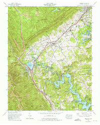
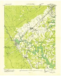 1936 Jacksboro1936 Print · USGSCampbell County industry and agriculture meet during the mid-1930s as the Tennessee Valley Authority begins flooding the valley. Trace the legacy of mountain coal works like High Point Mine alongside rural landmarks such as Sharp Cem and Cumberland View Sch.
 - 1936 Map of La Follette
 1936 La Follette1936 Print · USGSThe Powell Valley is shown during the early years of the Tennessee Valley Authority as the new shoreline of Norris Reservoir begins to take shape. Researchers can locate family landmarks like Bakers Forge Memorial Cem and coal infrastructure at Indian Creek Mines.
 - 1946 Map of Jacksboro, 1947 Print
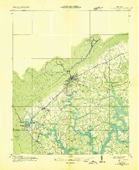
 1946 Jacksboro1947 Print · USGSCampbell County's industrial and mountain landscape comes into focus just after the war, showing the expansion of Norris Reservoir and the Caryville area. Trace local family history and industry through the High Point Mine, Woodlawn Cem, and College Hill Sch.
 - 1952 Map of Jacksboro, 1954 Print
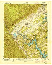
 1952 Jacksboro1954 Print · USGSMid-century Campbell County comes to life as coal mining and rail transport meet the expanding waters of Norris Lake. Trace family roots at the Poor Farm Cemetery or locate the High Point Mine and Indian Grave Tunnel near Jacksboro.2 unique versions available
 - 1956 Map of Corbin, 1966 Print
 1956 Corbin1966 Print · USGSThe Kentucky and Tennessee borderlands are captured here in the mid-fifties, showing the region's shift toward modern interstate travel and reservoir development. Genealogists and historians can trace old community lines near Albany and Monticello or locate early rail junctions along the Southern and Tennessee Central lines.3 unique versions available
 - 1958 Map of Corbin
 1958 Corbin1958 Print · USGSThe Upper Cumberland borderlands appear in the late 1950s as massive reservoirs and early atomic-era growth reshape the region. Trace family roots and vanished landmarks near Lake Cumberland, Oak Ridge, and the Cumberland National Forest.
 - 1973 Map of Jacksboro, 1975 Print
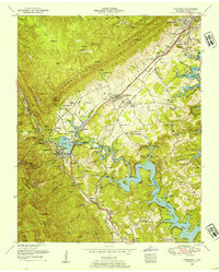
 1973 Jacksboro1975 Print · USGSThe Tennessee valley at the base of the Cumberland plateau reveals a complex landscape of coal mining and rising reservoirs in the early seventies. Trace the path of the Southern Railway through Bruce Gap or locate family markers at Queener Cem and the ancient Indian mound.3 unique versions available
 - 1979 Map of Oakridge, 1980 Print
 1979 Oakridge1980 Print · USGSThe eastern Tennessee highlands are captured here in the late 1970s, showcasing a landscape of coal mining and mountain conservation. Genealogists and researchers can locate family landmarks such as Potter Cem, Sunbright Sch, and the historic settlement of Rugby.
 - 2010 Map of Jacksboro, 2010 Print
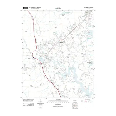 2010 Jacksboro2010 Print · USGSCovers Jacksboro, including La Follette, Caryville, and other nearby areas
 - 2013 Map of Jacksboro, 2013 Print
 2013 Jacksboro2013 Print · USGSCovers Jacksboro, including La Follette, Caryville, and other nearby areas
 - 2016 Map of Jacksboro, 2016 Print
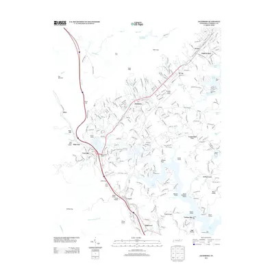
 2016 Jacksboro2016 Print · USGSCovers Jacksboro, including La Follette, Caryville, and other nearby areas
 - 2019 Map of Jacksboro, 2019 Print
 2019 Jacksboro2019 Print · USGSCovers Jacksboro, including La Follette, Caryville, and other nearby areas
 - 2022 Map of Jacksboro, 2022 Print
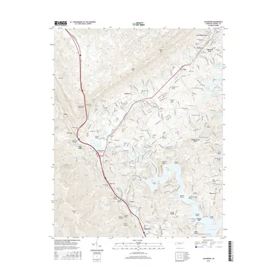
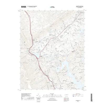
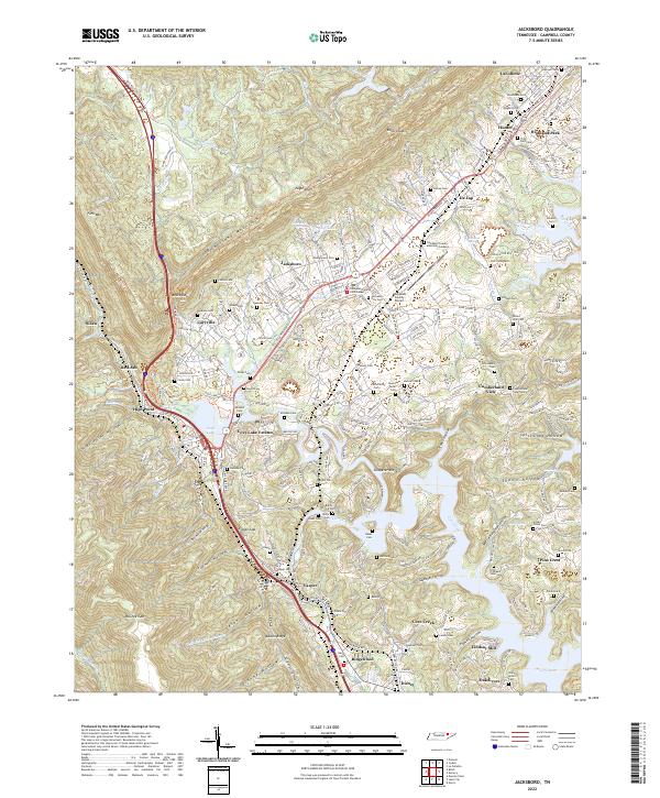 2022 Jacksboro2022 Print · USGSThe Powell Valley is shown here in the 2020s, where the Cumberland Mountains meet the waters of Norris Lake. Researchers can locate numerous family burial sites like Tiller Ford Cem and Poor Farm Cem, or trace the historic CSX RR through Caryville.
End of results
Showing maps 1-16 of 16
Top cities near Jacksboro
- Halls Crossroads historical maps
- Clinton historical maps
- LaFollette historical maps
- La Follette historical maps
- Caryville historical maps
- Rocky Top historical maps
See more
Frequently asked questions
- What are the different types of historical maps available for Jacksboro?
- What is the oldest map of Jacksboro?
- Where can I purchase historical maps of Jacksboro for my home or office?
- Where can I download high-res historical maps of Jacksboro?
- Are there historical topographic maps available for Jacksboro?
- Is there historical aerial imagery available for Jacksboro?
- Where are historical maps of Jacksboro sourced from?