1950s Maps of Cheatham County, Tennessee
Explore 10 historic maps of Cheatham County from the 1950s. These maps offer a rare glimpse into what life looked like during the 1950s — showing old roads, neighborhoods, homes, and landmarks that have changed or disappeared over time.
Whether you're researching your family's past, planning a metal detecting trip, or studying how Cheatham County's landscape evolved across the 1950s, these high-resolution maps are a powerful tool for exploring the history of this region.
- Focus on a specific era: All maps on this page are from the 1950s, giving you a focused view of this time period.
- See what’s changed: Compare century-old streets, trails, and buildings to today's modern landscape using overlays and satellite layers.
- Research with precision: Use these maps for genealogy, historical research, land use analysis, or educational projects.
- View, download, or print: Maps are fully viewable online in high resolution, and can be downloaded or printed for your own records.
Start exploring Cheatham County's history through authentic maps from the 1950s. This is your window into the past.
Cheatham County, TN maps
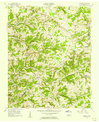
(10)- 1955 Map of Forest Grove, 1956 Print
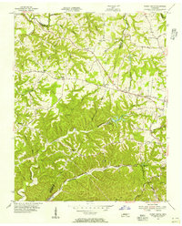 1955 Forest Grove1956 Print · USGSNorthwest of Nashville in the mid-fifties, this area shows a rural landscape of ridges and hollows defined by the meeting of three counties. Genealogists can trace family landmarks like Gupton Cem, New Hope Ch, and the small settlement of Morny.5 unique versions available
 - 1955 Map of Scottsboro, 1956 Print
 1955 Scottsboro1956 Print · USGSThe Cumberland River bends through western Davidson County in the mid-fifties, revealing a landscape of rural schoolhouses and riverside bends. Local researchers can trace family roots at New Bethel Ch, Wade Sch, and the grounds of the State Penitentiary.
 - 1956 Map of Nashville, 1971 Print
 1956 Nashville1971 Print · USGSThe Tennessee-Kentucky borderlands come into focus in the mid-1960s as major reservoir projects transformed the Cumberland and Tennessee river valleys. Researchers can trace the rail networks of the Louisville and Nashville and visit sites like Fort Campbell and Fort Donelson National Military Park.2 unique versions available
 - 1957 Map of Cheatham Dam, 1958 Print
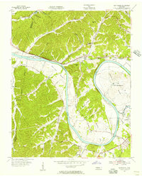
 1957 Cheatham Dam1958 Print · USGSMid-century Tennessee river life is preserved here as the Cumberland River transitions into Lake Cheatham. Genealogists and historians can trace family locations through rural landmarks like Bellsburg Sch, Mt Zion Ch, and the Tennessee Central rail line.3 unique versions available
 - 1957 Map of Pleasant View, 1958 Print
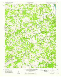
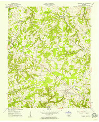 1957 Pleasant View1958 Print · USGSMid-century Middle Tennessee comes to life here, showing the rural landscapes of Cheatham and Robertson counties. Genealogists can locate family landmarks like Fox Cem or trace the development of crossroads hamlets such as Stroudville, Gause, and Pleasant View.3 unique versions available
 - 1957 Map of Henrietta, 1958 Print
 1957 Henrietta1958 Print · USGSThe rural Montgomery and Cheatham county line comes into focus during the late fifties, showing a landscape of family farms and small crossroads. Genealogists can trace family names at the Hollis-Nanny Cem or locate the County Home for the Indigent.3 unique versions available
 - 1957 Map of Ashland City, 1958 Print
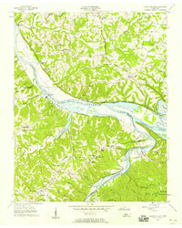
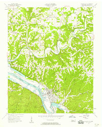 1957 Ashland City1958 Print · USGSAshland City and the Cumberland River valley are captured in the late fifties as the new reservoir landscape took shape. Genealogists and local historians can trace family burial grounds like Fannie Field Cem and rural hubs such as Sycamore Chapel.4 unique versions available
 - 1958 Map of Cumberland Furnace, 1959 Print
 1958 Cumberland Furnace1959 Print · USGSMid-century Middle Tennessee comes to life here as the rural landscapes of Dickson and Montgomery counties appear before modern development. Genealogists and local historians can trace family roots through numerous small burial sites like Hamble Cem and old community hubs such as McAllisters Crossroads and Stayton.3 unique versions available
 - 1958 Map of Excell, 1960 Print
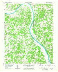 1958 Excell1960 Print · USGSThe Cumberland River valley in the late fifties was a landscape of crossroads hamlets and family farmsteads. Researchers can trace old family sites near Orgains Crossroads, locate the Indian Mounds, or find early churches like Marthas Chapel and Bethlehem Ch.3 unique versions available
 - 1959 Map of Nashville
 1959 Nashville1959 Print · USGSMiddle Tennessee and Southern Kentucky come into focus during the late fifties, showing the region's transition into a modern transportation and military hub. Researchers can trace the sprawling Fort Campbell Military Reservation or locate historic rail stops along the Tennessee Central Ry and Illinois Central RR.
End of results
Showing maps 1-10 of 10
Top cities of Cheatham County
- Ashland City historical maps
- Pleasant View historical maps
- Kingston Springs historical maps
- Pegram historical maps
Frequently asked questions
- What are the different types of historical maps available for Cheatham County?
- What is the oldest map of Cheatham County?
- Where can I purchase historical maps of Cheatham County for my home or office?
- Where can I download high-res historical maps of Cheatham County?
- Are there historical topographic maps available for Cheatham County?
- Is there historical aerial imagery available for Cheatham County?
- Where are historical maps of Cheatham County sourced from?