Old Maps of Cheatham County, Tennessee for Metal Detecting
Plan your next treasure hunt with 91 historic maps of Cheatham County. Find old homesites, ghost towns, trails, and gathering spots that may be lost to time — perfect for identifying promising metal detecting locations.
- Locate forgotten sites: Uncover places like long-lost settlements, abandoned rail lines, or gathering spots.
- Plan better hunts: Use map overlays combined with LiDAR or satellite views to narrow in on historically rich areas.
- Made for detectorists: Thousands of hobbyists use these maps to discover relics, coins, and hidden history.
Use these historic maps to boost your research and find new opportunities beneath the surface of Cheatham County.
Cheatham County, TN maps
(91)- 1903 Map of Nashville
 1903 Nashville1903 Print · USGSTennessee's capital region is captured at the dawn of the 1900s, when iron pikes and river locks dominated local commerce. Trace ancestral routes along Stewarts Ferry Pike, find rural landmarks like Curry Mill, or locate historical sites like The Hermitage.4 unique versions available
 - 1930 Map of White Bluff, 1953 Print
 1930 White Bluff1953 Print · USGSMiddle Tennessee in the 1930s is defined by the serpentine bends of the Harpeth River and the steam-era dominance of the Nashville Chattanooga and St Louis RR. Genealogists and historians can locate vanished country schools like Opossum Sch and trace early road networks including the Dickson Turnpike.
 - 1931 Map of Ridgetop, 1957 Print
 1931 Ridgetop1957 Print · USGSUpper Middle Tennessee in the early thirties reveals a landscape of ridge-top towns and deep hollows. Genealogists can trace family footprints through dozens of rural landmarks like St Michaels Ch, Gordons Store, and the old Ridgetop Sta.2 unique versions available
 - 1932 Map of Nashville
 1932 Nashville1932 Print · USGSNashville and its river bends are captured here in the early thirties, showing a city expanding toward suburbs like Belle Meade and Glendale Park. Genealogists can locate family landmarks like Loves Ch, Brentwood Sta, and numerous rural schools from Gower Sch to Ash Grove Sch.2 unique versions available
 - 1933 Map of White Bluff
 1933 White Bluff1933 Print · USGSThe Tennessee river country in the early thirties is defined here by the winding loops of the Harpeth River and the rail line through White Bluff. Genealogists and researchers can trace rural life through landmarks like Mound Bottom, Frog Pond Ch, and Opossum Sch.
 - 1935 Map of Ridgetop
 1935 Ridgetop1935 Print · USGSNorthern Tennessee's ridge country is captured here between the mid-twenties and early thirties, showing a landscape tied to the Louisville and Nashville railroad. Genealogists can trace family roots through numerous local landmarks like Bethlehem Sch, Gordons Store, and St Michaels Ch.2 unique versions available
 - 1955 Map of Forest Grove, 1956 Print
 1955 Forest Grove1956 Print · USGSNorthwest of Nashville in the mid-fifties, this area shows a rural landscape of ridges and hollows defined by the meeting of three counties. Genealogists can trace family landmarks like Gupton Cem, New Hope Ch, and the small settlement of Morny.5 unique versions available
 - 1955 Map of Scottsboro, 1956 Print
 1955 Scottsboro1956 Print · USGSThe Cumberland River bends through western Davidson County in the mid-fifties, revealing a landscape of rural schoolhouses and riverside bends. Local researchers can trace family roots at New Bethel Ch, Wade Sch, and the grounds of the State Penitentiary.
 - 1956 Map of Nashville, 1971 Print
 1956 Nashville1971 Print · USGSThe Tennessee-Kentucky borderlands come into focus in the mid-1960s as major reservoir projects transformed the Cumberland and Tennessee river valleys. Researchers can trace the rail networks of the Louisville and Nashville and visit sites like Fort Campbell and Fort Donelson National Military Park.2 unique versions available
 - 1957 Map of Cheatham Dam, 1958 Print
 1957 Cheatham Dam1958 Print · USGSMid-century Tennessee river life is preserved here as the Cumberland River transitions into Lake Cheatham. Genealogists and historians can trace family locations through rural landmarks like Bellsburg Sch, Mt Zion Ch, and the Tennessee Central rail line.3 unique versions available
 - 1957 Map of Pleasant View, 1958 Print
 1957 Pleasant View1958 Print · USGSMid-century Middle Tennessee comes to life here, showing the rural landscapes of Cheatham and Robertson counties. Genealogists can locate family landmarks like Fox Cem or trace the development of crossroads hamlets such as Stroudville, Gause, and Pleasant View.3 unique versions available
 - 1957 Map of Henrietta, 1958 Print
 1957 Henrietta1958 Print · USGSThe rural Montgomery and Cheatham county line comes into focus during the late fifties, showing a landscape of family farms and small crossroads. Genealogists can trace family names at the Hollis-Nanny Cem or locate the County Home for the Indigent.3 unique versions available
 - 1957 Map of Ashland City, 1958 Print
 1957 Ashland City1958 Print · USGSAshland City and the Cumberland River valley are captured in the late fifties as the new reservoir landscape took shape. Genealogists and local historians can trace family burial grounds like Fannie Field Cem and rural hubs such as Sycamore Chapel.4 unique versions available
 - 1958 Map of Cumberland Furnace, 1959 Print
 1958 Cumberland Furnace1959 Print · USGSMid-century Middle Tennessee comes to life here as the rural landscapes of Dickson and Montgomery counties appear before modern development. Genealogists and local historians can trace family roots through numerous small burial sites like Hamble Cem and old community hubs such as McAllisters Crossroads and Stayton.3 unique versions available
 - 1958 Map of Excell, 1960 Print
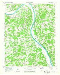 1958 Excell1960 Print · USGSThe Cumberland River valley in the late fifties was a landscape of crossroads hamlets and family farmsteads. Researchers can trace old family sites near Orgains Crossroads, locate the Indian Mounds, or find early churches like Marthas Chapel and Bethlehem Ch.3 unique versions available
 - 1959 Map of Nashville
 1959 Nashville1959 Print · USGSMiddle Tennessee and Southern Kentucky come into focus during the late fifties, showing the region's transition into a modern transportation and military hub. Researchers can trace the sprawling Fort Campbell Military Reservation or locate historic rail stops along the Tennessee Central Ry and Illinois Central RR.
 - 1961 Map of Springfield South, 1963 Print
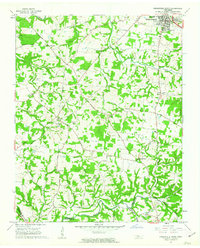 1961 Springfield South1963 Print · USGSRobertson County's rural landscapes and agricultural crossroads are captured here in the early sixties. Researchers can locate family landmarks like Martins Chapel Cem, the County Farm, and community hubs like Glover Crossroad.4 unique versions available
 - 1966 Map of Harpeth Valley, 1967 Print
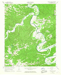 1966 Harpeth Valley1967 Print · USGSThe Harpeth River meanders through the Dickson and Cheatham county line in the mid-1960s, revealing a landscape of high ridges and rural valley settlements. Genealogists and researchers can trace family-named locations such as Petway, Griffintown, and the Taylortown Ch Cem.3 unique versions available
 - 1966 Map of White Bluff, 1967 Print
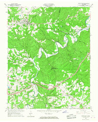 1966 White Bluff1967 Print · USGSThe wooded ridges of Dickson and Cheatham Counties are captured here in the mid-sixties as Interstate development began to reach the area. Genealogists can locate family landmarks like Pinkerton Cem, James Sch, and the rail stops at Craggie Hope and White Bluff.3 unique versions available
 - 1966 Map of Kingston Springs, 1967 Print
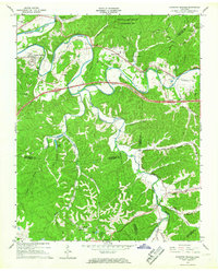 1966 Kingston Springs1967 Print · USGSIn the mid-sixties, the Harpeth River valley near Kingston Springs maintained its rural character and winding rail lines. Genealogists and local historians can locate several country churches like Wards Chapel and Lone Oak Ch, or trace the path of the Louisville and Nashville railroad.4 unique versions available
 - 1966 Map of Lillamay, 1967 Print
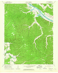 1966 Lillamay1967 Print · USGSThe Harpeth and Cumberland rivers frame this 1960s landscape of managed wilds and ancient sites. Genealogists and historians can trace Indian Mounds at Mound Bottom and local landmarks like Sams Creek Ch and Scott Cem.3 unique versions available
 - 1968 Map of Scottsboro, 1970 Print
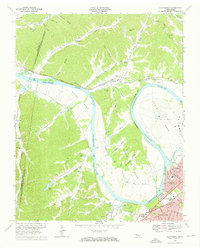 1968 Scottsboro1970 Print · USGSThe Cumberland River loops west of Nashville in the late sixties as suburban growth meets the rural bends. Trace the river economy via Cleeces Ferry and the Illinois Central Railroad, or find the massive State Penitentiary at Cockrill Bend.4 unique versions available
 - 1984 Map of Nashville, 1985 Print
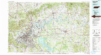 1984 Nashville1985 Print · USGSMiddle Tennessee in the mid-1980s reveals a region balancing urban expansion with its deep river-valley roots. Genealogists and historians can trace family locations near Old Hickory Lake, explore the grounds of Vanderbilt University, or locate ancestral sites like Greenwood Cem.
 - 1985 Map of Dickson
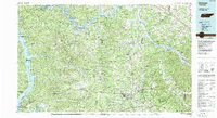 1985 Dickson1985 Print · USGSMid-Tennessee in the mid-1980s was defined by the intersection of the Cumberland and Tennessee rivers and a massive network of wildlife refuges. Researchers can trace the Seaboard System rail lines connecting Waverly, Dickson, and White Bluff, or locate old landmarks near Fort Donelson National Military Park.
 - 1994 Map of Forest Grove, 1997 Print
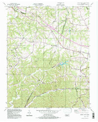 1994 Forest Grove1997 Print · USGSThe hills of Cheatham and Davidson Counties are captured here in the mid-nineties, showing a landscape of rural ridges and developing communities. Researchers can trace the heritage of local settlements through landmarks like Paines Chapel, Morny Sch, and the winding Old Clarksville Pike.
Showing maps 1-25 of 91
Top cities of Cheatham County
- Ashland City historical maps
- Pleasant View historical maps
- Kingston Springs historical maps
- Pegram historical maps
Frequently asked questions
- What are the different types of historical maps available for Cheatham County?
- What is the oldest map of Cheatham County?
- Where can I purchase historical maps of Cheatham County for my home or office?
- Where can I download high-res historical maps of Cheatham County?
- Are there historical topographic maps available for Cheatham County?
- Is there historical aerial imagery available for Cheatham County?
- Where are historical maps of Cheatham County sourced from?