2020s Maps of Cheatham County, Tennessee
Explore 13 historic maps of Cheatham County from the 2020s. These maps offer a rare glimpse into what life looked like during the 2020s — showing old roads, neighborhoods, homes, and landmarks that have changed or disappeared over time.
Whether you're researching your family's past, planning a metal detecting trip, or studying how Cheatham County's landscape evolved across the 2020s, these high-resolution maps are a powerful tool for exploring the history of this region.
- Focus on a specific era: All maps on this page are from the 2020s, giving you a focused view of this time period.
- See what’s changed: Compare century-old streets, trails, and buildings to today's modern landscape using overlays and satellite layers.
- Research with precision: Use these maps for genealogy, historical research, land use analysis, or educational projects.
- View, download, or print: Maps are fully viewable online in high resolution, and can be downloaded or printed for your own records.
Start exploring Cheatham County's history through authentic maps from the 2020s. This is your window into the past.
Cheatham County, TN maps
(13)- 2022 Map of Ashland City, 2022 Print
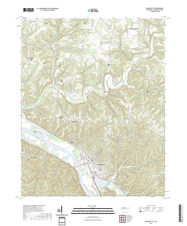 2022 Ashland City2022 Print · USGSAshland City and the surrounding Cheatham County hills are documented here in the early twenty-first century as the landscape maintains its traditional river-and-hollow character. Researchers can pinpoint family burial sites like Teasley Cem and Hunt Cem or locate the historic Cheatham County Courthouse near the Cumberland River.
 - 2022 Map of Kingston Springs, 2022 Print
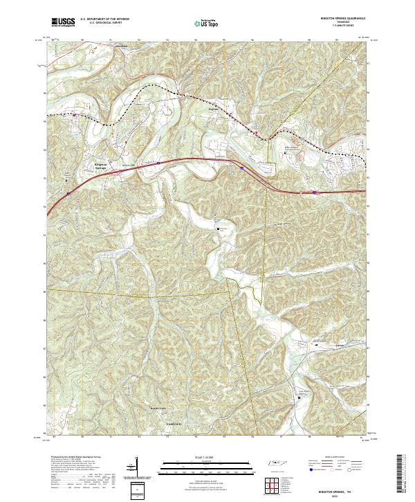 2022 Kingston Springs2022 Print · USGSThe Harpeth River valley and its surrounding hollows are captured here as they appeared in the early 2020s. Researchers can locate family landmarks like Thornton Cem, trace old routes like Old Harding Pike, or explore the settlement patterns of Kingston Springs and Linton.
 - 2022 Map of Excell, 2022 Print
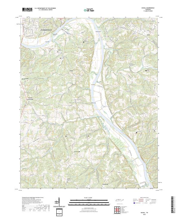 2022 Excell2022 Print · USGSThe Cumberland River valley south of Clarksville comes into sharp focus during the 2020s, showing a landscape defined by historic family landholdings and river navigation. Genealogists can trace deep local roots at Edward Neblett Cem and Brame Cem or explore the quiet crossroads of Liverworth and Salem.
 - 2022 Map of Lillamay, 2022 Print
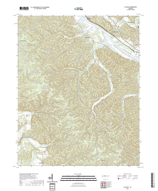 2022 Lillamay2022 Print · USGSCheatham County settlement patterns are preserved here as they appeared in the early 2020s, defined by the winding Cumberland River and prehistoric Mound Bottom. Researchers can trace local lineage through Scott Cem or locate the historic river settlements of Lillamay and Gravelotte.
 - 2022 Map of Cumberland Furnace, 2022 Print
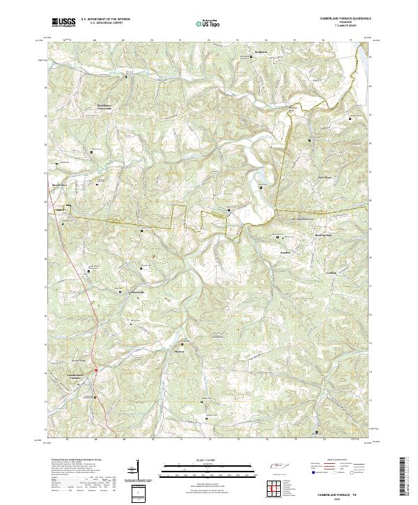 2022 Cumberland Furnace2022 Print · USGSThe rural hills at the Dickson and Montgomery county line are shown here in the early twenty-first century, preserving a landscape of family-named hollows and cemeteries. Genealogists and historians can trace lineage through the Isham J Davis Family Cem, the namesake Cumberland Furnace, and settlements like McAllisters Crossroads.
 - 2022 Map of Harpeth Valley, 2022 Print
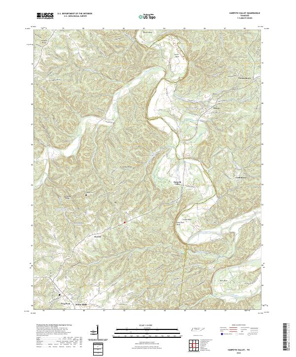 2022 Harpeth Valley2022 Print · USGSThe Harpeth River valley in the early 2020s reveals a landscape of winding watercourses and rural settlements along the Dickson and Cheatham county line. Researchers can locate family landmarks like Nosegay Cem, the community of White Bluff, and the unique Narrows of the Harpeth.
 - 2022 Map of Henrietta, 2022 Print
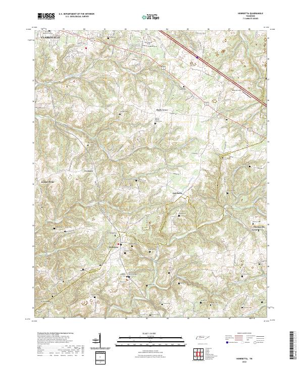 2022 Henrietta2022 Print · USGSThe rural borderlands of Montgomery and Cheatham counties are documented here in the early twenty-first century. Researchers can trace dozens of family burial sites and rural landmarks, from the Bethel Baptist Church to the Hollis Nanny Cem and Blue Spring.
 - 2022 Map of Pleasant View, 2022 Print
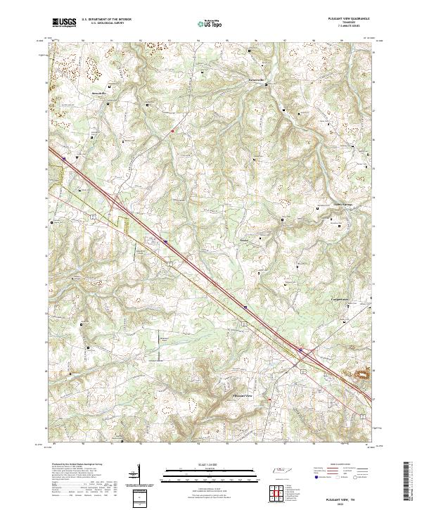 2022 Pleasant View2022 Print · USGSThe rural borderlands between Cheatham and Robertson counties are captured here in the early twenty-first century as modern transit corridors meet deep-rooted family lands. Researchers can locate dozens of historic burial sites, from Shepard Cem and Luter Cem to the family plots near Sandy Springs and Gause.
 - 2022 Map of Cheatham Dam, 2022 Print
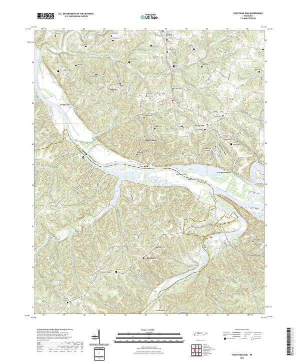 2022 Cheatham Dam2022 Print · USGSCheatham and Dickson Counties are defined by the winding Tennessee river valleys in the early 2020s. Researchers can trace rural settlement patterns near Cheap Hill and Neptune or locate river features like Harpeth Shoals and Pack Island.
 - 2022 Map of Forest Grove, 2022 Print
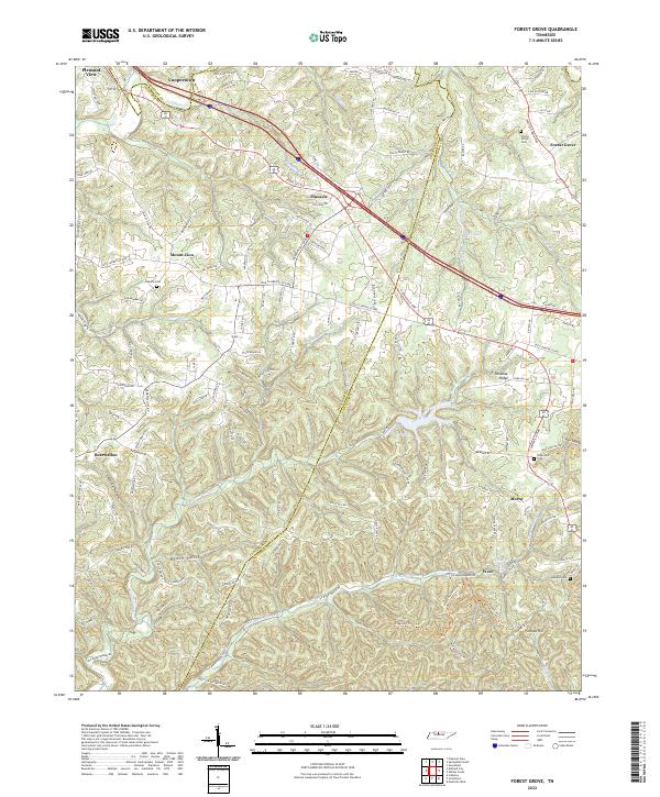 2022 Forest Grove2022 Print · USGSThe ridges and hollows of Cheatham and Robertson counties are documented here in the early twenty-first century. Researchers can locate family landmarks like Gupton Cem or trace the rural crossroads of Paradise Ridge and Bearwallow.
 - 2022 Map of Springfield South, 2022 Print
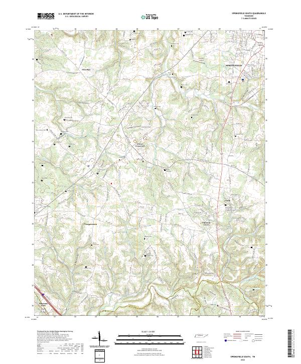 2022 Springfield South2022 Print · USGSThe rural stretches south of SPRINGFIELD come into focus during the early twenty-first century as old family homesteads meet modern suburban growth. Genealogists can trace dozens of burial sites including Billy Cothron Cem and Saint Michaels Cem near Flewellyn.
 - 2022 Map of Scottsboro, 2022 Print
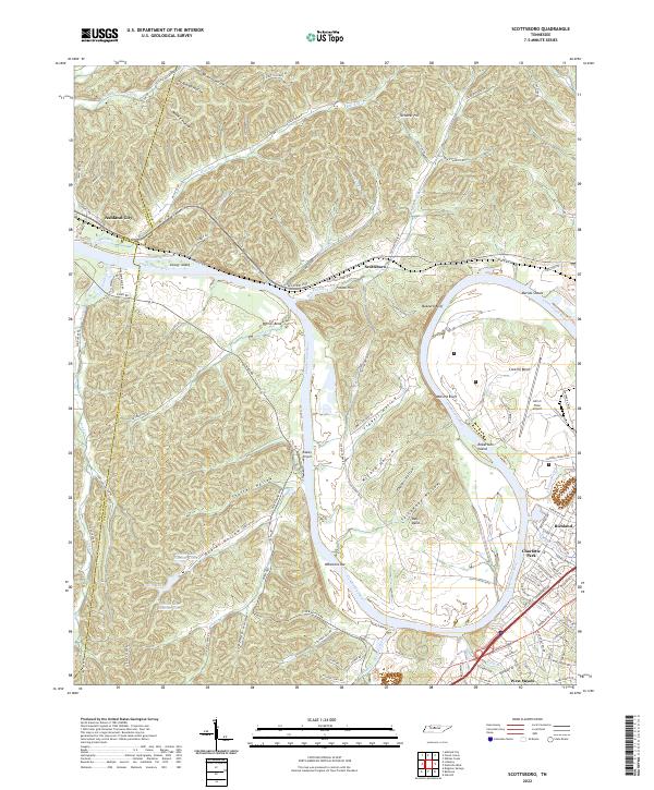 2022 Scottsboro2022 Print · USGSThe western edges of Nashville and the Cumberland River bends come into focus in this early 2020s study. Genealogists and historians can trace the landscape from established neighborhoods like Charlotte Park to the river landmarks of Whartons Bar and Robertson Island.
 - 2022 Map of White Bluff, 2022 Print
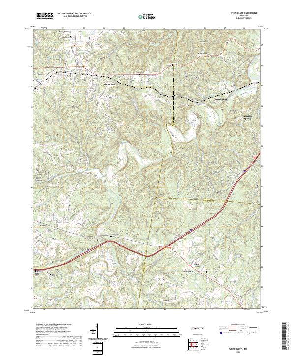 2022 White Bluff2022 Print · USGSThe rural hills of Dickson and Cheatham counties are documented here in the early twenty-first century, showing the established communities of White Bluff and Bell Town. Genealogists can trace local legacies through family landmarks like the Pinkerton Cem, Carothers Cem, and Martin Garton Cem.
End of results
Showing maps 1-13 of 13
Top cities of Cheatham County
- Ashland City historical maps
- Pleasant View historical maps
- Kingston Springs historical maps
- Pegram historical maps
Frequently asked questions
- What are the different types of historical maps available for Cheatham County?
- What is the oldest map of Cheatham County?
- Where can I purchase historical maps of Cheatham County for my home or office?
- Where can I download high-res historical maps of Cheatham County?
- Are there historical topographic maps available for Cheatham County?
- Is there historical aerial imagery available for Cheatham County?
- Where are historical maps of Cheatham County sourced from?