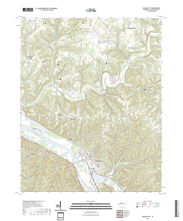
2022 Map of Ashland City
USGS Topo · Published 2022About this map
Ashland City serves as the focal point of this Cheatham County landscape, situated where the Cumberland River meets Marks Creek. The town's civic heart is marked by the Cheatham County Courthouse, surrounded by a dense network of local roads and several family-named burial grounds like Forest Hill Cem and the Allen Stack Cem. The surrounding terrain is characterized by deep hollows and ridges, including Teasley Hollow and Boston Hollow, which have historically dictated the placement of small communities and homesteads.
Find a feature on this map
157 named features on this map. Tap any name to fly to it.
Don’t see what you’re looking for? This feature index may not catch every label — zoom into the map to look around manually.
Map Details
Editions of this 2022 Ashland City Map
This is the sole edition of this map. No revisions or reprints were ever made.
Other maps of this area

1903 · Nashville
USGS Topo · 1:125,000

1930 · White Bluff
USGS Topo · 1:62,500

1931 · Ridgetop
USGS Topo · 1:62,500

1932 · Nashville
USGS Topo · 1:62,500

1933 · White Bluff
USGS Topo · 1:62,500

1935 · Ridgetop
USGS Topo · 1:62,500

1955 · Forest Grove
USGS Topo · 1:24,000

1955 · Scottsboro
USGS Topo · 1:24,000

1956 · Nashville
USGS Topo · 1:250,000

1957 · Cheatham Dam
USGS Topo · 1:24,000