
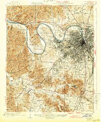
1932 Map of Nashville
USGS Topo · Published 1932About this map
The Cumberland River carves a dramatic serpentine path through this 1932 survey, defining the industrial and agricultural character of Nashville and its western reaches. This era shows the city expanding into suburbs like Belle Meade and Richland, while the river's deep loops encompass the State Reservation at Cockrill Bend and the County Farm near Bordeaux. The landscape is transitioning from rural farmstead to suburban enclave, evidenced by the proliferation of neighborhood institutions such as Trevecca College and the sprawling Percy Warner Park. To the south, the Harpeth River and Little Harpeth River wind through a more pastoral setting near Brentwood, where the Louisville and Nashville RR connects smaller communities. Local education and faith are deeply mapped through numerous country schools like Pond Creek Sch and Robertson Academy, providing a detailed view of Davidson County's social geography before mid-century modernization.
Find a feature on this map
85 named features on this map. Tap any name to fly to it.
Don’t see what you’re looking for? This feature index may not catch every label — zoom into the map to look around manually.
Map Details
Editions of this 1932 Nashville Map
2 editions found
Other maps of this area

1901 · Colombia
USGS Topo · 1:125,000

1903 · Nashville
USGS Topo · 1:125,000

1909 · Franklin
USGS Topo · 1:62,500

1930 · White Bluff
USGS Topo · 1:62,500

1931 · Ridgetop
USGS Topo · 1:62,500

1932 · Hermitage
USGS Topo · 1:62,500

1933 · White Bluff
USGS Topo · 1:62,500

1935 · Ridgetop
USGS Topo · 1:62,500

1942 · Gallatin
USGS Topo · 1:100,000

1942 · Lebanon
USGS Topo · 1:100,000