
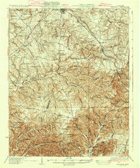
1935 Map of Ridgetop
USGS Topo · Published 1935About this map
The Louisville and Nashville railroad serves as the primary spine for this region, connecting the plateau communities of Greenbrier and Ridgetop to the broader Tennessee landscape. Surveyed in 1925 and 1931, the map captures a rural social fabric defined by local institutions like Bethlehem Sch and St Michaels Ch. An Airway Beacon near Forest Grove signals the arrival of early aviation infrastructure alongside the traditional network of pikes and lanes. The terrain is deeply carved by drainage systems including Sycamore Creek and Whites Creek, creating the distinctive Dividing Ridge that separates the watersheds. Scattered rural commerce is represented by Gordons Store, while numerous community-specific schools like Pinnacle Sch and Kelly Willis Sch reflect the era's decentralized educational system before the widespread consolidation of rural districts.
Find a feature on this map
96 named features on this map. Tap any name to fly to it.
Don’t see what you’re looking for? This feature index may not catch every label — zoom into the map to look around manually.
Map Details
Editions of this 1935 Ridgetop Map
2 editions found
Other maps of this area

1903 · Nashville
USGS Topo · 1:125,000

1930 · White Bluff
USGS Topo · 1:62,500

1931 · Ridgetop
USGS Topo · 1:62,500

1932 · Hermitage
USGS Topo · 1:62,500

1932 · Nashville
USGS Topo · 1:62,500

1933 · White Bluff
USGS Topo · 1:62,500

1942 · Gallatin
USGS Topo · 1:100,000

1942 · Lebanon
USGS Topo · 1:100,000

1952 · Goodlettsville
USGS Topo · 1:24,000

1952 · Springfield North
USGS Topo · 1:24,000